North America fires

California wildfires spawn first ‘gigafire’ in modern history

Via The Guardian News Source:

August complex fire expanded beyond 1m acres, elevating it from a mere ‘megafire’ to a new classification: ‘gigafire’

 At 1.03m acres, the fire is larger than the state of Rhode Island and is raging across seven counties, according to fire agency Cal Fire. Photograph: Noah Berger/AP

At 1.03m acres, the fire is larger than the state of Rhode Island and is raging across seven counties, according to fire agency Cal Fire. Photograph: Noah Berger/AP

California’s extraordinary year of wildfires has spawned another new milestone – the first “gigafire”, a blaze spanning 1m acres, in modern history.

California fires set bleak record as 4m acres destroyed

On Monday, the August complex fire in northern California expanded beyond 1m acres, elevating it from a mere “megafire” to a new classification, “gigafire”, never used before in a contemporary setting in the state.

At 1.03m acres, the fire is larger than the state of Rhode Island and is raging across seven counties, according to fire agency Cal Fire. An amalgamation of several fires caused when lightning struck dry forests in August, the vast conflagration has been burning for 50 days and is only half-contained.

The August complex fire heads a list of huge fires that have chewed through 4m acres of California this year, a figure called “mind-boggling” by Cal Fire and double the previous annual record. Five of the six largest fires ever recorded in the state have occurred in 2020, resulting in several dozen deaths and thousands of lost buildings.

There is little sign of California’s biggest ever fire season receding, with above-average temperatures expected this week. The state endure a heatwave this summer, aiding the formation of enormous wildfires even without the seasonal winds that usually fan the blazes that have historically dotted the west coast.

Vast, out-of-control fires are increasingly a feature in the US west due to the climate crisis, scientists say, with rising temperatures and prolonged drought causing vegetation and soils to lose moisture.

This parched landscape makes larger fires far more likely. Big wildfires are three times more common across the west than in the 1970s, while the wildfire season is three months longer, according to an analysis by Climate Central.

“We predicted last year that we were living with the chance of such an extreme event under our current climate,” said Jennifer Balch, a fire ecologist at the University of Colorado Boulder. “Don’t need a crystal ball.”

The 2020 fire season has seen choking smoke blanket the west coast and at times blot out the sun. But experts warn this year may soon seem mild by comparison as the world continues to heat up due to the release of greenhouse gases from human activity.

“If you don’t like all of the climate disasters happening in 2020, I have some bad news for you about the rest of your life,” said Andrew Dessler, a climate scientist at Texas A&M University.

29 days to save the Earth ...

... because that is when the US withdraws from the Paris climate accord, on 4 November. Five years ago nearly 200 countries committed to a collective global response to tackle the climate crisis. But when Donald Trump took office he announced that the US would leave the Paris agreement. On the one issue that demands a worldwide response to help safeguard the Earth for future generations, the US has chosen to walk away.

The stakes could hardly be higher. The period since the Paris agreement was signed has seen the five hottest years on record, along with a cascade of disasters, from strengthening hurricanes to growing wildfires. If carbon emissions continue we can expect even worse.

With your help we can keep this issue at the center of our 2020 election coverage. The Guardian has promised to give the climate emergency the sustained attention and prominence it demands. And we practice what we preach: we have renounced fossil fuel advertising, becoming the first major global news organisation to do so. We have committed to achieving net zero emissions by 2030. And above all, we will continue our longstanding record of powerful reporting that recognizes the climate crisis as the defining issue of our time.

High-quality journalism that is grounded in science will be critical for raising awareness of these dangers and driving change. Because we believe every one of us deserves equal access to fact-based news and analysis, we’ve decided to keep Guardian journalism free for all readers, regardless of where they live or what they can afford to pay. This is made possible thanks to the support we receive from readers across America in all 50 states. If you can, support the Guardian from as little as $1 – and it only takes a minute. Thank you.

Spark from hammer caused California's largest wildfire, agency says

The Mendocino Fire Burned for weeks before it was contained.

The Ranch Fire was Californiaʻs largest wildfire at 410,203 acres, and It was started from one tiny spark. The Mendicino Fire Complex that raged during the summer of last year was multiple fires that ignited at the same time in close proximity, heavily taxing all fire suppression resources in the area. 280 structures were destroyed in the fire complex, and the biggest fire in the dual-fire incident started due to a single spark.

From the source:

(CNN) The Ranch Fire, the largest wildfire in California history in terms of acres burned, was caused by a spark or hot metal fragment that came from a hammer driving a metal stake into the ground, according to the California Department of Forestry and Fire Protection.

"After a meticulous and thorough investigation, CAL FIRE has determined that the Ranch Fire was caused by a spark or hot metal fragment landing in a receptive fuel bed," the news release said.

Read More about the Mendicino Fire Complex here

Climate Change is Creating Catastrophic Wildfires

“Wildfires can have detrimental impacts on entire ecosystems.” Credit: Reuters / Rafael Marchante

According to a recent study from Dr. Clay Trauernicht of UH CTAHR Cooperative Extension, parts of Hawaiʻi Island are at risk of an increase in up to 375% in annual fire risk due to climate change. Global warming is contributing to worsening wildfire conditions across the globe.

From the Source:

With little fanfare and scant news coverage, fire season 2019 has arrived. Firefighters are already containing blazes in several states, including ColoradoFlorida and Oklahoma, and seasonal outlooks suggest that significant wildfires are likely in parts of Alaska, Hawaii and the West Coast.

While forest management and human development have increased wildfire incidence and risk, climate change has exacerbated the trend of large fires and contributed to the lengthening of the fire season, in some cases making wildfires a year-round phenomenon. In the Western U.S., climate change is a major driver behind the near doubling in burned area that we've experienced over the past 35 years, and has contributed to an increase in the frequency and severity of fires, while lengthening the fire season in some regions.


Hawaii Wildfire Potential Above Normal April Through July

Be vigilant - wildfire conditions are ripe for wildfire these next few months in Hawaii. Are you prepared? Check out the Ready, Set, Go! guide and Wildfire LOOKOUT! for tips on how to prepare for and prevent wildfires.

From the Source:

Hawaii and Puerto Rico will continue to see slightly elevated potential early in the outlook period until the impacts of tropical weather conditions begin to be felt.

How One Homeowner Saved His House from the Carr Fire

Credit: FEMA

Investing in wildfire preparedness works. Check out this wildfire risk reduction success from a FEMA excerpt from Fire Adapted Communities Learning Network.

From the Source:


“Some of the wildfire mitigation measures he took during construction and maintained over the years to make his home fire-resilient included:

  • A well-maintained, simple Class A metal roof.

  • A non-combustible zone (3-5 feet wide) around the outside of the home that helped prevent embers from landing in close-by vegetation.

  • Pruned trees and low-growing cactus and succulents.

  • Boxed-in or soffited eaves with venting located at the outside edge. This makes ember intrusion more difficult.

  • Well-maintained stucco siding.

  • Accessible water and hoses labeled with reflective signs for firefighters.”

In California Wildfires, Disabled People May Be Left Behind

Credit: Elijah Nouvelage / Getty Images

The voices of those with disabilities need to be heard and included in all disaster preparedness planning. Here is a powerful article written by a wheelchair user who uses a ventilator on ways you can support people with disabilities as frequent natural disasters have become the worsening normal with climate change.

From the Source:

Climate change is real. Frequent natural disasters are the new normal. Right now, disabled advocates are working with communities all over the state connecting them to the help they need. Community organizations and informal networks need support coordinating services and providing direct assistance. Our lives are at stake and thoughts and prayers are not enough. Below are some ways you can support people with disabilities and the general population during these wildfires and the ones to come in the near future.


1. Ability Tools is a program of the California Foundation for Independent Living Centers, providing medical equipment, daily living aids, and technology to people in shelters who need them. They are currently taking donations, and you can contact them via Facebook or by calling 1-800-390-2699 (1-800-900-0706 TTY). Support them by donating money or equipment in good condition.

2. Donate to the Portlight Strategies/Partnership for Inclusive Disaster Strategies, a national organization on disability rights, accessibility and inclusion related to disaster operations. It manages a 24-hour disaster hotline for for people with disabilities and others with access and functional needs (1-800-626-4959 or info@disasterstrategy.org)

3. Give money to Mask Oakland, a volunteer group of queer disabled people delivering free N95 respirator masks to Oakland’s most vulnerable. They use donations to buy more masks and post receipts of all their purchases. Twitter: @MaskOakland; Venmo: @maskoakland.

4. Donate to the Northern California Fire Relief Fund by the North Valley Community Foundation to raise money to support the operations of organizations sheltering evacuees of the Camp Fire.

5. Give to Supplying Aid to Victims of Emergency (SAVE) program from the California Fire Foundation, which gives $100 gift cards to people impacted by wildfires including firefighters and civilians.

Fueling the Fire: Trump Thinks Logging Will Stop the Burning in California. It won't.

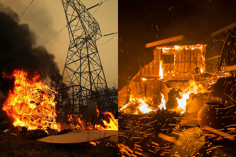
“On the left is the Camp Fire in Big Bend, California, and on the right the Woolsey Fire in Malibu, California.” - Credit: Justin Sullivan/Getty Images and David McNew/Getty Images

One of the most renowned wildland fire experts, Stephen J. Pyne, offers more than his two cents of why the California fires are as extreme as they are…and it is not because California has not removed enough trees.

From the Source:

Where fires are crashing into towns, the real fuel is the built environment. Aerial photos of savaged suburbs tend to show incinerated structures and still-standing trees. The vegetation is adapted to fire; the houses aren’t. Once multiple structures begin to burn, the local fire services are overwhelmed and the fire spreads from building to building. This is the kind of urban conflagration Americans thought they had banished in the early 20th century. It’s like watching measles or polio return. Clearly, the critical reforms must target our houses and towns and revaccinate them against today’s fire threats. The National Fire Protection Association’s Firewise program shows how to harden houses and create defensible space without nuking the scene into asphalt or dirt.

Too often, whether we’re talking about politics or fire management, the discussion ends up in absolutes. We leave the land to nature, we strip it, or we convert it to built landscapes. We have either the wild or the wrecked. In fact, there are lots of options available, and they will work best as cocktails. There is a place for prescribed burning, for prescribed grazing, for prescribed thinning (a kind of woody weeding), for prescribed chipping and masticating by machines, for greenbelting—crafting swathes of low-fuel land use like recreational parks or even golf courses—and, in select sites, for prescribed logging. Most treatments should concentrate where people and high-value assets are at risk—exurbs, suburbs, municipal watersheds. Elsewhere, in wildlands, some kind of managed fire will likely prove the most usable means, and in the West, hybrid practices—half suppression, half prescribed burn—are becoming common.

Officials: Fuelbreaks ‘Without A Doubt’ Save Homes In Grand Lake Golf Course Fire

Credit: Colorado State Forest Service

Wildfire preparedness - it really works! HWMO has committed much time and resources working with community and agency partners to protect communities and natural resource areas using vegetation reduction strategies such as fuelbreaks. Check out this success story from one of the large fires in Colorado this summer.

From the Source:

Last Thursday, 300 homes were ordered to evacuate due to the 20-acre wildfire burning at the Grand Lake Golf Course in Grand Lake.

The fire came within 30 feet of some homes but no homes burned.

“The forestry work and fuels mitigation the Colorado State Forest Service has administered in the Grand Lake community without a doubt saved the Columbine subdivision,” said Chief Mike Long, Grand Lake Fire.

Integrating Traditional Ecological Knowledge and World Renewal Ceremonies into Fire Adaptation: An Indigenous Stewardship Model

"Shown in this image is a California-hazel-stem basket holding tanoak acorns that were collected from the 2015 Klamath River Prescribed Fire Training Exchange (TREX) burn area. Also shown is a Karuk woman’s “work” basket cap and an acorn cooking paddle made of Pacific maple. These are a few of the resources used by Karuk women to gather and prepare acorn soup. This burn reduced acorn pests, cleared out surface and ladder fuels to improved acorn gathering, and maintained the tanoak cavity at the base of this older tree. Cavities like this are important habitat for animals that hunt small game that eat acorns. "

Credit: Frank Lake, USDA Forest Service and Karuk Tribe.

In Hawaii, traditional ecological knowledge plays a critical role in the path forward towards more resilient and vibrant landscapes and communities. For example, restoring native dryland plants that are culturally significant along watersheds and even around your own home, helps to also reduce fire threats and impacts to our communities, lands, and waters. Hawaii is not alone in integrating traditional ecological knowledge with fire adaptation, there are many other great examples globally, including in the mainland U.S.:

From the Source: 

"The Karuk Tribe’s Traditional Ecological Knowledge (TEK) and belief systems are constructed and preserved in the form of stories, practices, performances and ongoing interactions with the natural world. Among such rituals include our World Renewal Ceremonies, which the Karuk Tribe has practiced since time immemorial. These ceremonies have been passed down for millennia, and are a key part of our local communities’ social fabric. They link human practices like fishing, hunting and gathering to responsibility. They also ceremonially align our culture with ecosystem process and function. In our worldview, cultural resources have a life, as do the people using them. Each life deserves consideration when planning projects, including fire adaptation projects."

How California's Record Wildfire Season Paved the Way for Catastrophic Mudslides

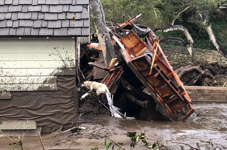
"Santa Barbara County Fire search dog Reilly looks for people trapped in the debris left by devastating mudslides in Montecito, California." Credit: Mike Eliason/Santa Barbara County Fire

As we keep all those affected by the mudslides and flooding in California in our thoughts, we should note that post-fire flooding can impact islands in the Pacific, as well. The characteristics that lead to these events are similar whether in California or in Hawaii.

From the Source:

"Also called post-fire debris flows, these mudslides form when water rushing down slopes picks up dirt, burnt trees, rocks, and other debris (like cars), reaching speeds of more than 35 miles per hour. “When you mix a lot of mud, water, and boulders, it certainly can be quite catastrophic,” says Dennis Staley, a scientist with the US Geological Survey Landslide Hazards Program. The slurries can start with almost no warning after as little as a third of an inch of rain in just 30 minutes — especially on slopes scorched by fires. After fires blazed across more than half a million acres this fall in California’s worst fire season on record, it’s not hard to find burnt land."

Fire makes slopes more susceptible to mudslides for a few reasons, according to climate scientist Daniel Swain’s Weather West blog. For one thing, flames can strip hillsides of plants that would otherwise anchor the dirt in place. Extreme fires that burn through thick vegetation can also physically change the soil — leaving behind a layer of water-repellant dirt near the surface. That layer acts like a raincoat, slicking off water that can then form mudslides, according to the USGS California Water Science Center.

Plus, without plants to slow the rain before it reaches the dirt, the soil can’t absorb as much water — leaving more to race down hillsides as runoff. Imagine the soil as coffee grounds in a filter: if you pour your boiling water slowly, it will soak into the grounds and drip through into your cup. But if you dump your boiling water all at once, a watery, muddy slurry will overflow. That’s what’s happening on the bare slopes of Southern California right now."

Mudslide and Flood Threat Prompts Evacuations in Burnt Southern California as Major Storm Looms

"A Los Angeles County Sheriff's deputy alerts a Kagel Canyon resident of mandatory evacuations on January 8, 2018 in the Creek Fire burn area." Credit: LA County Sheriff's Office

Whether in Hawaii or California, post-fire erosion and flooding is a big deal. For example, the 2016 floods in Maui after an explosive fire season created massive plumes of soil, debris, trash, oil, and other pollutants along the shorelines. We are crossing our fingers that the post-fire flood threat in California this week will spare all homes and people in its path and have minimal damage throughout the watersheds.

From the Source:

"The mandatory evacuation order was issued for unincorporated parts of Santa Barbara County, Montecito, Summerland and Carpinteria, the county said. Areas along Tecolote Canyon, Eagle Canyon, Dos Pueblos Canyon, Gato Canyon, and Whittier burn areas near Goleta were also included in that order."

“This is the first significant rain the area has had in some time, it’s the first where they’ve had to be concerned about the fire scarred areas of the hills,” he added. Lucksinger said flooding and mudslides were always a concern in the foothills and mountains “when rain comes down quickly in a short amount of time like that.”

Deadly California Wildfire Could Become Largest in State's History

"Firefighters from the Governors Office of Emergency Services monitor the advance of smoke and flames from the Thomas Fire, Dec. 16, 2017 in Montecito, Calif." Credit: Robyn Beck/AFP/Getty Images

From the Source:

"The Thomas fire, which has killed two and destroyed more than a thousand structures in Southern California, could become the largest wildfire in the state’s history as the monster inferno continues to grow.

The Thomas fire has burned steadily since Dec. 4, and authorities say it could take weeks to fully contain. It has reduced at least 1,026 homes and business to ashes and damaged more than 240 others.

It was 45 percent contained as of Sunday evening as about 8,530 firefighters from about 100 different crews battled the blaze. Officials estimated that firefighters won’t achieve full containment until Jan 7."

California Firefighter Dies Fighting Massive Thomas Fire

"The Thomas Fire burns on a bluff in La Conchita, California, on Dec. 7, 2017. Many evacuation holdouts were forced to flee the small seaside town as the flames approached. 

Strong Santa Ana winds rapidly spread multiple wildfires across tens of thousands of acres, destroying hundreds of homes and other buildings.

CREDIT: Mario Tama / Getty Images

Our hearts are heavy today with the sad news of the death of a Calfire firefighter who bravely fought alongside many other firefighters on the massive Thomas Fire burning in Ventura and Santa Barbara counties. Our thoughts and prayers are with the victim's loved ones. 

From the Source:

"A firefighter died Thursday while working a colossal wildfire burning in coastal mountains northwest of Los Angeles that has become the fourth largest in California history.

CBS Los Angeles reports the victim was a Cal Fire engineer who worked for the department's San Diego unit. The death, but no details of the circumstances, was confirmed in a statement from Chief Ken Pimlott of the California Department of Forestry and Fire Protection."

Amid The Horrors Of Wildfire, A Tale Of Survival And Singed Whiskers

It has been heavy news, one after another, with the California wildfires alone (not to mention the numerous destructive hurricanes this summer). We thought we'd share this incredible story of survival (of both humans and pets) for a glimpse at the silver-linings that can exist during such tremendous disasters. Added bonus, the story reveals how strategic, controlled grazing can literally save lives!

From the Source:

"What they discovered was both the worst and the best of outcomes. The house was gone, the trucks were gone, everything was ash and gray.

Except for the goats.

All eight of them had survived. Odin did, too, limping, with singed fur and melted whiskers. But his tail still wagged. Hendel thinks he knows what happened."

"As he shuffled through some things — watching objects disintegrate into ash as he poked at them — he heard the noise. It was unmistakable: a bleat that could only come from a goat. There, standing in the drive were Lucy and Ethel, singed and hungry and fine. Somebody, probably the firefighters, had even left them a bowl of water. He has no real idea how they survived, only a theory.

'All I can think is the pasture was just low grass and so the fire couldn't sustain itself there.'"

Is All That Wildfire Smoke Damaging My Lungs?

"Residents of the community of Tujunga, Calif., flee a fire near Burbank on Sept. 2. Even people much farther from the flames are feeling health effects from acrid smoke." (David McNew/Getty Images)

It's been a rough year for North America when it comes to wildfire smoke. This new NPR report has some good information on the risks of wildfire smoke and how you can keep as much smoke as possible from entering your lungs.

From the Source:

"A standard dust mask that you can buy at the pharmacy won't do you much good, Thomas says. It may keep out the large pieces of ash, but it also may cause you to inhale more deeply, and it won't filter out the microscopic particles that can get into your lungs. An N95 mask can filter out 95 percent of smoke particles, but only if it's fitted properly and dirty air doesn't leak around the sides.

In addition to the particulates, there are gases like carbon monoxide and cyanide in wildfire smoke, but these are more of a danger to firefighters who work close to the flames and are exposed year after year, says Thomas.

The rest of us shouldn't worry too much about long-term damage, even if the smoke persists for a few days or weeks. "I don't want to downplay the significance of the symptoms that many of us are feeling," Thomas says. "But the good news is, they go away. They'll resolve quickly, unless you are in one of these high-risk groups."

If you are at high risk, you might want to invest in a high-efficiency particle arresting(HEPA) air filter, which costs around $50 to $300. And when air conditions are bad, avoid burning candles, frying meat, even vacuuming, which can all add more tiny particles to the air. And drink lots of water. The fluid keeps your eyes, nose and throat moist, which can help alleviate irritation."

Wildfires Rage Out West Amid Scorching Temperatures

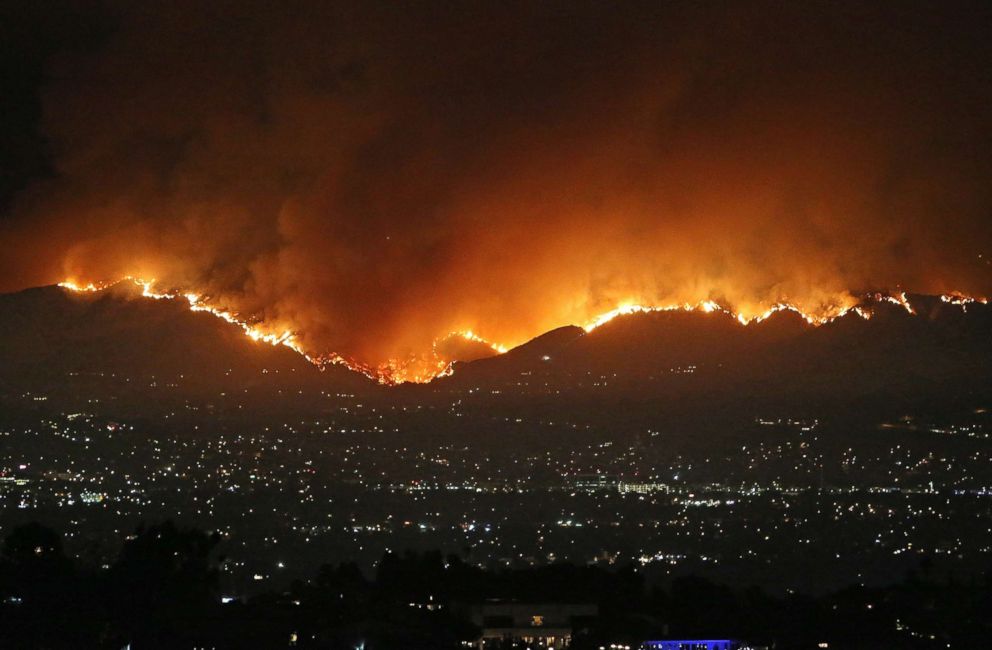
"A huge wildfire is seen in Los Angeles, Sept. 1, 2017." Credit: Splash News

78 large wildfires (and many more smaller ones) are currently scorching eight western states that are experiencing extreme temperatures -- all of this while the Atlantic Ocean is experiencing the strongest hurricanes on record and Hawaii is facing another year of extreme droughts. These are not anomalies, but signs of a new age in which the climate is reaching new extremes. We must connect the dots. It's all related.

From the Source:

"The La Tuna fire that began last Friday in Los Angeles has scorched over 7,000 acres across Burbank and Glendale, making it the largest fire in the history of Los Angeles, fire department officials said. Firefighters have contained the flames to 80 percent and are actively investigating the cause.

This summer 7.5 million acres were torched in the U.S. from wildfires, ABC News meteorologists said."

Seattle Chokes as Wildfire Smoke From Canada Blankets the Northwest

"Mount Rainier on a clear day last week, left, and a day later, after a haze had descended, obscuring the view from across Lake Washington." Credit - NWS Seattle, via Twitter

Wildfire smoke can be harmful to your health, especially if you already have chronic hearth and lung diseases. The CDC recommends when there is brushfire smoke in the area to: 

"Keep indoor air as clean as possible if you are advised to stay indoors. Keep windows and doors closed. Run an air conditioner, but keep the fresh-air intake closed and the filter clean to prevent outdoor smoke from getting inside. If you do not have an air conditioner and it is too warm to stay inside with the windows closed, seek shelter in a designated evacuation center or away from the affected area."

From the Source:

"Government officials have cautioned people about air quality in a region that is usually known, especially at this time of year, for pristine cobalt skies.

But that has not been the case since last week, as the Pacific Northwest has been inundated by plumes of smoke from Canada, where more than 20 wildfires are blazing. The region has also contended with record-breaking temperatures on some days."

"Harborview Medical Center in downtown Seattle, part of UW Medicine, has seen 'an increase over the past week in exacerbations in people who have chronic obstructive pulmonary disease, which includes emphysema, and also in people who have asthma,' Leila Gray, a spokeswoman for the hospital system, said in an email on Monday evening."

This is How Much of the World is Currently on Fire

"September 2014 Happy Camp Complex Fire in the Klamath National Forest in California." Credit: US Forest Service

These interactive maps and graphics offer a grim look at what we might expect as a new normal with climate change. The world is on fire like never before this year. Hawaii is no exception.

From the Source:

"Here in the United States the Forest Service is reporting that 2017 is shaping up to be a worse than average fire year based on acres of federal, private and state land burned. So far, 5.6 million acres of land has burned this year, or 1.8 million acres more than the ten year average of 3.8 million acres burned by this time."

"Across the border from the United States, fires are also currently scorching Canada’s British Columbia. This is the province’s second worst fire season on record and NASA satellites have identified the conflagration from space."

"On the other side of the globe, if you load up the European Commission’s fire map, it looks like the end of the world, especially in Italy and Romania. So far, an area just slightly smaller than the state of Rhode Island has burned. The total is already roughly three times the normal amount of summer wildfires. Back in June, 60 people died over the course of one weekend in Portugal due to wildfires. Thirty people were killed when the fires reached roads on evacuation routes. And as the map makes clear, those fires don’t seem to be abating, in part because of the hotter, drier temperatures."

Wildfire Threat is High for Big Isle

"Tim Weyer tours his ranch, which was consumed by wildfires, Tuesday, in Sand Springs, Mont. Firefighters say they have stopped most of the growth and gained 20 percent containment on the fires that were started last week by lightning." Credit - Associated Press

Areas of drought have now hit all Hawaiian islands, but leeward Big Island is forecast to have the highest wildfire threat. Regardless of what island you live on, make sure to create defensible space around your home, fire-proof your house, and create an evacuation plan using tips from Wildfire Lookout!

From the Source:

"The threat of major wildfires for the leeward side of Hawaii island will remain high through October, forecasters said today.

All other areas of the state can expect normal conditions through November, according to the National Interagency Fire Center in Boise, Idaho, which produces the forecast.

Sea surface temperatures around the islands are expected to remain above normal through November, helping to raise temperatures throughout the islands, the report said.

A lighter than normal rainfall in July allowed drought conditions to spread across parts of the Big Island, but normal rainfall is now expected and the most critical drought conditions are expected to remain only in leeward areas of the island."

Devastating California Detwiler Fire Can Be Seen From Space

Screenshot - Geostationary Operational Environmental Satellite R Series via Storyful

Satellites have many uses and functions. Did you know they could also aid in firefighting?

From the Source:

"One of the largest recent fires in California has been the Detwiler fire. Since it began on July 16, the blaze has burned across 80,000 acres, destroyed 63 residences, and threatened nearly 1,500 more. Thousands of people have had to evacuate their homes, more than 2,000 firefighters have been deployed, and the fire has also come perilously close to Yosemite National Park."

"The images are not quite like those from a typical camera or what one would see with the naked eye if one were circling the Earth. The special images are instead created by overlaying infrared images onto geocolor, the Earth-like colors produced by the 16 spectral bands aboard the satellite. GOES-R's images are essentially a heat map created using the satellite's different spectral bands to detect the fire's hot spots.

In addition to helping firefighters monitor blazing fires, GOES-R has also been used to monitor other potentially disastrous weather. Earlier this month, the satellite captured images of three tropical storms in the eastern Pacific, tornado cells in Iowa, and a solar eruption."