firebreaks/fuelbreaks

As Dry Summer Season Nears, A Community is Working to Prevent Wildfires

Team Rubicon volunteers out in full force to help create a firebreak. Credit: Hawaii News Now

As a very fitting tribute to Memorial Day, a collaboration of people including military veterans from Team Rubicon, an international veteran service organization that uses disaster response to help reintegrate veterans back into civilian life, came out in full force to create a large firebreak around Kamilonui-Mariner’s Cove. The Firewise Community (the first ever on Oahu as of 2018!) of agricultural and residential lots in Hawaii Kai, has been working with HWMO for a couple of years now in an effort to create a more wildfire resilient community.

This weekend, as part of Wildfire Preparedness Day, we are seeing what it means to be fire-adapted: everyone playing a role to reduce wildfire risk. The Firewise committee consisting of local residents and farmers, Aloha Aina O Kamilo Nui, and Livable Hawaii Kai Hui organized the work days; Team Rubicon volunteers are knocking back fire fuels; neighboring landowners provided access to the land and green waste hauling services; residents are feeding volunteers; and HWMO provided a hazard assessment, continual guidance through the Firewise Communities process, and a $2,000 grant from the U.S. Forest Service. We are so grateful to everyone who is helping out to make Kamilonui - Mariner’s Cove a model for community-driven wildfire protection on Oahu and for the rest of the Hawaiian Islands!

From the Source:

This Memorial Day weekend, hard-working volunteers are helping out homeowners worried about the threat of wildfires. They started creating a new firebreak on Saturday near Mariner’s Cove.

With the help of a hazard assessment from the Hawaii Wildfire Management Organization, the community came up with an action plan.

With moderate drought conditions across the state, wildfire experts are concerned about this summer.

“During those El Nino periods, we actually see significant increases in wildfire ignitions, but also in the amount of area that burns so we’re defintiely very worried this summer,” said Pablo Beimler, Hawaii Wildfire Management Organization’s community outreach coordinator.

“It’s like black and white, like a swarm of bees come in here and sort of take over, start in five different spots and just continue on down. It’s really amazing,” said homeowner Dick Johnson.

Restoration of Forest Key to Fire Control, Expert Says

Dr. Trauernicht gives background on the wildfire issue in Maui and across the state. Credit: The Maui News

Great article on the wildfire issue in Hawaii based on a recent talk by our close partner, Dr. Clay Trauernicht of University of Hawaii CTAHR Cooperative Extension / Pacific Fire Exchange. Also, important identification of the need for more funding for forest restoration and fire prevention by another close partner of ours, Chris Brosius, program manager of the West Maui Mountains Watershed Partnership.

From the Source:

The causes of most fires are unknown. Out of 12,000 recorded incidents statewide from 2000 to 2011, only 882, or about 7 percent, had a determined cause. Of those, 72 percent were accidental, which also means they’re preventable, Trauernicht said at Wednesday’s meeting in the Pacific Whale Foundation’s classrooms in Maalaea. That’s why part of the solution is public education on the risks of fire and how to avoid sparking a fire.

That’s why it’s important to find ways to change the landscape to less sensitive and less flammable vegetation, he said. Statewide, non-native grasses and shrubland cover 25 percent of the total land; in Maui County, it’s 36 percent.

“Rather than trying to weed wack or spray to kill the grass, maybe you should think about a more permanent strategy, like planting trees to shade those grasses out,” Trauernicht said. “In other words, converting that vegetation to something that’s less likely to burn.”

“We can really only do two things,” Trauernicht explained. “We can target ignitions . . . and the only thing we have direct control over is the vegetation.”

“A lot of people think about jumping right into fuels management,” he said. “One of the big things is just having access and safer conditions and water for firefighters. So I think some of the more immediate things is ensuring they have the safest conditions.”

Fueling the Fire: Trump Thinks Logging Will Stop the Burning in California. It won't.

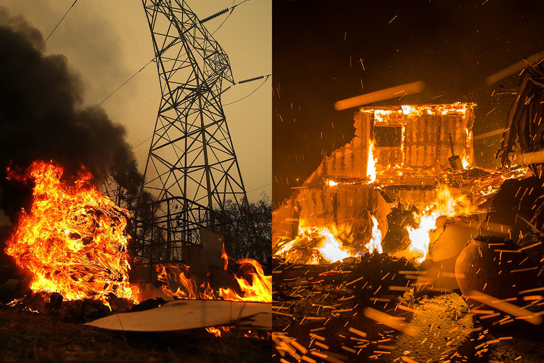
“On the left is the Camp Fire in Big Bend, California, and on the right the Woolsey Fire in Malibu, California.” - Credit: Justin Sullivan/Getty Images and David McNew/Getty Images

One of the most renowned wildland fire experts, Stephen J. Pyne, offers more than his two cents of why the California fires are as extreme as they are…and it is not because California has not removed enough trees.

From the Source:

Where fires are crashing into towns, the real fuel is the built environment. Aerial photos of savaged suburbs tend to show incinerated structures and still-standing trees. The vegetation is adapted to fire; the houses aren’t. Once multiple structures begin to burn, the local fire services are overwhelmed and the fire spreads from building to building. This is the kind of urban conflagration Americans thought they had banished in the early 20th century. It’s like watching measles or polio return. Clearly, the critical reforms must target our houses and towns and revaccinate them against today’s fire threats. The National Fire Protection Association’s Firewise program shows how to harden houses and create defensible space without nuking the scene into asphalt or dirt.

Too often, whether we’re talking about politics or fire management, the discussion ends up in absolutes. We leave the land to nature, we strip it, or we convert it to built landscapes. We have either the wild or the wrecked. In fact, there are lots of options available, and they will work best as cocktails. There is a place for prescribed burning, for prescribed grazing, for prescribed thinning (a kind of woody weeding), for prescribed chipping and masticating by machines, for greenbelting—crafting swathes of low-fuel land use like recreational parks or even golf courses—and, in select sites, for prescribed logging. Most treatments should concentrate where people and high-value assets are at risk—exurbs, suburbs, municipal watersheds. Elsewhere, in wildlands, some kind of managed fire will likely prove the most usable means, and in the West, hybrid practices—half suppression, half prescribed burn—are becoming common.

Fire Is the One Hawaii Disaster We Can Avoid

The August 2018 wildfires in Waianae Valley. Credit: Clay Trauernicht

An excellent article by Dr. Clay Trauernicht, wildland fire specialist of University of Hawaii CTAHR Cooperative Extension and Pacific Fire Exchange.

Not only does he explain why wildfires in Hawaii have burned 30,000 acres in August 2018, (more than double the annual average), but that it was predictable and there is much people can do to prevent wildfires. Dr. Trauernicht specifically sites the Wildfire LOOKOUT! tips for wildfire prevention.

To learn more about what you can do to protect your home and community from wildfire, visit HawaiiWildfire.org/lookout

From the Source:

Vegetation may be the most problematic issue facing fire management in Hawaii. Simply put, our communities and forests now exist amid an ocean of fire-prone grasslands and shrublands — about a million acres statewide. This is mostly a consequence of benign neglect as the value of real estate outweighs the value of maintaining production landscapes. Our agricultural and ranching footprint has declined by more than 60 percent across the state….

So what can we do about it? Awareness and education is the first step. Multiple state and county agencies and non-profits are working on this via the Hawaii Wildfire Lookout! Campaign, spearheaded by the Department of Land and Natural Resources and Hawaii Wildfire Management Organization. Fire prevention education can reduce accidental fires. Homes can be “hardened” to reduce the risk of loss. Communities can become “firewise” and organize to take actions such as increasing access for firefighters and reducing hazardous fuels near homes.

Vegetation is in some sense the simplest issue to tackle because it is the only fire hazard we can directly manage.  Yet it is also the most challenging due to the scale of the problem — the million acres of grasslands and shrublands across the state. There are multiple solutions for reducing risk in these fuels: fuel breaks, targeted grazing, prescribed fire, the restoration of agricultural and native ecosystems. There are also regulatory measures that can help such as firewise building and development codes.

Check out this letter to the editor from a former Firewise Co-Chair for Launiupoko, Ms. Linda Jenkins, who talks about their Firewise outreach efforts as a pathway forward.

”We completed assessments and provided all our neighbors with tips on how to make their homes and properties fire wise. An extensive public education campaign was conducted and we received our Firewise certification. We circulated tips on how to build a home and lay out a property to reduce fire risk. We also circulated tips on how to make your existing property and already built home safer.

This was successful in that many people made simple changes to their properties. I was also on the board at Makila and we maintained the sides of the bike path to create a fire break and kept our grass verges green.”

Hokukano Ranch Fire Burns 350 Acres

Hokukano Ranch fire as detected by NASA satellite.

From the Source:

Firefighters are working to douse a brush fire ignited by lightning Sunday afternoon in a remote area of Hokukano Ranch.

Responding to a 2:04 p.m. report, firefighters from Captain Cook arrived at the scene 7 miles up Hokukano Ranch Road to find two moderate-sized brush fires burning about 50 acres in a very remote area with no radio or phone coverage, according to a media release from the Hawaii Fire Department. The department noted that someone witnessed lightning strikes in the area around the time the fire started.

VIDEO: Mauna Loa Brush Fire Update From NPS

“Briefing map used to chart the brush fire fight on Mauna Loa.” Credit: Big island Video News

From the Source:

“With the cooler and wetter weather, firefighters are focusing on mop-up and patrol of firelines,” a recent National Park Service media release stated. “They are also starting the process of back-haul, returning equipment and supplies used on the fire, by strategically bringing those resources back to be cleaned and refurbished. Additionally, fire crews are working with park biologists along the park boundary to assess fences and to carefully fall a limited number of trees that became hazards from the fire. Together they are also analyzing any potential impacts from the fire suppression efforts such as bulldozer lines that were created to stop the spread of the fire.”

Waikoloa Brush Fire Continues to Burn, Scorching 3,000 acres

"A large fire is blanketing the air in Waikoloa with heavy smoke." Credit: Hawaii News Now

We are thinking of you, Waikoloa. Be safe and stay aware of your surroundings. A big mahalo to all of the firefighters from county, state, and federal agencies who are working tirelessly to protect the community!

Should an evacuation occur, which is not expected at this time, CERT members would help notify residents to evacuate by going door-to-door and also with a megaphone. However, relying on your own judgment is critical during a fire. If conditions do not look favorable, whether the spread of the fire or ember showers or smoke...leaving early is the best option. 

Here are some helpful resources for you during the fire, but also use these to plan for the next inevitable fire. Waikoloa is one of the most fire-prone regions in the entire state.

How to protect yourself from smoke inhalation during a fire:

http://www.hawaiiwildfire.org/fire-resource-library-blog/air-oasis-family-fire-guides?rq=smoke

Your all-in-one wildfire preparedness guide:

http://www.hawaiiwildfire.org/fire-resource-library-blog/rsg-your-personal-wildland-fire-action-guide

From the Source:

Hawaii Island firefighters are still working to contain a brush fire that burned at least 3,000 acres in Waikoloa on Wednesday.

"Hawaii County Fire is reporting heavy smoke blowing into Waikoloa Village. We ask people to monitor air conditions and if you have respiratory issues please take necessary precautions," officials said. 

While most of the road blocks have been lifted, Waikoloa Road is still closed between Mamalahoa and Paniolo Avenue.

Officials: Fuelbreaks ‘Without A Doubt’ Save Homes In Grand Lake Golf Course Fire

Credit: Colorado State Forest Service

Wildfire preparedness - it really works! HWMO has committed much time and resources working with community and agency partners to protect communities and natural resource areas using vegetation reduction strategies such as fuelbreaks. Check out this success story from one of the large fires in Colorado this summer.

From the Source:

Last Thursday, 300 homes were ordered to evacuate due to the 20-acre wildfire burning at the Grand Lake Golf Course in Grand Lake.

The fire came within 30 feet of some homes but no homes burned.

“The forestry work and fuels mitigation the Colorado State Forest Service has administered in the Grand Lake community without a doubt saved the Columbine subdivision,” said Chief Mike Long, Grand Lake Fire.

Crews Respond to Flare Up of Fire West of Omaopio and Pulehu Road

Area where fire occurred - west of Omaopio and Pulehu Road junction.

From the Source:

"A series of brush fires that kept firefighters busy last week rekindled Sunday night, forcing crews to return to the area west of the Omaopio and Pulehu road junction, fire officials said.

The flare-up at about 8:30 p.m. occurred inside the perimeter of one of three fires, about a half-mile to a mile apart, that began Oct. 9, Fire Services Chief Edward Taomoto said."

"Although the fire was declared 100 percent contained Thursday afternoon and has not spread beyond firebreaks carved out by bulldozers, large areas of unburned fuel remain inside containment lines, Taomoto said. That is where flare-ups have been occurring.

In addition, difficult-to-reach areas with large kiawe trees and heavy brush on the mauka edges were making it challenging for firefighters to fully extinguish the fires, Taomoto said."

Puako Among Seven New Firewise Communities in Hawaii As of 2016

Aerial photo of Puako community fuelbreak.

Over the last few decades, Puakō has had many encounters with wildfires, one of which burned down six homes in 1987. Increased human activity in the area along with more frequent and severe drought periods and unmanaged vegetation have been recipes for increased wildfire hazards and occurrences in the area. The 2007 fire prompted the creation of Puakō’s nearly 3-mile long fuelbreak with the facilitation of a U.S. Forest Service Wildland-Urban Interface grant from Hawaii Wildfire Management Organization (HWMO). HWMO is a 501(c)3 nonprofit organization based in Waimea that has been providing the Hawaiian Islands with nationally recognized wildfire protection services since 2000. We serve as the hub of the collaborative wildfire efforts of government agencies, nongovernment organizations, and communities across Hawaiʻi. For more information, go to hawaiiwildfire.org

Some of the members of the Puako Firewise Committee who helped the community achieve Firewise Communities recognition.

In 2016, Puakō residents concerned with the wildfire issues in their community, came together to form a Firewise Committee that would work towards Firewise Community recognition. The NFPA Firewise Communities Recognition Program, which over 1,300 communities are currently participating in, certifies communities that have banded together to reduce their wildfire risks through a five-step process. HWMO is pleased to announce that, thanks to the efforts of proactive residents in the community and help from various partners, Puakō is now an official Firewise Community as of 2016. The benefits of being a Firewise Community include community-building, increasing wildfire awareness, gaining greater access to funding and assistance, and possible reduction to insurance costs in the near future. Most importantly, a Firewise Community is better protected from wildfire. Puakō now joins 6 other new Firewise Communities on Maui and Hawaiʻi Island that HWMO was able to assist this past year, making it a total of 9 communities with this honor.

Wildfires not only impact communities, businesses, infrastructure, native forests, and cultural resources, but they also affect our watersheds and coral reefs (check out the video HWMO produced in 2016: https://www.youtube.com/watch?time_continue=1&v=ZtsG5fP-Z9Y)...

Heavy rain events after fires cause erosion that sloughs off topsoil leaving some areas completely denuded and unable to support vegetation. Post-fire erosion fills streams with sediment, depositing it in the ocean. This sedimentation smothers coral reefs, massively impacting water quality, fisheries, and long term coral health. By reducing the wildfire threats in Puakō, being a Firewise Community also means protecting the area’s wai and kai. Mahalo to Puakō residents for all the hard work you put in this past year!

When Spark Meets Sprawl: Building in Wildlands Increases Fire Risk

Sand Fire. (Credit - Center for Investigative Reporting)

An incredibly thorough and comprehensive Center for Investigative multimedia article with many facts, figures, maps, images, and soundbites that is definitely worth checking out! This is the article to read if you want to learn more about the current state of the "Wildland-Urban Interface (WUI)" and the continuing risks developing into the wildlands presents for communities and our natural resources.

From the Source:

"Nationally, more than a third of new homes built since 2000 are in WUI areas. What has happened, wildfire historian Stephen J. Pyne wrote in 2008, is that we’re “leaving natural growth alone and then stuffing the openings with combustible structures.”

“Stephen J. Pyne, the wildfire historian, said that unless there’s coherent and coordinated policy that looks at development and forest management, these problems will be difficult to solve.

‘Otherwise, you’re just in the whack-a-mole mode and you’re not going to win,’ Pyne said. ‘In cities, every fire you put out is a problem solved. In wildlands, every fire you put out is a problem put off.’”

'Good Neighbors' Help to Fight Fires in Remote Kahikinui Homestead

Excellent, in-depth article of the recent PFX Field Tour of Kahikinui, the community's history and past struggles with large wildfires, and the bright future ahead of them for their preparedness efforts. Mahalo to the Maui News for the great coverage and to Leeward Haleakala Watershed Partnership and Pacific Fire Exchange for coordinating the field tour.

From the Source:

"There have been some smaller meetings with the community and adjacent landowners in the past, but this was the first time so many people with such a broad range of experience and interest in collaboration came together that I'm aware of," said Andrea Buckman, coordinator for the Leeward Haleakala Watershed Restoration Partnership, who organized the event along with the Pacific Fire Exchange.

Kahikinui resident Ainoa Kaiaokamalie and others joined Pacific Fire Exchange, Leeward Haleakala Watershed Restoration Partnership, Hawaii Wildfire Management Organization, and a variety of other stakeholders for the field tour. Photo Credit: The Maui News

"In the meantime, grant funding is also an option for the community. One available program is the U.S. Forest Service Wildland Urban Interface grant, which provides funding for projects related to fire education, planning and prevention. Through this grant, the Hawaii Wildfire Management Organization already has $5,000 for a fuel reduction project in Kahikinui that must be matched by cash or volunteer hours."

"Currently, Kahikinui is working to become a certified Firewise Community through the help of the Hawaii Wildfire Management Organization. Pablo Beimler, the organization's community outreach coordinator, said that he expects Kahikinui to receive its certification by the end of the year. Being certified would help push Kahikinui higher on grant funding lists and could reduce insurance costs in the future, he said.

Trauernicht said that the prevention projects being considering 'are always cheaper in the long run' when compared to the costs of restoring forests, livestock fuel and homes."

Olowalu Fire Near Puamana Beach Park Burns 1300 Acres

Credit: Maui Fire Department

It was only a week ago when a 4,700 acre fire burned through Maalaea in West Maui threatening homes and causing massive traffic jams. Another large fire is burning in the Olowalu-Ukumehame area, totaling over 1,300 acres. Only a month or so ago, HWMO, Maui Electric Company, and DLNR Division of Forestry and Wildlife collaborated on a project to create fuelbreaks along powerlines on the mauka side of Ukumehame.

From the Source:

"Maui police evacuated two homes Friday night as a precaution, and residents returned hours later. MFD says that the homes are not in immediate danger at this time, and no homes have been damaged.

Honoapiilani Highway was closed for a short time, but it remains opens Saturday. Firefighters say they do not anticipate any more road closures."

Brush Fire Covers 393 Acres Near Waikii Ranch

"An Army UH-60 Blackhawk drops water on a fire near Waikii Ranch on Monday afternoon. The crew came from the medevac team." (Graham Milldrum / West Hawaii Today)

Creating a buffer-zone doesn't just have to stop around your home - a community-wide fuelbreak can be the difference between a destructive fire or not. Firefighters primarily from U.S. Army Pohakuloa Training Area were able to keep a 393-acre fire in the northern portion of Waikii on Hawaii Island from getting close to homes in the area in large part due to pre-fire fuels management. 

From the Source:

"Firefighters managed to keep it away from the homes in large part because a crew at the Waikii Ranch keeps the buffer zone largely clear of material, said Captain Steve Colona of the Pohakuloa Training Area’s Fire and Emergency Services."

"Then things changed.

'Well, the wind didn’t cooperate,' said Hawaii Fire Department Battalion Chief Ty Medeiros.

It moved to the south and expanded the blaze, he said, which broke the fire’s containment although the area threatened has no structures in it.

The 20-mph winds not only directed the fire, they complicated the efforts of the two helicopters dropping water. One came from the county, and the other from the medevac unit stationed at the base."

PHOTOS: Kanehoa Community Clears the Way to Being 'Firewise'

Credit: HWMO

We cannot be any happier to see the great work the Kanehoa Firewise Committee and residents have put in to reduce the wildfire threat in their area. The second Firewise Community in Hawaii is well on their way to retaining that title for this year and beyond!

From the Source:

"Members of the Kanehoa community spent their Saturday making their community safer against the threat of wildfires.

The Hawai’i Wildfire Management’s Wildfire Prep Day provided communities across the island, state, and nation to participate in a day of preparation in honor of Wildfire Preparedness Month.

In total, two dozen Kanehoa community members joined in to remove an entire large dumpster with haole koa, also known as ekoa. The plant is known to be highly flammable and has the potential to create embers that can spark new fires, both near and far away."

"'All of us at Hawai’i Wildfire Management Organization are very proud of the work the Kanehoa community has contributed towards reducing the wildfire threat in their area and we hope more communities will follow their lead,' Pablo Akira Beimler, HWMO Community Outreach Coordinator, said in an e-mail.

Beimler says the efforts greatly reduced the wildfire threat by ensuring the roads can act as a fuel break to slow the spread of wildfire."

Hawaii's Wildland Firefighters Need More Resources

Three DOFAW firefighters watch as smoke billows from a distance. Credit: DOFAW.

Front page headlines!

With the ever-growing problem of wildfires statewide, Hawaii's first responders have faced numerous challenges accessing adequate resources to ensure communities and natural resources are out of harm's way. This is a great article that highlights the underlying issues of wildfire in Hawaii, the current realities of wildfire suppression across the state, and tactics that may help alleviate these issues. The answer: improved resources for wildland firefighting and a focus on pre-fire mitigation.

From the Source:

"Experts say both the frequency and size of wildfires have steadily grown in recent decades as changing weather patterns and invading fire-prone, non-native grasses and shrubs have put Hawaii’s forests and natural areas at greater risk of fire.

Data from a recent Hawaii Wildfire Management Organization study indicate that the average area burned each year in Hawaii has climbed by 400 percent over the past century.

The study also shows that an average of more than 17,000 acres has burned each year over the past decade, with some years exceeding even the most fire-prone Western states.

In fact, a greater percentage of Hawaii is under high risk of wildfire than any of the other 16 westernmost states, according to an assessment by the Council of Western State Foresters."

"Clay Trauernicht, extension fire specialist with the University of Hawaii at Manoa, said the state needs to provide more realistic funding levels to help protect the state’s natural areas in the face of a rapidly growing wildfire threat."

"Cutting firebreaks, reducing vegetation and brush, and working with landowners to provide access for water and vehicles help to minimize the size of fires, their impacts and their potential danger to firefighters, he said."

"Trauernicht said the state should consider establishing a full-time team dedicated solely to wildfires. Not only would it improve the division’s initial response, but the team could also conduct pre- and post-fire activities when not responding to fires, he said."

25-Acre Blaze Ignites Near Kailua-Kona Neighborhood

"A Hawaii County helicopter performs a water drop on a brush fire that threatened homes in the Komohana Kai subdivision of Kailua-Kona on Wednesday. (Photo courtesy Denny Miller/Special to West Hawaii Today)"

We hope all are okay after an incredibly close-call in the Komohana Kai subdivision. Just the intensity of the smoke near homes was enough to cause some residents to evacuate. Mahalo to firefighters for their quick response and to community members who cooperated with evacuation procedures and helped make suppression efforts easier for firefighters. 

From the Source:

"The southern edge of Kailua-Kona was draped in large black clouds of smoke Wednesday afternoon as a brush fire consumed an open area near the Komohana Kai subdivision, causing people to evacuate their homes voluntarily and at least one government office to close for the day.

The fire started about noon in the vicinity of Banyan Apartments on Alii Drive and quickly raced mauka through dry brush toward the subdivision, which is located on the bottom portion of Lako Street."

"Firefighters were assisted by residents, who helped realign hoses, mark out areas and provide lifts on mopeds.

Hawaii Fire Department Battalion Chief Gantry Andrade said the brush fire makai of Lako and Kololia streets was close to being under control by Wednesday afternoon. The fire was slowly spreading, however, most of the active burning was within the burn area. Bulldozers were close to cutting the final parts of the firebreak to control the blaze, he said."

Kahikinui Brush Fire Flare Up Burns Toward Dense Forest

Kahikinui fire as of February 18, 2016. Credit - Ryan Piros

Even after a large wildfire is extinguished, there are always chances for flare-ups. Remember the fire triangle? A little oxygen can restart an unnoticed hot spot and resurrect a wildfire. The "Set" portion of "Ready, Set, Go!" means "stay vigilant of your surroundings." 

From the Source:

"Crews arrived to find 3 to 4 acres burning near the mauka perimeter, about 1.5 miles from the nearest structure, according to Maui Fire Services Chief Edward Taomoto."

"When darkness fell, officials say the fire was still active, and was creeping slowly upslope. According to department reports, the fire grew to 7 to 10 acres and was moving into denser forested areas overnight."

Firefighters Battle 200-Acre Brush Fire Near HCC - Palamanui

"Firefighters are battling a brush fire in the vicinity of Hawaii Community College — Palamanui. (Graham Milldrum/West Hawaii Today)"

"Firefighters are battling a brush fire in the vicinity of Hawaii Community College — Palamanui. (Graham Milldrum/West Hawaii Today)"

Hawaii Community College at Palamanui had a recent wildfire scare and took the right precaution of evacuating early and advising the public to avoid the area. Thanks to efforts by our firefighting partners, the blaze was kept away from important resources. Another close call, but this is only the beginning of what will be a very busy El Nino-driven wildfire period. 

From the Source:

"The blaze was roughly arrowhead-shaped, with the point headed toward the mauka forested area. The sides expanded slowly, often burning against the wind. With the plan reliant on the bulldozers and helicopters, the firefighters were largely limited to monitoring the blaze.

The fire was almost exclusively fed by fountaingrass, some of which effectively cylinders of vegetation four feet tall and four feet across. The fire could be seen jumping from bush to bush as it advanced."

Crews Battle Brush Fire in Laupahoehoe

"COLIN M. STEWART/Tribune-Herald A Hawaii County rescue helicopter returns after making several water drops above the wildfire in Laupahoehoe Tuesday afternoon."

"COLIN M. STEWART/Tribune-Herald A Hawaii County rescue helicopter returns after making several water drops above the wildfire in Laupahoehoe Tuesday afternoon."

The Hamakua coastline is not typically known for its wildfire issues. However, during times of drought, which we are currently entering into due to El Niño, wet areas can burn. This might be a telling sign of things to come. Even if you live in a typically wet area, it's best to prepare for wildfires now rather than when it's too late. Find out more about resources that will help you prepare.

From the Source:

"Located in the mauka areas near the ends of Spencer Road and Kihalani Homestead Road, the fire had charred large patches of the hillside and appeared at one point to approach at least one home at the top of the hill near the end of Spencer Road, the source said. The firefighters managed to knock the blaze in that area down, however, using a pair of fire engines and a county helicopter outfitted with a large water bucket.

The helicopter was seen making its way down to a livestock pond in the area several times to refill the bucket and return to drop it on hot spots on the hillside."

"A four-wheel drive road between Kihalani Homestead Road and Spencer Road appeared to have acted as a natural fire break in a few spots, with areas mauka of the road burned black and smoldering, while makai fields appeared to remain untouched."