News Center — Hawaii Wildfire Management Organization

extreme fire behavior

Ahead of Wildfire Season, Scientists Study What Fuels Fire (AUDIO)

A great example of science that meets management needs, which happens to be the state mission for the Pacific Fire Exchange.

From the Source: 

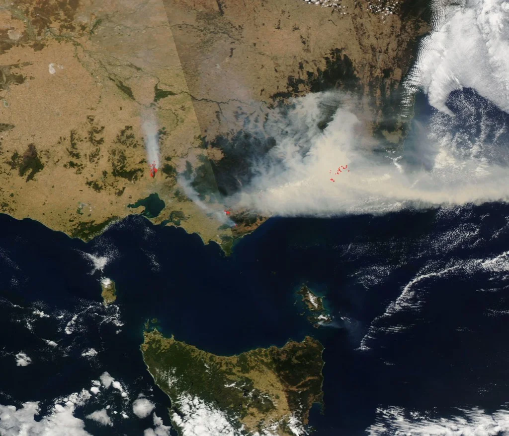
"As fire managers in the drought-stricken Southwest gear up for another long and expensive wildfire season, federal fire scientists are trying to better understand the physics behind what makes blazes spread.
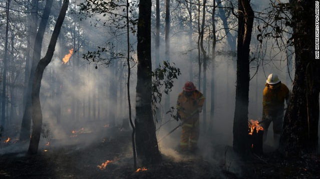
At a U.S. Forest Service fire lab in Riverside, Calif., a team of scientists is conducting daily experiments over the next few months on different fire behavior conditions. They hope to hand off their findings to fire managers, who have to make the quick decisions on where to deploy resources that could protect lives and property.

The centerpiece of the lab is a 30-foot-long, 10-foot-high wind tunnel and inside is a layer of wood shavings meant to mimic a dry, forest floor. Above them, resting on a shelf, are freshly picked green shrubs, the live green trees in this soon-to-be simulated forest fire...

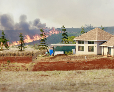
After all, these are the plants that blanket the chaparral hills of Southern California and Arizona, notorious for fueling some spectacular wildfires. But what Weise wants to know are the precise conditions that turned this small blaze into a potentially large one; one that would be almost impossible to control in the field...

'What we're trying to do here is conduct these experiments so that we can produce models, which can be used to perhaps predict what might happen under conditions that might be outside of a manager's experience,' Weise says.

Weise says that with improved models of fire behavior, that fire manager will have a better idea where to put resources to get out in front of the fire. His team plans to conduct these daily experiments under all types of different wind speeds, humidity and types of fuel for a couple more months...

There is a sense of urgency with research like this. It turns out that most of the fire behavior models commonly in practice today are based on research conducted 40 years ago. And there's no indication that wildfires are going to get any less severe anytime soon."

Above: "A lab technician lighting a fire in a wind tunnel at a fire lab in Riverside, Calif." Credit: Sean Nealon/University of California, Riverside

Above: "A lab technician lighting a fire in a wind tunnel at a fire lab in Riverside, Calif." Credit: Sean Nealon/University of California, Riverside

Winds Whip Up Calif. Wildfire That has Charred at Least 1,000 Acres (PHOTOS, VIDEO)

From the Source: 

"A fresh blast of strong winds hit a wildfire on Thursday in the foothills east of Los Angeles but did not spread the blaze that drove people from 1,600 homes, officials said.

The fire remained within the previous burn area despite new winds that reached 60 mph, the U.S. Forest Service said.

The winds still brought trouble, however, forcing the grounding of helicopters and planes that were being used to fight the fire that began Wednesday in San Bernardino National Forest.

The lack of aircraft also prevented an accurate mapping of the blaze that has charred at least 1,000 acres and likely many more, the Forest Service said.

The fire was 10 percent contained after an initial surge on Wednesday that included a gust of winds that topped 100 mph...

'The message is, 'ready, set, go,'' said Rancho Cucamonga Fire Chief Mike Bell. "Be ready just in case something changes.'...

California usually has about 500 wildfires by May. But this year there have already been more than 1,000, with the start of the fire season still a month away."

Above: "Bert Newman sprays water on his home as a wildfire driven by fierce Santa Ana winds closes in on him in Rancho Cucamonga, California, April 30, 2014. Credit: David McNew/Reuters" 

Above: "Bert Newman sprays water on his home as a wildfire driven by fierce Santa Ana winds closes in on him in Rancho Cucamonga, California, April 30, 2014. Credit: David McNew/Reuters" 

Brushfire South of Punaluu Beach Under Control

From the Source:

"County firefighters this morning continued to extinguish hot spots in a brush fire that blackened about 12 acres near Punaluu Beach Tuesday night.

Firefighters arriving at the scene at 6:03 p.m. Tuesday found a fire with a 75-foot front moving through brush and trees along the shoreline just south of the beach.

The fire was being driven by east-northeasterly winds of 25-35 mph, said fire Capt. Curt Yamashita of the Pahala Fire Station.

It took about two hours of efforts by personnel from the Pahala station and volunteer firefighters to get the fire under control.

Vehicles with off-road capabilities were used to suppress the head of the fire while other equipment was utilized to secure the roadway separating the shore from the SeaMountain Golf Course, and to keep the fire from the Colony One condominiums further mauka.

The cause of the fire was unknown, Yamashita said."

Above: "The coast south of Punaluu Beach, with Punaluu Beach Park at the far left."

Above: "The coast south of Punaluu Beach, with Punaluu Beach Park at the far left."

Wildfires Rage in Chile (VIDEO)

From the Source: 

"At least 16 people are dead from wildfires burning around the coastal town of Valparaiso, Chile.

Strong winds have fanned the flames, making it difficult for firefighters to stop the blaze from spreading to over 2,000 acres of steep terrain. Homes are mostly wood, often built on hillsides with narrow access roads and no fire hydrants.

The fires have so far destroyed roughly 2,000 homes, and displaced at least 10,000 people. Until the burning is controlled, local officials expect those numbers will continue to rise."

Above: Screen-capture from Time video.

Above: Screen-capture from Time video.

Fire Destroys 2,000 Homes in Valparaiso (PHOTOS)

Stunning and quite chilling photos from the recent Valparaiso fires in Chile.

From the Source: 

"In the port city of Valparaiso, Chile, a massive fire started late Saturday. Fueled by strong winds, flames swept across hilly residential areas, destroying more than 2,000 houses and killing at least 12. Firefighters battled the blaze throughout the weekend and are still extinguishing isolated hot spots. Today, some Valparaiso residents are being allowed to return to their homes to assess the damage, recover what they can, and plan their next steps."

Above: "Embers are carried by high winds as a large forest fire reaches urban areas in Valparaiso, Chile, on April 13, 2014. Authorities say the fires destroyed thousands of homes, forced the evacuation of more than 100,000 and claimed the lives of …

Above: "Embers are carried by high winds as a large forest fire reaches urban areas in Valparaiso, Chile, on April 13, 2014. Authorities say the fires destroyed thousands of homes, forced the evacuation of more than 100,000 and claimed the lives of at least 12 people." AP Photo/Luis Hidalgo.

Blaze in Chilean Port City Kills 12, Destroys 2,000 Homes

From the Source: 

"At least 12 people have been killed by a massive blaze in Chile's port city of Valparaiso famous for its UNESCO-listed historic center, authorities confirmed Monday. 

Chilean police said 12 people have been confirmed dead, 500 injured and more than 10,000 people evacuated.

Pushed by strong Pacific coast winds, the fire rampaged over 741 acres of hilly residential neighborhoods — destroying at least 500 homes. The cause of the fire, which began in woodland near the city late on Saturday, was being investigated.

Over 2,000 homes were destroyed in the city of 250,000 over the weekend. Valparaiso’s rolling hills and closely spaced houses, many of them made of wood, make it difficult to fight the flames. The city, part gritty port town and part bohemian retreat, has a large number of people living in poverty."

Above: "People look at smoke from a forest fire in Valparaiso city, northwest of Santiago April 12, 2014." Courtesy of Cesar Pincheira (Reuters). 

Above: "People look at smoke from a forest fire in Valparaiso city, northwest of Santiago April 12, 2014." Courtesy of Cesar Pincheira (Reuters). 

California's Drought Heightens Fear of Fire Season

From the Source:

"There is no relief in sight from the historic drought ravaging every corner of California, and where there's drought, there's fire. In the thick of winter and normally wet months, 545 fires have broken out so far this year, burning 1,142 acres.

That is a staggering 330 percent increase in fires over the same Jan. 1 to Feb. 15 period last year and a 150 percent jump in burned acreage...

Current conditions are as severe as during the hottest summer months, and Cal Fire is bracing for the worst. It has already brought in 125 additional firefighters, who normally come on board when fire season starts in late May in the North and in June in Southern California...

There is enough water to fight fires now, [Capt. Michael] Mohler said, but he added a note of warning to the state’s residents and urged them to conserve supplies. 
We’re reminding California residents that not only is it important to save water for the environment and human consumption but for firefighting,' he said."

Above: "Firefighters being deployed as wildfires burn through the foothills in Azusa, Calif., in January." - Al-Jazeera America

Above: "Firefighters being deployed as wildfires burn through the foothills in Azusa, Calif., in January." - Al-Jazeera America

Western Wildfire Season 'Likely to Set a Record'

From the Source:

"The number of wildfires has increased over the years. In the 1980s, wildfires burned on average 2.98 million acres a year in the U.S. However, between 2003 and 2012, an average of 7.26 million acres burned each year.

The average length of the annual fire season has grown by 78 days over the last four decades.

Also almost certain to grow is the cost of battling wildfires. National costs have averaged $1.8 billion annually for the past five years, and the 2012 fire season was among the most expensive on record for many regions and states, according to Headwater Economics, a nonprofit research group...

'Because they aren't getting any water, the trees are in danger and won't survive, creating more fuel for fires,' [Malcolm North, a research ecologist with the U.S. Forest Service] said.

North added that the level of destruction this year's fire season brings will depend a lot on luck.

'All we can do is hope for more rain and hope we get some," he said. "But we've had years of dry conditions, so it will take a lot of rain for a long time to prevent the fires.'"

Above: "Firefighters monitor the Colby Fire on Highway 39, January 17, 2014, in Azusa, California." Courtesy of CNBC.

Above: "Firefighters monitor the Colby Fire on Highway 39, January 17, 2014, in Azusa, California." Courtesy of CNBC.

Devastating Australian Brushfires as Seen from Space

From the Source:

"Bushfires are continuing to rage across parts of Australia’s state of Victoria today despite the arrival of milder conditions.

You can see them in the image [on the left] from NASA’s Aqua satellite. Massive plumes of smoke stream from fires burning in the eastern part of the state, as well as just north of the city of Melbourne. Red dots mark spots where the satellite sensor detected fire...

The region has been experiencing hot and windy conditions that have raised the fire risk in Victoria to its highest level since 2009, when fires killed 173 people."

Above: "NASA’s Aqua satellite captured this view of bushfires blazing in the Australian state of Victoria today. (Source: NASA)" - Discover

Above: "NASA’s Aqua satellite captured this view of bushfires blazing in the Australian state of Victoria today. (Source: NASA)" - Discover

Half a Decade After Black Saturday, Towns are Still Rebuilding

A very engaging, interactive, and creative webpage detailing the long-term physical and psychological effects of catastrophic wildfires on communities in Australia. Definitely worth spending some time scrolling through!

From the Source:

"TODAY the Herald Sun begins a series of reports on Victoria's bushfire-affected communities five years on from Black Saturday. We speak to survivors who recount their courageous stories, meet a town that is rising from the ashes, and remember those we lost."

"The Herald Sun can reveal that, five years on:
*Doctors and psychologists have reported anecdotal evidence of a rise in suicides, alcohol and drug abuse and addictive behaviour such as gambling by traumatised bushfire survivors.

*Family violence reports increased in traumatised fire communities including Marysville, Flowerdale and Kinglake.

*There is unhappiness in some areas about block buybacks, which weren’t available until the change of government in 2010. Residents such as Phil Fennell in Kinglake West worried about a lack of maintenance on the two empty blocks either side of his house. He was also concerned about any negative impact on his property price.

*Many houses are not complete, as survivors ran out of money before they could apply the finishing touches, and increased fireproofing drove up construction costs.

*20 of the 67 recommendations from the bushfire royal commission have not yet been completed.

*Only three fire refuges have been completed — none in the Kinglake or Marysville regions."

Above: "An aerial of Marysville after the fires. Picture: Mark Smith" - Herald Sun News

Above: "An aerial of Marysville after the fires. Picture: Mark Smith" - Herald Sun News

Brushfires in Australia Deadlier, More Destructive and Worse to Come (VIDEO)

From the Source:

"BUSHFIRES are almost twenty times more deadly and eighty times more destructive than a century ago - and experts warn the devastation will continue to grow as urban sprawl pushes further into bushland. Exclusive analysis by News Corp Australia has revealed the true extent of the devastating toll caused by decades of bushfires.

In today's money, the combined damage caused by bushfires over the past 90 years is almost $7 billion.

And $2.6 billion of this damage was caused in the past 13 years."

Above: "Harmful effect ... Sydney’s CBD is shrouded in a haze of smoke from bushfires in Springwood, Winmalee and Lithgow in the Blue Mountains last October. Picture: Getty Source: Getty Images"

Above: "Harmful effect ... Sydney’s CBD is shrouded in a haze of smoke from bushfires in Springwood, Winmalee and Lithgow in the Blue Mountains last October. Picture: Getty Source: Getty Images"

Wildfire Rages in Forest Outside of Los Angeles, Residents Evacuated (VIDEO)

Driest year in California's recorded history and notorious Santa Ana winds create a recipe for an early fire season - a VERY early fire season.

From the Source:

"GLENDORA, Calif. » Homes burned in a wildfire threatening neighborhoods in dangerously dry foothills of Southern California's San Gabriel Mountains today, fanned by gusty Santa Ana winds that spit embers into the city below. Residents who awakened in the pre-dawn darkness to see flames approaching were ordered to evacuate.

Television images showed several structures engulfed in flames in a neighborhood abutting Angeles National Forest, just north of the San Gabriel Valley community of Glendora. Homes are nestled in canyons and among rugged ridges that made an accurate assessment difficult.

At least 2 1/2 square miles of dry brush were charred in the wilderness area about 25 miles northeast of downtown Los Angeles...

The notorious Santa Anas, linked to the spread of Southern California's worst wildfires, picked up at daybreak. The extremely dry Santa Anas blow downslope and can push fires out of the mountains and into communities below. The area, which has been historically dry, has been buffeted by the winds which have raised temperatures into the 80s. The Santa Anas typically begin in the fall and last through winter into spring. A wet winter reduces fire risk, but the whole state is experiencing historically dry conditions."

Above: "A wildfire burned in the hills just north of the San Gabriel Valley community of Glendora, Calif. today. Southern California authorities have ordered the evacuation of homes at the edge of a fast-moving wildfire burning in the dangerously dr…

Above: "A wildfire burned in the hills just north of the San Gabriel Valley community of Glendora, Calif. today. Southern California authorities have ordered the evacuation of homes at the edge of a fast-moving wildfire burning in the dangerously dry foothills of the San Gabriel Mountains." - Associated Press

Warm Weather, Low Humidity Raise Wildfire Risk in San Diego County

Extreme summer-like winter conditions in Southern California are extending the fire season. Article demonstrates a good example of the conditions that create extreme fire behavior:

From the Source:

"'A combination of strong winds, low relative humidity, above normal temperatures and very low fuel moisture will contribute to extreme fire behavior,' the NWS said."

"NWS forecasters said the lack of rainfall this winter had further dried vegetation well beyond what was normal for this time of year in many areas."

"This National Weather Service map shows in pink the areas under a red flag warning beginning Monday, Jan. 13, 2014." - Courtesy of KPBS

"This National Weather Service map shows in pink the areas under a red flag warning beginning Monday, Jan. 13, 2014." - Courtesy of KPBS

A Tragic Year for Wildland Firefighters Ends in Reflection (AUDIO)

From the Source:

"'This was an unusual year, and so part of this may be due to just the fact that it was an unusual year, and part of it may be due to the growing footprint of the wildland-urban interface,' Rideout says.

That interface is where homes and even whole cities are being built into the forests, and it's where most of today's high-profile fires happen — Yarnell Hill included. The homes in these zones are being built safer, and Rideout says that comes with some unintended consequences.

'As we take measures to try to make the wildland-urban interface a nice and safe place to be and to occupy, the incentive for it to grow gets even larger, so it's kind of a self-perpetuating situation,' he says."

Above: "The wildfire in Yarnell, Ariz., last June destroyed homes and killed 19 firefighters. Experts say expansion into wildfire-prone areas has created new challenges for firefighters." Courtesy of NPR.

Above: "The wildfire in Yarnell, Ariz., last June destroyed homes and killed 19 firefighters. Experts say expansion into wildfire-prone areas has created new challenges for firefighters." Courtesy of NPR.

Wildfire Science Returns to Rim Fire

From the Source:

"Although dousing the flames was foremost in people's minds during the recent Rim Fire in Stanislaus National Forest and Yosemite National Park, U.S. Geological Survey scientific work continues well after the fire is out. USGS scientists are continuing their critical research characterizing the hidden dangers faced after large wildfires.

While the fire was still smoldering in September, the multi-agency BAER (Burned Area Emergency Response) team developed a burn-severity map and shared it with USGS scientists. USGS assessed the potential for debris flows that tend to occur when the winter rains soak the steep slopes following fires by adding critical information on soil characteristics, the ruggedness of the terrain, and the typical amount of rainfall in that area in order to model the likelihood and possible volumes of debris flows. The just published Rim Fire debris-flow hazards assessment map, will help land and emergency managers focus mitigation treatments on where the greatest damage might be done by post-fire debris flows."

Above: "A recent image from the Landsat 8 satellite in the vicinity of Yosemite National Park, California, during the Rim Fire (August 31). Started on August 17, the Rim Fire had burned over 219,000 acres by August 31 (an area nearly 15 times the si…

Above: "A recent image from the Landsat 8 satellite in the vicinity of Yosemite National Park, California, during the Rim Fire (August 31). Started on August 17, the Rim Fire had burned over 219,000 acres by August 31 (an area nearly 15 times the size of Manhattan Island). Image is false-colored using bands 6, 5, 4 to allow identification of critical vegetation and fuels information that will help firefighters and emergency managers. In the image fire appears bright red, vegetation is green, smoke is blue, clouds are white, and bare ground is tan-colored."

Australia Bush Fire Crisis Eases, But Firefighters Warn Fight Isn't Over

"Aggressive firefighter and high-risk strategies" proving successful for fighting bush fires in Australia. Cooperation from local communities has also helped the cause. 

From the Source:

"A combination of high winds and temperatures Wednesday had fueled fears the bush fires burning across a 1,000-mile stretch of New South Wales would spread even farther.


But thanks to fire crews' "extraordinary" work, helped out by some unexpected light rain overnight, the worst of the danger has been avoided, said Rural Fire Service Commissioner Shane Fitzsimmons.


He praised firefighters for their skill and use of "aggressive and high-risk strategies" that included "backburning" operations -- fires begun by emergency crews to reduce potential tinder for the wildfires to feed on -- and thanked local communities for following instructions to keep them safe." 

Above: New South Wales Rural Fire Service crews mop up an area after stopping a fire in Bilpin in the Blue Mountains of Australia on October 23. 

Above: New South Wales Rural Fire Service crews mop up an area after stopping a fire in Bilpin in the Blue Mountains of Australia on October 23. 

New South Wales Communities Band Together After Bushfire Disasters

From the Source:

"Severe bushfires have destroyed more than 200 properties and damaged 37,000 hectares of land in New South Wales since Thursday.

Whilst dozens of people have lost their homes, many others are reaching out to those affected, as well as emergency services currently working against the blazes.

Charity organisations, local businesses, wildlife rescue teams and members of the community are among those who have shown their support."

Above: "Alecia Newton and Mairead Sheehy busking on Springwood's shopping strip, Macquarie Street on October 20, 2013, to raise money for those who have lost homes in the fire."

Above: "Alecia Newton and Mairead Sheehy busking on Springwood's shopping strip, Macquarie Street on October 20, 2013, to raise money for those who have lost homes in the fire."

Into the Wildfire: What Science is Learning About Fire and How to Live With It

Incredible article put out by the New York Times putting fire science in a publicly-accessible format and stunning pictures and moving graphics. A must read!

From the Source:

"By suppressing fires ... we’re saving the landscape for the worst conditions,’ a fire researcher says. ‘We need to choose good fire over bad fire, and if we understand spread we can make better choices."

"Fire has always been a part of the natural ecology — many plant species evolved in direct response to it and couldn’t survive without it; when the sap of some pine cones melts, for example, seeds are released. But the reflexive practice of putting out all fires, which has dominated national policy for so many decades, has turned much of the American West into a tinderbox."

Above: "Scientists at the Fire Sciences Laboratory in Missoula observe the behavior of fire in a wind tunnel."

Above: "Scientists at the Fire Sciences Laboratory in Missoula observe the behavior of fire in a wind tunnel."

Blaze Threatens North Shore Homes

CONGRATULATIONS! You have found one of the four fires of your scavenger hunt. 

"A brush fire closed in on a residential area on Poamoho Street in Haleiwa yesterday. Smoke from the huge blaze was visible from miles away." (Cindy Ellen Russell/Star Bulletin)

"A brush fire closed in on a residential area on Poamoho Street in Haleiwa yesterday. Smoke from the huge blaze was visible from miles away." (Cindy Ellen Russell/Star Bulletin)

The Waialua Fire was the largest wildfire between 2003-2007 that burned during the kau season. 

The fire ultimately burned over 7,000 acres. You can see just how scary the fire was from the photo on the right! This shows the importance of planning and creating defensible space around your home ahead of time. Learn more about how you and your family can protect yourselves from wildfire with the Ready, Set, Go! Action Guide.

From the Source:

"A brush fire that consumed more than 1,500 acres closed roads and forced the evacuation of at least two housing areas on the North Shore yesterday."

"Portions of Kamehameha Highway, Kaukonahua Road and Farrington Highway were closed to traffic as a result of the fire.

Hawaiian Electric Co. shut down power to about 1,130 customers in the area.

The Hawaii chapter of the American Red Cross opened up a shelter at Waialua District Park community center but moved it to Whitmore Community Park at about 8 p.m. after power went out."

Makaha Valley Fire

CONGRATULATIONS! You have found one of the four fires of your scavenger hunt. 

"A firefighter waters down hot spots along a steep slope in Makaha Valley after this week's brushfire, which started Tuesday night and was mostly extinguished by late yesterday afternoon." (Jeff Widener/Honolulu Advertiser)

"A firefighter waters down hot spots along a steep slope in Makaha Valley after this week's brushfire, which started Tuesday night and was mostly extinguished by late yesterday afternoon." (Jeff Widener/Honolulu Advertiser)

The Makaha Valley Fire was the largest wildfire between 2003-2007 that burned during the hooilo season. Pay close attention to the description of the changing weather patterns and vegetation conditions that led up to the fire. Sounds a lot like El Niño 2016!

From the Source:

"'It was just a small fire when we first saw it but it went berserko in a matter of minutes," DeSoto said. "You know what happened last year. If it turns out to be a dry spring and summer, given the amount of rain we had during the fall and all of the foliage that results from it, we could be in for another bad season again.'

Speculation among DeSoto's neighbors is that the fire is the result of someone igniting fireworks in the area."

"The brushfire scorched a mile-long area on the west side of Makaha Valley, burning off all the green and brown grass cover, along with hale koa scrub brush. From Farrington Highway, the charred earth extended along Kili Drive up to a large water tank.

The area burned had no structures, and firefighters struggled to control it because of the steep slopes and remote location. Tejada said it could have been a small fire, but winds caught it and sent it up the slope quickly."

"In 2005, arsonists set more than 700 brushfires on O'ahu. Seven arrests were made, but only one case is being prosecuted, in federal court."

Powered by Squarespace