The Hawaii State Wildfire History HWMO spearheaded comes to life in this interactive map, made possible by our friends at UH Manoa, College of Tropical Agriculture and Human Resources (CTAHR). Click around the map to locate wildfires that have occurred from 2002-2011 across the entire state and track down their sizes (acreage burned).
Hawaii Wildfire Interactive Webapp
State of Hawaii Wildfire History Map (1999-2022)
2018-19 Rapid Assessment of Vegetation Management Results
In Hawaii, wildfire has devastating impacts on our communities and native ecosystems. With land use and climate changes, wildfire is a significant and growing hazard in many places across Hawaii.
Research in wildfire science shows that vegetation is a key ingredient in the recipe for recurring wildfire. Vegetation management is essential for wildfire hazard mitigation strategies that:
reduce wildfire hazard;
create safer conditions for firefighters; and
serve as key climate adaptation strategies for our communities, economies and environment.
Fire follows fuel and the impacts do not abide by property boundaries. Therefore, reducing wildfire hazard is a landscape-level issue that we need to collaboratively tackle together to create safer and more wildfire resilient communities.
In 2015, HWMO’s Technical Advisory Committee, comprised of more than 35 fire and natural resource experts from across the state, discussed Hawaii’s lack of consolidated landscape-level information on vegetative fire fuels treatments.
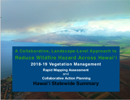
To start to fill the gap, HWMO conducted a Rapid Mapping Assessment and facilitated Collaborative Action Planning on Vegetation Management in 2018-19 to:
Better understand all of the important hazard reduction already happening by diverse land managers;
Identify and prioritize actions that address the island-wide fire issue to optimize expenditures and efforts and maximize protection at the landscape-scale;
To kick-start collaboration, information sharing, and integrate fire-thinking into current activities to address the cross-boundary fire risk.
We thank State Division of Forestry and Wildlife, University of Hawaiʻi CTAHR Cooperative Extension, and Pacific Fire Exchange for their collaborative support on this project. Funding was provided by Hawaiʻi State Grant-in-Aid Program, 2016, and the U.S. Forest Service, Pacific Southwest Region, under the terms of Grant No. 16-11052012-146 and No. 17-DG-11052012-143. USDA is an equal opportunity provider and employer.
We also thank the many mapping participants, workshop attendees, and survey respondents who made this all possible!
The summary results of the Rapid Mapping Assessment and Collaborative Action Planning can be found below.
Hawaiʻi Statewide Summary
Hawaiʻi Island
Lānaʻi
Maui
Molokaʻi
Oʻahu
Kauaʻi
Wildfire in Hawaii Factsheet
Did you know that the average area burned per year in Hawaii has increased 400% over the past century? Check out this Pacific Fire Exchange fact sheet that presents Hawaii Wildfire Management Organization's State Wildfire History Map and Dr. Clay Trauernichts' key findings from his research on the scale and scope of wildfire in Hawaii.
"Over the past decade, an average of >1000 wildfires burned >17,000 acres each year in Hawai‘i, with the percentage of total land area burned comparable to and often exceeding figures for the fire-prone western US (Fig. 1). Humans have caused much of the increase in wildfire threat by increasing the abundance of ignitions (Fig. 2) and introducing nonnative, fire-prone grasses and shrubs. Nonnative grasslands and shrublands now cover nearly one quarter of Hawaii's total land area and, together with a warming, drying climate and year round fire season, greatly increase the incidence of larger fires (Fig. 3), especially in leeward areas. Wildfires were once limited in Hawai‘i to active volcanic eruptions and infrequent dry lightning strikes. However, the dramatic increase in wildfire prevalence poses serious threats to human safety, infrastructure, agricultural production, cultural resources, native ecosystems, watershed functioning, and nearshore coastal resources statewide."
Hawaii Wildfire Impacts Flyer
Hawaiian Fire Potential Outlook Products
March - June 2017 weather conditions that affect fire potential in Hawaii.
Stay up-to-date about various weather and fuels conditions in Hawaii that affect fire potential with this useful service from North Ops Predictive Services meteorologists. 4-month Significant Fire Potential Outlook products are available as a "pdf", powerpoint, or video.
Communities at Risk from Wildfires - State of Hawaii Map
In line with its mission to protect communities and natural resources from wildfire through planning, mitigation, and education, HWMO has conducted hazard assessments for every community in the state. These assessments, coupled with the overall Communities At Risk From Wildfire Map update, will enable a more thorough understanding of wildfire hazards that can be addressed by communities, decision makers, fire responders, and natural resource managers.


