Community Assessments

West Kauaʻi Ready Set Go! Workshop and Home Ignition Zone Training

Earlier this week, Hawaiʻi Wildfire Management Organization traveled to West Kauaʻi to present the Ready Set Go! framework, and even practice those concepts in the field at the beautiful Kōkeʻe State Park.

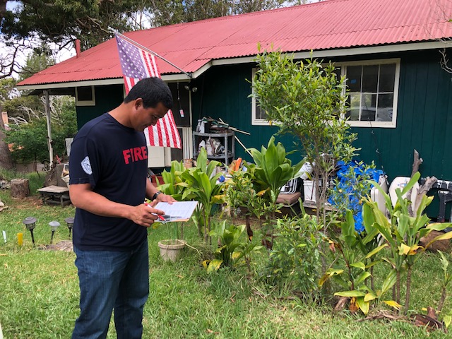
HWMO Executive Director Elizabeth teaches what to look out for while assessing Home Ignition Zones.

HWMO Executive Director Elizabeth teaches what to look out for while assessing Home Ignition Zones.

It was great to hear from members of the community in Waimea the night before, and Pablo Beimler (HWMOʻs Community Outreach Coordinator) did a great job presenting the Ready Set Go! (RSG) framework. The RSG! program was devised by the International Association of Fire Chiefs (IAFC), and is a very useful tool, presenting the best practices for preventing unintended fires from happening in the first place, and then if they do happen, what steps to take and WHEN to take them. We were joined by representatives of the DLNR Division of Forestry and Wildlife (DOFAW), and went over some of the actions that Waimea residents could take to prevent destructive wildfires.

The Ready Set Go! workshop participants.

The Ready Set Go! workshop participants.

The RSG! presentation was filled with information on how to reduce the risk of certain wildfire fuels surrounding your home, how to lessen the chances of wildfire spread from surrounding vegetation to your structure, as well as how to protect structures themselves from igniting, should the embers or flames from a fire come into contact. We all walked away with a little more knowledge on how protect ourselves, our homes, and our livelihoods from fire.

After Pabloʻs presentation, we learned a significant amount about the obstacles certain community members are up against while taking measures to reduce wildfire hazards around their properties and homes. The community members, agency representatives, and HWMO had time to converse and share ideas on the next steps that could be taken to reduce fire risk.

Kauai workshops 5_14_19_15.JPG

The next morning, we met and went through a Home Ignition Zone (HIZ) score card at Kōkeʻe state park, where one cabin resident allowed us to assess the fire risk of built structures at his cabin. It was beneficial to put the knowledge we had gleamed the night before into direct use, and understand what phrases like ladder fuels, fire-prone brush, and defensible spaces meant while applying it to a real-life structure. Each member of that workshop left with a greater understanding of how fire can travel faster uphill, the risks of storing wood underneath your house that could easily act as kindling, and how tree branches growing right next to the eaves of your roof could ignite your structure. It was a beautiful day outside in the precious native forest of Kōkeʻe.

Kauai workshops 5_14_19_26.JPG

We would like to thank the community members that came out to this event to learn how to be more Firewise, as well as the member of DOFAW that helped put on this educational event. DOFAW representatives Mapuana, Ceanne, Kawika, and Mike all helped us put on the successful event. We look forward to working with the West Kauaʻi communities again in the future, and hope to see the Ready Set Go! program grow there so that the people in those communities are as prepared as they can be in the event of a wildfire. An ounce of prevention is worth more than a pound of suppression!

Mahalo everyone for making this event successful!

Paniolo Hale Firewise Community Hazard Assessment

The assessment crew pointing out vegetative hazards on the wildland-urban interface of Paniolo Hale.

The assessment crew pointing out vegetative hazards on the wildland-urban interface of Paniolo Hale.

On April 1, 2019, HWMO flew to Molokaʻi, past the stunning cliffs of the North Shore, for a Firewise community hazard assessment of Paniolo Hale on the West End.

Paniolo Hale is an 8.75-acre condominium complex consisting of 21 buildings that include 76 dwelling units and a main office. Approximately 140 people live there, but nearly all are part-time residents (only about a half-dozen or so are full-time residents). Each unit is privately owned and ranges from studios to one or two-bedroom units. There is a resident manager and landscaping manager on-site. The condos are located in Kaluakoi in West Molokaʻi as part of a larger cluster of resort-style homes and vacation rentals along the scenic Kepuhi Beach (Paniolo Hale being the northern-most development in this zone). 

Across the gulch from Paniolo Hale due south is the partially-abandoned Kepuhi Beach Resort. Although some of the buildings are completely abandoned, many of the buildings are used as vacation rentals. Most of the grounds’ vegetation is still maintained, but the large golf course surrounding it is no longer in use and has gone fallow since the resort officially closed over a decade ago. Another condominium complex is situated due southeast of Paniolo Hale: Ke Nani Kai.

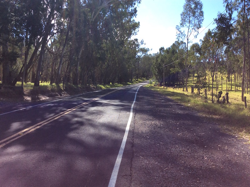
Captain Hanale Lindo of Maui Fire Department in front of roadside fuels.

Captain Hanale Lindo of Maui Fire Department in front of roadside fuels.

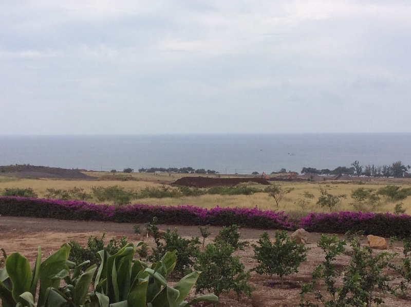
An abandoned golf course that once served as a wildland buffer, or greenbreak, for the community.

An abandoned golf course that once served as a wildland buffer, or greenbreak, for the community.

The assessment team taking a look at the wildland fuels.

The assessment team taking a look at the wildland fuels.

In early 2019, HWMO was contacted by the landscaping manager of Paniolo Hale for advice on wildfire prevention opportunities for the community. HWMO informed her about Firewise Communities and after a short turnaround, the Paniolo Hale neighborhood board decided to proceed in working towards Firewise Community recognition. As a first major step, a group of proactive residents and Paniolo hale staff met with HWMO, Maui Fire Department, and State Division of Forestry and Wildlife for the Firewise hazard assessment.

The assessment team first convened at the Paniolo Hale main office to map out an itinerary for the day, determine priority community areas to examine on the field assessment, and establish boundaries for the Firewise site. Following the meeting, the group walked to several areas to gain a vantage point of the intersection between wildland and urban areas. Along with these priority areas, the team also visited several representative homes to conduct a “Home Ignition Zone” assessment to better comprehend the wildfire hazards at the individual household level and identify locally-relevant examples of best practices for creating defensible space and fire-proofing structures.

The scenic Kepuhi Beach near Paniolo Hale.

The scenic Kepuhi Beach near Paniolo Hale.

Paniolo Hale is well on pace to become the first Firewise Community on Molokaʻi by the end of 2019! Mahalo Paniolo Hale!

Banner photo: view of Paniolo Hale from Kepuhi Beach Resort

Sea Country Firewise Hazard Assessment

The assessment team.

The assessment team.

On June 1, 2018, HWMO met with representatives from DLNR Division of Forestry and Wildlife, Honolulu Fire Department, Sea Country Community Association, and Waianae Coast Disaster Readiness Team, along with residents from Sea Country to conduct a Firewise Community Hazard Assessment of the Sea Country subdivision in Maili in West Oahu. Together, the group caravanned to several areas in the community to gain a vantage point of the intersection between wildland and urban areas. Along with these priority areas,  the team also visited several representative homes to conduct a “Home Ignition Zone” assessment to better comprehend the wildfire hazards at the individual lot level and identify locally-relevant examples of best practices for creating defensible space and fire-proofing structures.

The community of Sea Country is at a high risk for wildfires due to its high winds, history of nearby human-caused ignitions, location on the wildland-urban interface, and prevalence of fire-prone vegetation. By conducting the assessment, Sea Country will be one step closer to becoming a Firewise Community.

Sea Country Firewise Hazard Assessment 6/1/18


Nanawale Estates ReadySetGo! Workshop and Firewise Intro

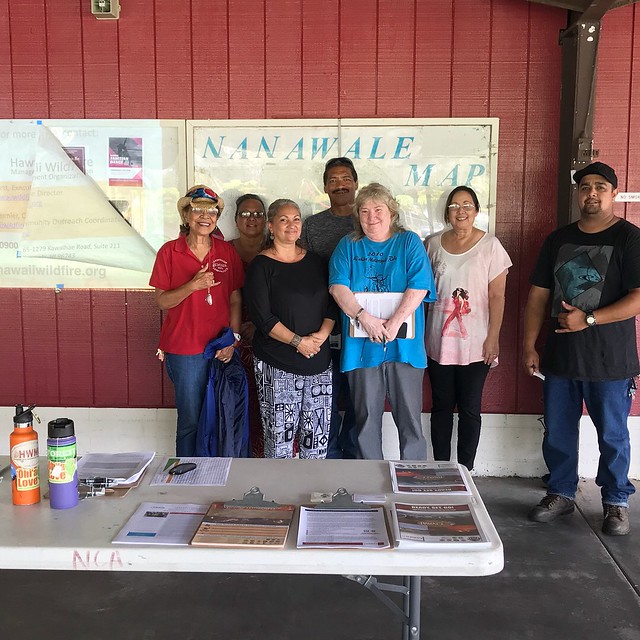
The Nanawale Estates community members who came to the workshop are willing and ready to help the community become a Firewise site.

The Nanawale Estates community members who came to the workshop are willing and ready to help the community become a Firewise site.

We started the week by working on recruiting a potential new Firewise Community in Puna on the Big Island (which would be the first on the east side). Proactive Nanawale residents and HOA staff joined us for a wildfire preparedness workshop on February 5 at the Nanawale Longhouse. We guided the workshop attendees through the Ready, Set, Go! program and encouraged them to pursue looking into becoming a nationally-recognized Firewise Community. Following the presentation, we walked over to a nearby home to practice assessing a home ignition zone for wildfire hazards (the best way to learn is out in the field!)

During the workshop, we held an input session to hear about the wildfire-related concerns of community members. Some key concerns included albizia control, lack of ingress/egress, and lack of continuous support from legislators. We then discussed possible solutions that could help address these issues. Nanawale is no stranger to environmental hazards. In 2014, the Pahoa lava flow threatened the community and the recent Hurricane Iselle proved very damaging to the community, which was largely out of power for several weeks. The community may not have gotten the federal aid and even local government support they had hoped for, but they took matters in their own hands anyways by supporting each other. This is a key function of a Firewise Community that is fire-adapted to its surroundings: building community resilience for the long-run is most impactful and effective when the whole community comes together.  

Nanawale Estates ReadySetGo! Workshop and Firewise Intro 2/5/2018

Kamilonui-Mariner’s Cove Firewise Hazard Assessment

The Firewise Communities movement is spreading to Oahu! Over the last two years, HWMO has assisted 10 communities in becoming nationally-recognized Firewise Communities. There are now 11 official communities in Hawaii, part of a network of over 1,400 across the U.S. Those 11 communities are located on Hawaii Island and Maui. That is soon to change as proactive residents and community organizations from Kamilonui-Mariner’s Cove are taking the necessary steps towards making their beloved community in Hawaii Kai a Firewise Community. 

Private landowners, contractors, farmers, legislators, community groups, government agencies...we are truly seeing a Firewise Community in the making where all stakeholders play an important role. 

Private landowners, contractors, farmers, legislators, community groups, government agencies...we are truly seeing a Firewise Community in the making where all stakeholders play an important role. 

This year has been a particularly stressful one for Kamilonui Valley Farm Lots and Mariner’s Cove residents. Over a dozen suspicious fire starts, a few that grew into larger fires, had burned close to the community in the first half of 2017. Since then, the community has been charged to take action. HWMO linked with Livable Hawaii Kai Hui and Senator Stanley Chang’s Office to organize a community-wide Firewise hazard assessment on November 27. Together with representatives from DLNR Division of Forestry and Wildlife (DOFAW), Hawaii Kai Neighborhood Board, Royal Contracting, and Kamilonui Farm Lots, the working group walked and drove around the community to examine common wildfire hazards and areas for potential wildfire risk reduction projects. 

The assessment team first convened at the Mariner’s Cove Bay Club to map out an itinerary for the day, determine priority community areas to examine on the field assessment, and establish boundaries for the Firewise Community designation. Following the meeting, the team walked along an access road off of Hawaii Kai Drive, visited Pahua Heiau, and caravanned to the end of Kamilonui Place to examine the wildland area in the back of the valley. Along with these priority areas, the team also visited a home to conduct a “Home Ignition Zone” assessment to gain a better idea of the wildfire hazards at the individual lot level and pull locally-relevant examples of best practices for creating defensible space and fire-proofing structures.

The assessment team examining fuels, or flammable vegetation, along the wildland border of Kamilonui-Mariner's Cove.

The assessment team examining fuels, or flammable vegetation, along the wildland border of Kamilonui-Mariner's Cove.

Hearing from a resident about her wildfire hazard concerns.

Hearing from a resident about her wildfire hazard concerns.

Once HWMO completes a written report of the hazard assessment, they will present their findings to the working group and the larger community in February 2018. The working group will take recommendations provided in the report into consideration when they develop an action plan for wildfire risk reduction activities in their community.

We thank all of the partners who joined us for the hazard assessment and are excited for what’s to come in 2018 for Kamilonui-Mariner’s Cove!

Kamilonui-Mariner's Cove Firewise Community Hazard Assessment 11/27/17

Firewise Workshop 2018 in Boise

HWMO had the honor on October 31 to share about its Firewise Communities successes (and challenges) at the national Firewise Workshop hosted by the National Fire Protection Association in Boise, Idaho. Community Outreach Coordinator for HWMO, Pablo Beimler, presented on the importance of laying the foundations for community-wide grassroots and sustained actions towards becoming a Firewise Community. This requires building autonomy, pride, inspiration, and enthusiasm in community members, along with agency and governmental support.

View of Boise from the foothills near the city.

View of Boise from the foothills near the city.

Hawaii was well-represented at the workshop that was held at the Grove Hotel. Representatives from Honolulu Fire Department and DLNR Division of Forestry were there with HWMO, thanks to funding support NFPA. We were informed about updates relating to Firewise and joined interesting group discussions regarding the future of wildfire risk reduction work in the U.S.

As an added bonus, with our friends from HFD and DOFAW, we took part in a two-day training on assessing the Home Ignition Zone (HIZ). The training was taught by two extremely knowledgeable wildland fire experts: Jack Cohen, who many consider being a father of modern wildfire mitigation theory and practices, and Pat Durland, who has 30 years of experience as a wildland firefighter and mitigation specialist. Together, they gave engaging lessons on fire ecology and science, the sociology behind assessing homes, and more. On the final day of the training, we hopped on the bus with the other training participants, who hailed from across the U.S., and practiced assessing home ignition zones in a local Firewise Community. 

Trainees practicing their new home ignition zone assessment skills at a home in a local Firewise Community.

Trainees practicing their new home ignition zone assessment skills at a home in a local Firewise Community.

Jack Cohen (right) provides insight regarding home ignition hazards around a practice home.

Jack Cohen (right) provides insight regarding home ignition hazards around a practice home.

Big thanks to NFPA for inviting and flying us to Boise to share about our efforts and learn from experts in the field!

Firewise Workshop 2018 in Boise

Puu Kapu Firewise Community Hazard Assessment

The Firewise Communities movement in Hawaii continues to grow. There are now 11 Firewise Communities in Hawaii, 10 of which HWMO has assisted in the last two years. Puukapu Farm Lots, which spans thousands of acres of Department of Hawaiian Homeland-owned pasture in Waimea on Hawaii Island, is the latest candidate for becoming a Firewise Community. HWMO has a new round of funding from the US Forest Service, with additional help from State Farm, to assist at least 4 more communities towards becoming a nationally-recognized Firewise Community. Puukapu residents have jumped on the opportunity early, aiming to become certified in 2018. 

The homestead community has had many encounters with brushfires over the years, especially during droughts and summer months. The most recent large fire that occurred in and around Puukapu was a 2,200-acre wildfire that started on July 7, 2017. The fire originated from one of the lots on the southwest end of Puukapu and, fueled by strong prevailing trade winds, quickly spread through the adjacent Parker Ranch pastures towards Highway 190. The start of the fire is now suspected to be an accidental start from fireworks. Several residents stayed to fight the fire with garden hoses before first responders could arrive to protect a home on one of the properties. Other residents also helped by driving skid steers or tractors to create firebreaks. Fortunately, no human casualties resulted from the blaze. The fire did, however, burn down a home and vehicle and took the lives of a couple of sheep on another property. There was also significant damage to fencing, waterlines, and water tanks on both Puukapu private lots and Parker Ranch lands, let alone the thousands of acres of pasture that were burned.

July 2017 brushfire that burned in Puukapu and towards the highway. Credit: Hawaii Tribune Herald

July 2017 brushfire that burned in Puukapu and towards the highway. Credit: Hawaii Tribune Herald

As a response to the latest fire, several community members gathered on October 20, 2017, to meet with HWMO and Hawaii Fire Department (HFD) representatives to conduct a community-wide Firewise hazard assessment. The assessment team first convened at the entrance of Poliahu Alanui to map out an itinerary for the day and determine priority community areas to examine on the field assessment. The team drove throughout the subdivision, examining various water resources and wildland borders along the way Along with the priority areas, the team visited a few homes to conduct a “Home Ignition Zone” assessment to gain a better idea of the wildfire hazards at the individual lot level and pull locally-relevant examples of best practices for creating defensible space and fire-proofing structures. 

The assessment crew examining a standpipe in Puukapu.

The assessment crew examining a standpipe in Puukapu.

Taking notes on a dip tank that has the potential for use during wildfires.

Taking notes on a dip tank that has the potential for use during wildfires.

Once HWMO completes a written report of the hazard assessment, they will present their findings to the new Firewise Committee formed by Puukapu community members. The Committee will take recommendations provided in the report into consideration when they develop an action plan for wildfire risk reduction activities in their community.

We thank the Puukapu community members and HFD for joining the hazard assessment and look forward to their continuing partnership in this effort to establish Puukapu as a Firewise Community.

Puukapu Firewise Community Hazard Assessment

Kohala Waterfront Firewise Hazard Assessment

Firewise Communities is quickly taking the Kawaihae area by storm. Kohala-By-The-Sea, the longest running certified Firewise Community in the state, and one of the newest Firewise Communities, Honokoa, are both located in the arid Kawaihae region. Kohala Waterfront is the next community to step up to the plate. On April 19, as a major step towards certification, a couple residents from the gated community on the makai side of the highway (and directly across from Kohala-By-The-Sea) met with HWMO and HFD representatives to conduct a Firewise hazard assessment. They visited several homes to point out and document fire hazards and successful Firewise practices put in place. They also walked along a stretch of the Ala Kahakai Trail which runs adjacent to the makai side of the community. One of the main community-wide hazards they noted were overgrown kiawe trees adjacent to several homes. U.S. Forest Service, through HWMO’s administration, has granted the community $5,000 for a fuels reduction project, which HWMO recommended could be put towards kiawe limbing. 

Native kou growing on mowed green belts that serve as living fuelbreaks along roadsides within Kohala Waterfront.

Native kou growing on mowed green belts that serve as living fuelbreaks along roadsides within Kohala Waterfront.

There are lots of signs of previous burns throughout the subdivision including this charred stump of a kiawe tree.

There are lots of signs of previous burns throughout the subdivision including this charred stump of a kiawe tree.

Kohala Waterfront Firewise Hazard Assessment 4/19/17

Waikiʻi Ranch Firewise Hazard Assessment

HFD Fire Prevention, HWMO, and Waikiʻi Ranch HOA teamed up to assess wildfire hazards in and around the subdivision.

HFD Fire Prevention, HWMO, and Waikiʻi Ranch HOA teamed up to assess wildfire hazards in and around the subdivision.

For the casual passer-by during the winter, the rolling green hills of Waikiʻi Ranch may strike them as an area free of wildfire threats. However, over the past several years, Waikiʻi Ranch has had numerous close calls with wildfires that have burned in and around the subdivision. The subdivision is exposed on each side by large tracts of unmanaged grass and shrublands prone to ignition from starts along neighboring roads and highways. 

On March 6, HWMO teamed up with Hawaiʻi Fire Department and Waikiʻi Ranch HOA to conduct a Firewise hazard assessment for Waikiʻi. The group first met at the community clubhouse to discuss what it takes for a community to become Firewise certified. As a major first step towards certification, the a few members of the group drove to various points of interest within the community. Some of the major wildfire hazards that struck our attention included the many dead trees along the edges of roads and fencelines, piles of wood underneath tree canopies, and large expanses of unmanaged grass and shrublands surrounding homes and the greater Waikiʻi area. 

The association has been allocating some of their funds and resources towards Firewise improvements already. Most notably, the community has herds of cows, goats, and sheep that are used to graze easements along the perimeters of properties and the subdivision boundary. As more and more people in Waikiʻi join the Firewise efforts, the community will hopefully become another shining example in Hawaiʻi and a part of a statewide collaborative, grassroots movement for communities to take fire readiness into their own hands.

Waikii Ranch Firewise Hazard Assessment

Puʻunoa Firewise Hazard Assessment

Assessment team walking along a road to assess wildfire risks/hazards.

In 2016, Launiupoko, near Lahaina, became the first nationally-recognized Firewise Community in West Maui. The accomplishment did not go unnoticed. In fact, news quickly spread to the neighboring Puʻunoa community. This year, Puʻunoa will be working towards the same certification as Launiupoko. 

To begin the process, HWMO joined its partners from Division of Forestry and Wildlife and West Maui Mountains Watershed Partnership to conduct a Firewise hazard assessment of the agricultural lots in Puʻunoa. The team first met with several residents from Puʻunoa and the general manager of the HOA to discuss the Firewise certification process.

Assessment team examines road crossing on Kauaula Stream that was damaged during a recent rain event. 

Assessment team examines road crossing on Kauaula Stream that was damaged during a recent rain event. 

They soon followed the meeting by caravanning (and walking/hiking) throughout the community to assess common wildfire hazards and successful Firewise modifications around homes. Brainstorming ideas, the topic of managed grazing emerged numerous times as one of the ways to mitigate the large tracts of flammable grasslands. The group made their way to the Makila Reservoir and Kauaula Stream, important water suppression resources used by firefighters during past wildfires in the area. During one of the recent storms, the roadway across the stream was destroyed — flooding is another hazard the community faces.

Mahalo to DOFAW, WMMWP, Hawaiiana Management Company, and the newly formed Puʻunoa Firewise Committee for playing an important role in moving Puʻunoa towards Firewise certification.

Puunoa Firewise Hazard Assessment 2/10/17