Wildfire Prep Workshops

West Kauaʻi Ready Set Go! Workshop and Home Ignition Zone Training

Earlier this week, Hawaiʻi Wildfire Management Organization traveled to West Kauaʻi to present the Ready Set Go! framework, and even practice those concepts in the field at the beautiful Kōkeʻe State Park.

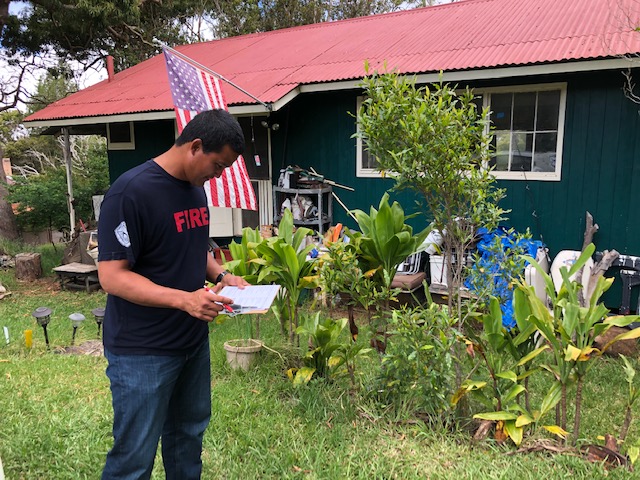
HWMO Executive Director Elizabeth teaches what to look out for while assessing Home Ignition Zones.

HWMO Executive Director Elizabeth teaches what to look out for while assessing Home Ignition Zones.

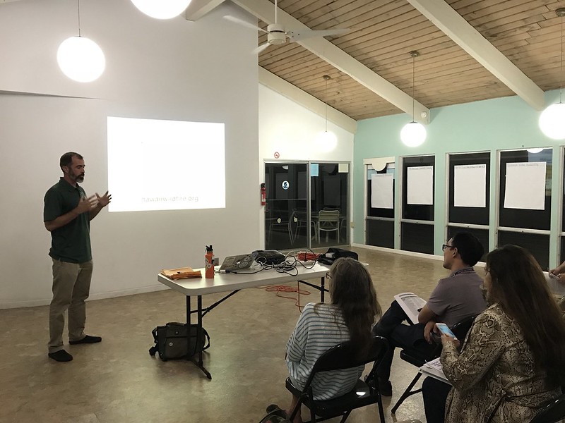
It was great to hear from members of the community in Waimea the night before, and Pablo Beimler (HWMOʻs Community Outreach Coordinator) did a great job presenting the Ready Set Go! (RSG) framework. The RSG! program was devised by the International Association of Fire Chiefs (IAFC), and is a very useful tool, presenting the best practices for preventing unintended fires from happening in the first place, and then if they do happen, what steps to take and WHEN to take them. We were joined by representatives of the DLNR Division of Forestry and Wildlife (DOFAW), and went over some of the actions that Waimea residents could take to prevent destructive wildfires.

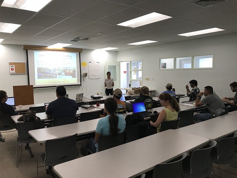
The Ready Set Go! workshop participants.

The Ready Set Go! workshop participants.

The RSG! presentation was filled with information on how to reduce the risk of certain wildfire fuels surrounding your home, how to lessen the chances of wildfire spread from surrounding vegetation to your structure, as well as how to protect structures themselves from igniting, should the embers or flames from a fire come into contact. We all walked away with a little more knowledge on how protect ourselves, our homes, and our livelihoods from fire.

After Pabloʻs presentation, we learned a significant amount about the obstacles certain community members are up against while taking measures to reduce wildfire hazards around their properties and homes. The community members, agency representatives, and HWMO had time to converse and share ideas on the next steps that could be taken to reduce fire risk.

Kauai workshops 5_14_19_15.JPG

The next morning, we met and went through a Home Ignition Zone (HIZ) score card at Kōkeʻe state park, where one cabin resident allowed us to assess the fire risk of built structures at his cabin. It was beneficial to put the knowledge we had gleamed the night before into direct use, and understand what phrases like ladder fuels, fire-prone brush, and defensible spaces meant while applying it to a real-life structure. Each member of that workshop left with a greater understanding of how fire can travel faster uphill, the risks of storing wood underneath your house that could easily act as kindling, and how tree branches growing right next to the eaves of your roof could ignite your structure. It was a beautiful day outside in the precious native forest of Kōkeʻe.

Kauai workshops 5_14_19_26.JPG

We would like to thank the community members that came out to this event to learn how to be more Firewise, as well as the member of DOFAW that helped put on this educational event. DOFAW representatives Mapuana, Ceanne, Kawika, and Mike all helped us put on the successful event. We look forward to working with the West Kauaʻi communities again in the future, and hope to see the Ready Set Go! program grow there so that the people in those communities are as prepared as they can be in the event of a wildfire. An ounce of prevention is worth more than a pound of suppression!

Mahalo everyone for making this event successful!

Kaʻū ReadySetGo! Wildfire Preparedness Weekend

This past weekend, as part of Wildfire Preparedness Month, Hawaii Wildfire Management Organization (HWMO) teamed up with Nā Mamo O Kāwā (NMOK), and led a workshop on Friday night to help community members learn about the Ready Set Go! fire preparedness framework. Many people in the group were volunteer firefighters from the Kaʻū area, and had plenty of knowledge to share with everyone in the room. This wonderful night, which was hosted at the historic Pahala Plantation House was filled with anecdotal stories and great information to be absorbed as the community examined its current fire situation.

Before Ladder Fuel Thinning…

Before Ladder Fuel Thinning…

After!

After!

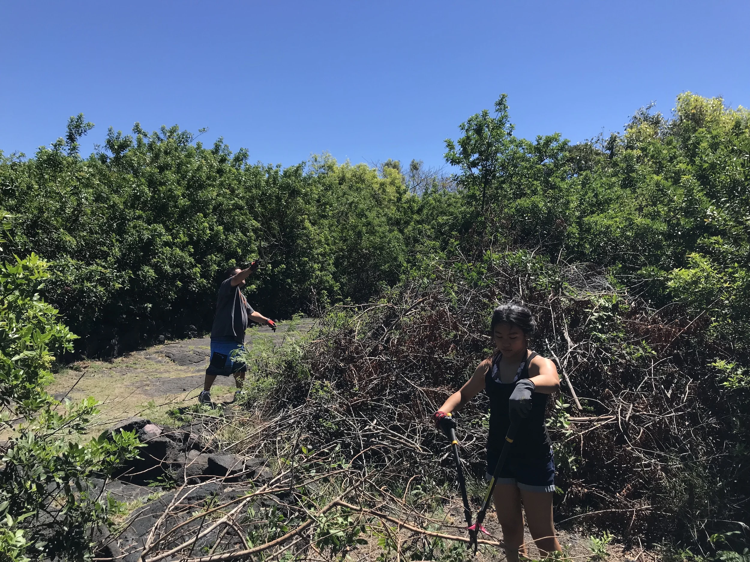
Community members were able to take immediate action the next day as we got our hands dirty in Kāwā restoration efforts. We got to put our ladder fuel knowledge into action as we removed lower branches of christmasberry and ʻekoa that could easily help a fire climb into the upper canopy of the forest. We planted several Firewise native plants including ʻaʻaliʻi that are now able to grow under the shade of the freshly pruned canopy. Members of NMOK taught us about the cultural significance of Kāwā, and the methods they are using to restore such an important place. In all, over 20 people participated in the 2 events, and we would like to extend a sincere mahalo for being a part of such a successful weekend!

Puukapu Pastoral Wildfire Planning Meeting and RSG! Workshop

HFD gives a presentation on wildfire access in Puukapu.

HFD gives a presentation on wildfire access in Puukapu.

An elaborate 3D map the Puukapu Pastoral committee assembled.

An elaborate 3D map the Puukapu Pastoral committee assembled.

Last year, Puukapu Pastoral became the 9th Firewise Community on Hawaii Island (and the 4th Firewise Community statewide on Hawaiian Home Lands). A committed group of community members from Puukapu Pastoral Steering Committee / Firewise are taking action to reduce the fire threats of the Waimea homestead area. Through outreach and education, community members are reaching out to neighbors about the importance of creating defensible space around houses, hardening homes, and having a household evacuation plan. The committee is also developing a well-thought-out, community-driven plan to create safer first response access and ingress/egress.

On March 21, the committee held a community meeting and invited HWMO and HFD representatives to give presentations. HWMO’s Pablo Akira Beimler gave a comprehensive Ready, Set, Go! wildfire preparedness workshop to the intent participants. The highlight of the night for us was to see an amazing 3D map the committee members had created (they were up till the wee hours of the night!) to demonstrate their color-coded road system proposal. We were very impressed with the level of detail and the immense effort and care the group put into this project. This community spirit is what keeps HWMO motivated to do the work that we do and support efforts like this. Keep up the great work, Puukapu!

Kohala Waterfront Firewise Educational Evening

Kohala Waterfront Wildfire Prep Day 2018

Kohala Waterfront Wildfire Prep Day 2018

Kohala Waterfront, a relatively new community in Kawaihae, invited HWMO’s Pablo Akira Beimler to join them for an educational evening on wildfire preparedness. In 2017, Kohala Waterfront became the 3rd community in Kawaihae on Hawaii Island to be nationally recognized as a Firewise Community. As an annual requirement, a Firewise Community must hold at least one educational event.

On February 11, 18 Kohala Waterfront homeowners gathered at the home of Firewise Chair, Marla Herman (Marla and her husband, Scott were amazing hosts). Pablo kicked off the night with a presentation on the Firewise Communities program, Ready, Set, Go!, and lessons learned from the memorable 2018 wildfire year in Hawaii. Following his presentation, Ms. Herman demonstrated what to pack in a “Go! bag” — the essentials that you need to evacuate early when a wildfire is in the area.

Mahalo Marla and the rest of the Kohala Waterfront Firewise Committee for continuing to raise the wildfire awareness level each year!

Kamilonui-Mariner's Cove Firewise Hazard Assessment Review Workshop

Dr. Clay Trauernicht of UH CTAHR Cooperative Extension and Pacific Fire Exchange encourages the community members in the room to continue to take proactive action in the neighborhood to prevent wildfire loss.

Dr. Clay Trauernicht of UH CTAHR Cooperative Extension and Pacific Fire Exchange encourages the community members in the room to continue to take proactive action in the neighborhood to prevent wildfire loss.

On February 13, over a dozen community members from Kamilonui Valley and Mariner's Cove in Hawaii Kai joined our workshop with Honolulu Fire Department, DLNR Division of Forestry and Wildlife, and University of Hawaii CTAHR Cooperative Extension. The community members heard from the various agency representatives about the importance of taking action early to prevent fire loss in the community. HWMO has teamed up with the community to support them in becoming the first Firewise Community in the eastern half of Oahu.

As a requirement of becoming a nationally-recognized Firewise Community, our team met with several of the community members a few months ago to conduct a community-wide wildfire hazard assessment. After synthesizing the information in a comprehensive report, we designed a workshop to inform the community members about their wildfire risk. At the end of the workshop, the community members listed the priority actions they wanted to see taken in the community to protect it from wildfire. Those actions will be used to formulate an action plan, another requirement for becoming a Firewise Community. From then on, it is action time! The community plans to take preventive action this summer as part of Wildfire Prep Day with a volunteer event to reduce hazardous vegetation along the edges of the community.


Kamilonui-Mariner's Cove Firewise Hazard Assessment Review Workshop 2/13/18

Collaborative Vegetation Management Mapping Workshop 1 - Mauna Kea Partners

Mauna Kea partners were busy at work mapping fuels management projects on Google MyMaps.

Mauna Kea partners were busy at work mapping fuels management projects on Google MyMaps.

Across the state, there are many vegetation management projects that are helping to reduce the fire threat around natural/cultural resources and near communities. However, there currently isn’t a way to track all of these projects and the desired areas for future management of flammable vegetation. Stemming from an idea communicated to us from an HWMO Technical Advisor and US Fish and Wildlife partner, Dawn Bruns, we have received US Forest Service funding to create a statewide database and map of vegetation management projects. 

Meeting participants worked in groups to map their fuels management projects.

Meeting participants worked in groups to map their fuels management projects.

We held our first workshop with our partners from the Mauna Kea Watershed Alliance (MKWA) and Three Mountains Alliance (TMA) on January 30 at the Hawaii Innovation Center in Hilo. Elizabeth Pickett, HWMO Executive Director, started the workshop off with an introduction to the project, emphasizing how important this project will be for future collaborative fuels management projects. Dr. Clay Trauernicht, Wildfire Extension Specialist of University of Hawaiii CTAHR Cooperative Extension and Co-Coordinator of the Pacific Fire Exchange, gave a brief course on fire science and pre-fire planning and management. Pablo Akira Beimler, HWMO Community Outreach Coordinator, followed with a training on Google MyMaps, which was the main platform we used to collect data from meeting participants. 

Cheyenne Perry, Coordinator of Mauna Kea Watershed Alliance, points out areas where he hopes there can be collaborative vegetation management projects on Mauna Kea.

Cheyenne Perry, Coordinator of Mauna Kea Watershed Alliance, points out areas where he hopes there can be collaborative vegetation management projects on Mauna Kea.

For the rest of the workshop, meeting participants began mapping their current and desired vegetation management projects on Google MyMaps. Once the projects were mapped, we projected the new data onto a screen and had the groups share about their work areas and what they envision for a more fire-safe Mauna Kea. 

HWMO will be spending the rest of the summer holding workshops across the islands. If you would like to participate, please contact admin@hawaiiwildfire.org. 

Special mahalo to MKWA Coordinator, Cheyenne Perry, and TMA Coordinator, Colleen Cole, for being our first workshop partners. Mahalo also to Mauna Kea Forest Restoration Project and U.S. Army-Garrison for joining our workshop and being our workshop “guinea pigs”!

Collaborative Vegetation Management Mapping Workshop in Hilo with MKWA and TMA 1/30/2018

Kanehoa Firewise Native Plant Workshop

Kanehoa, a subdivision halfway between Kawaihae and Waimea on Hawaii Island, was the second community in Hawaii to become a nationally-recognized Firewise Community. Since 2015, they have contributed hundreds of volunteer hours and linked with HWMO for a couple of $5,000 grants to remove flammable vegetation from along internal roadsides. As part of the next step in their action plan, they hope to plant more native vegetation along common areas and around their own homes. 

2016 Firewise Day: Kanehoa residents took fuels reduction into their own hands with a $500 grant from State Farm and $5,000 grant from HWMO to remove haole koa from roadsides. Here is a before...

2016 Firewise Day: Kanehoa residents took fuels reduction into their own hands with a $500 grant from State Farm and $5,000 grant from HWMO to remove haole koa from roadsides. Here is a before...

...and after.

...and after.

Native dryland plants can be an added defense for your home, though like with any plants, site location and what you plant matters greatly for fire safety reasons. On November 4th, Kanehoa Firewise Committee members invited HWMO to join them for a Firewise Native Plant Workshop. Fifteen community members listened in as guest speaker Jill Wagner of Hawaii Island Seed Bank talked story about the importance of restoring native plants in our own communities. The area between Puu Waa Waa to Kohala Mountain on the leeward side was one of the most biodiverse areas in Hawaii, she shared. Years of drought, invasive species and disease stress, overgrazing, climate change, and wildfire have contributed to the demise of the native forests, which act as important watersheds. We have seen some success in recent years towards preserving and restoring these native forests with the emergence of strong conservation partnerships and efforts, better grazing practices targeted towards conservation and wildfire risk reduction, and wildfire protection projects that span the South Kohala area. However, there is still a lot to be done and we can all play a large role even around our own homes. 

Ms. Wagner brought in a few native plants of her own for Kanehoa residents to pass around and get to know better. She enlightened us on ground covers such as iliee, akia, pohinahina and pau o hiiaka; shrubs such as aalii, aweoweo, and alahee; and trees such as mamane, lama, ohe makai, and wiliwili. If these names are unfamiliar to you or you would like to learn more, click on the links below. 

Waikii Ranch Firewise Hazard Training and BBQ

Community members from all over Waikii Ranch participated in the community's first Firewise Day on September 23, 2017.

Community members from all over Waikii Ranch participated in the community's first Firewise Day on September 23, 2017.

Waikii Ranch, which is surrounded by fire-prone grasslands on all sides, is a community near Waimea that is well on its way to being one of the next nationally-recognized Firewise Communities as of 2017. They took another major step on September 23 by hosting a Firewise Hazard Training and BBQ, which qualified as their annual Firewise Day. Over 25 community members joined in to listen to presentations from HWMO and our partners from Hawaii Fire Department, U.S. Army-Garrison Fire and Emergency Services, and DLNR Division of Forestry and Wildlife. HWMO’s Pablo Beimler gave a presentation on wildfire impacts, background on wildfire preparedness programs (Ready, Set, Go! and Wildfire Lookout!), and a brief intro to the Firewise Communities Recognition Program.

From left to right: Gary Grisham (Waikii Ranch Firewise Committee), Jacob Witcraft (DLNR DOFAW), Pablo Beimler (HWMO), Chief Eric Moller (US Army-Garrison, FES), and Captain Bill Bergin (HFD). Photo credit: Lynn Scully.

From left to right: Gary Grisham (Waikii Ranch Firewise Committee), Jacob Witcraft (DLNR DOFAW), Pablo Beimler (HWMO), Chief Eric Moller (US Army-Garrison, FES), and Captain Bill Bergin (HFD). Photo credit: Lynn Scully.

U.S. Army’s Chief Eric Moller spoke thereafter with the main message being that by becoming a Firewise Community, residents were taking an important step towards protecting themselves as well as the lives and safety of first responders. Captain Bill Bergin from HFD followed with several Firewise tips and background on some of the fire issues and history in Waikii. Jacob from DOFAW’s State Tree Nursery also spoke about the importance of creating defensible space and recommended the community plant more native trees and understory to reduce wildfire risk. To wrap up the presentations, a resident of Puu Kapu who lost her home in a recent brushfire gave a first-hand account of her harrowing experience evacuating the fire. She stressed the importance of planning ahead and it was a truly courageous thing for her to share her story in front of so many people.

After the speakers shared their thoughts, a member of the Waikii Ranch HOA put on a Firewise video outlining tips on Firewise landscaping and home fire-proofing. 

The event concluded with a BBQ where fire officials mingled with community members and enjoyed delicious grindz. Thank you Waikii Ranch HOA for hosting all of us and being a part of the growing Firewise movement in Hawaii.

Waikii Ranch Firewise Hazards Training and BBQ 9/23/17

Kohala Waterfront Firewise Meeting and Ready Set Go! Workshop

Kohala Waterfront homeowners joined HWMO and the Firewise Committee to learn more about how they could help the community become a nationally-recognized Firewise Community.

Kohala Waterfront homeowners joined HWMO and the Firewise Committee to learn more about how they could help the community become a nationally-recognized Firewise Community.

Kawaihae is becoming a hot bed, not just for wildfire, but for grassroots community efforts to reduce the wildfire threat in the fire-prone area. Kohala-By-The-Sea and Honokoa subdivisions have received Firewise Communities recognition inspiring Kohala Waterfront, a newer subdivision on the makai side of the highway opposite of the two other subdivisions, to pursue certification for 2017. 

On August 17, HWMO and Kohala Waterfront Firewise Committee hosted a meeting of twelve concerned and enthusiastic Kohala Waterfront homeowners to hear highlights from the Firewise Community Hazard Assessment conducted by HWMO and Hawaii Fire Department a few months ago. We shared our concerns about the sea of buffelgrass that surrounded homes throughout the subdivision and unlimbed kiawe trees that were dangerously encroaching upon homes. Although it may seem daunting at first, Kohala Waterfront has a lot working towards their advantage, especially since they are a newer subdivision and can get the community going in the right direction by becoming a Firewise Community early on. We gave tips based on Ready Set Go! and Wildfire Lookout! on how residents could reduce the fire threat around their homes or better yet, as a community. 

Kohala Waterfront is well on their way to becoming one of the next Firewise Communities, of which there are now nine in the state. 

PFX/HWMO Palehua Wildfire Mitigation Strategies Workshop and Field Tour

Opening circle and prayer to begin the day.

Opening circle and prayer to begin the day.

Pacific Fire Exchange (PFX) and HWMO linked up on July 17 to hold an exciting day of fun and learning in Palehua, just mauka of Makakilo on Oʻahu. PFX’s Clay Trauernicht, Melissa Kunz, and Elizabeth Pickett spent several weeks planning this wildfire mitigation strategies workshop that led into a field tour as a follow-up to a workshop they put on at the PICCC conference several months ago. HMMO’s Pablo Beimler also joined the workshop as a helping hand. The Palehua workshop was tied into the Hawaiʻi Conservation Conference as a pre-conference event that interested conservationists could attend. Thirty or so people from various agencies and organizations including National Park Service, Honolulu Fire Department, Fed Fire, DLNR Division of Forestry and Wildlife, and University of Hawaiʻi joined the event. 

The day kicked off with a workshop at Palehua Camp, formerly Camp Timberline, amongst tall trees and with scenic views of the Ewa area below. Clay Trauernicht gave a brief presentation on fire science using data he was synthesizing from the HWMO fire history database. Some interesting new factoids included:

* 75% of fires in Hawaiʻi are accidental

* 75% of fires in Hawaiʻi occur under drought conditions

* Over 80% of areas burned in Hawaiʻi are grassland/shrubland areas

Clay also shared about values at risk and their vulnerabilities. He adapted an equation he learned from a recent climate adaptation workshop, to fit into the fire science framework:

Vulnerability = exposure (fire hazards) + resource sensitivity (sensitivity to fire) — adaptive capacity (wildfire mitigation)

Elizabeth followed Clay’s presentation by highlighting various mitigation strategies. With these presentations in mind, the participants broke into groups for a computer-based activity. The groups picked a “designated mouse driver” and dug into the wildfire hazards and values at risk in Palehua using Google Earth. Once they determined areas of concern and the hazards that threatened those areas, they determined mitigation strategies they could apply to the area to reduce the fire hazard. They then shared their findings with the rest of the workshop participants. Anu and McD, two men who knew Palehua on the back of their hands, blessed us with examples of mitigation strategies they had actually implemented or planned to implement in the area. 

Breaking out into groups to discuss wildfire mitigation strategies for Palehua.

Breaking out into groups to discuss wildfire mitigation strategies for Palehua.

Scanning through Google Earth to determine areas of concern and wildfire hazards in Palehua.

Scanning through Google Earth to determine areas of concern and wildfire hazards in Palehua.

The workshop then shifted into a field tour as participants hopped into vans for the afternoon. The first stop was an overlook area where one could see where the 2014 Makakilo fire started and took off. The fire was an intense one that killed over 200 wiliwili trees and charred several homes. Mikiʻala Akiona, Public Education Specialist for Honolulu Fire Department, noted how difficult the fire was to suppress due to the many hot spots and restarts that occurred. The group then stopped towards the top of Palehua at a ranch-style building called Hokuloa, which had been used as a staging area and command center for large fires. Participants learned about the importance of having the right fittings for water tanks (as well as the need for suction hoses) and for creating fuelbreaks horizontal to the slope. Throughout this discussion, the participants had a spectacular view of central Oʻahu, which became increasingly obscured by a large rain cloud headed their way. 

Looking out over the area where the Makakilo 2014 fire started.

Looking out over the area where the Makakilo 2014 fire started.

Group photo in front of Nānakuli backdrop.

Group photo in front of Nānakuli backdrop.

Rain cloud headed towards the group while looking towards Kunia.

Rain cloud headed towards the group while looking towards Kunia.

Back of Nānakuli Valley where remnant native forests still exist.

Back of Nānakuli Valley where remnant native forests still exist.

The group then traveled up to a cabin for views of the north side of Palehua, where the discussion turned its focus toward the 2016 Nānakuli Fire that threatened homes and resources such as communication towers. The final stop added a little bit of adventure to the day. The participants hiked up to the top of Mauna Kapu through bamboo forests, stopping for a chant led by Anu before reaching the sacred peak. Once atop the mauna, Gary Gill, a large landowner in the area, gave background on how special the place they were surrounded by was. The area used to have one of the highest concentrations of native tree snails, but the population had been steadily declining within the last couple of years. There were several populations of different varieties of native birds still calling the area their home. Previous fires had burned ʻiliahi forests in the back of Nānakuli Valley, but about half of them had recovered, although they were much more stunted in growth than before. 

The workshop and field tour was a memorable one for us all and we hope that the valuable lessons and conversations that took place were of value for all of the participants. Mahalo to all who came out for a special day in Palehua.  

PFX-HWMO Wildfire Mitigation Strategies Workshop and Field Tour of Palehua 7/17/17