Maui (West)

Maui Vegetative Fuels Management Collaborative Action Planning Workshop

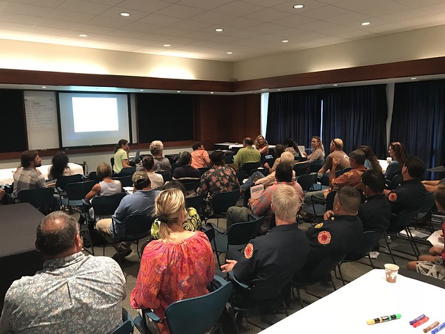
Full house for the workshop!

Full house for the workshop!

As a hub of wildfire protection efforts across the Hawaiian Islands, we are always looking for ways to bring people together to solve some of our most complex wicked problems. The Hawaiian Islands have been struggling with invasive species spread for decades, but now we are seeing what happens when invasive flammable plants take over the landscape and allow fires to spread more quickly and over larger areas. By controlling or managing flammable vegetation at the landscape-level, we can make great strides towards reducing the wildfire risk on our islands.

That’s why HWMO is coordinating a statewide vegetative fuels management mapping project — a rapid assessment to understand the vegetation management needs and priorities of landowners and land managers throughout the Hawaiian Islands. DLNR Division of Forestry and Wildlife and University of Hawaii CTAHR Cooperative Extension are key partners in the effort.

The vision for the project is that the resulting maps will lead to 1) better prioritization and communication of vegetative fuels management on the landscape-scale and 2) enhance project coordination between organizations and funding opportunities.

Marking areas of importance to protect from wildfires.

Marking areas of importance to protect from wildfires.

Discussing collaborative project ideas.

Discussing collaborative project ideas.

As part of the next phase of our groundbreaking project, we held a collaborative action planning workshop at the Maui Arts and Culture Center in Kahului. Nearly 50 participants representing a wide variety of fields and backgrounds came together to discuss what future landscape-level vegetation management projects could be on the horizon. During breakout group sessions, teams of people circulated to different tables to highlight key areas for protection, helping inform us on the top priority areas for the last part of the workshop: outlining actual project ideas. Additionally, and possibly more importantly, many people were able to meet new faces, share ideas, and became new work partners. HWMO truly is a hub!

Maui Vegetative Fuels Management Collaborative Action Planning Meeting 9/27/18

Maui Vegetative Fuels Management Mapping Meetings and LHWRP Workshop

Mapping with Lance De Silva of DOFAW.

Mapping with Lance De Silva of DOFAW.

As a hub of wildfire protection efforts across the Hawaiian Islands, we are always looking for ways to bring people together to solve some of our most complex wicked problems. The Hawaiian Islands have been struggling with invasive species spread for decades, but now we are seeing what happens when invasive flammable plants take over the landscape and allow fires to spread more quickly and over larger areas. By controlling or managing flammable vegetation at the landscape-level, we can make great strides towards reducing the wildfire risk on our islands.

That’s why HWMO is coordinating a statewide vegetative fuels management mapping project — a rapid assessment to understand the vegetation management needs and priorities of landowners and land managers throughout the Hawaiian Islands. DLNR Division of Forestry and Wildlife and University of Hawaii CTAHR Cooperative Extension are key partners in the effort.

The vision for the project is that the resulting maps will lead to 1) better prioritization and communication of vegetative fuels management on the landscape-scale and 2) enhance project coordination between organizations and funding opportunities.

Mapping at the LHWRP office with members of the ranching community on Maui.

Mapping at the LHWRP office with members of the ranching community on Maui.

On June 16 and 17, we had a series of meetings with DOFAW, Alexander & Baldwin, Hana Ranch, and DHHL to map current and desired vegetation management activities in Maui Nui. Activities could include any vegetation reduction or conversion projects such as roadside mowing, fuelbreaks, grazing rotations, clearing around structures or power poles, brush abatement or thinning, tree trimming, loi restoration, agriculture, and native forest restoration. On June 18, we held a workshop in conjunction with Leeward Haleakala Watershed Partnership to gather more data, especially in regards to restoration efforts and grazing areas.

Wildfire Readiness Presentation with Rotary Club of Lahaina Sunset

Ukumehame Fire on June 22, 2016. Photo Credit: Timothy Lara / Maui Now contributor

Ukumehame Fire on June 22, 2016. Photo Credit: Timothy Lara / Maui Now contributor

After a long day of visiting schools across the leeward side of Maui to promote the Wildfire Lookout! campaign, HWMO’s Community Outreach Coordinator, Pablo Beimler, joined Rotary Club of Lahaina Sunset members for a dinner at Royal Lahaina Resort on May 16. Fifteen Rotarians listened in as Pablo gave background on the wildfire situation in Hawaii. He then let the group know that there were concrete ways to get involved through the Firewise Communities and ReadySetGo! program. Pablo was able to speak afterwards with several real estate agents about possibilities for promoting good Firewise practices with potential buyers. Mahalo to Rotary Club of Lahaina Sunset for being such great hosts (and for the hearty meal!)

Launiupoko Firewise Certification Celebration

Launiupoko, just south of Lahaina on Maui, had a busy fire season last year (even a couple fires burned within the subdivision for the first time). A group of residents responded by forming a Firewise Committee and taking the necessary steps towards Firewise certification. As of 2016, the community is now an official Firewise Community, the first in Western Maui. 

Launiuopoko became a Firewise Community as of 2016 and is sporting their certification proudly on their main road.

Launiuopoko became a Firewise Community as of 2016 and is sporting their certification proudly on their main road.

This accomplishment was celebrated on May 15th at the home of one of the Firewise Committee members. HWMO’s Pablo Beimler was invited to join and to hold the floor for a speech. Committee members and their neighbors made up a group of 16 or so at the celebration. Pablo thanked the community for its hard work and reminded them that this was only the beginning of a long journey towards becoming a Fire Adapted Community, one in which ALL local stakeholders share responsibility in the wildfire solution. The community is off to a great start and although they are presented with some monumental challenges, they continue to be persistent and enthusiastic in their efforts. Truly inspiring.

March Wildfire Readiness Tour - Oʻahu, Maui, and Hawaiʻi Island

As peak wildfire season approaches, HWMO is committed to reach out to as many people as possible statewide about wildfire readiness. With stacks of Ready, Set, Go! guides, Firewise plant bookmarks, Wildfire Prep Day info, and Firewise Communities brochures on hand, Community Outreach Coordinator, Pablo Beimler, traveled to various parts of Oʻahu and Maui to present wildfire readiness information. From March 7 to March 9, Pablo visited Rotary Clubs of Diamond Head/Kaimuki, Kahala Sunrise, West Pearl Harbor, and Wailuku. In total, 57 Rotarians were reached out to, some of whom have followed up with HWMO about possible partnerships in the future. 

Pablo Beimler promoted Wildfire Prep Day at each presentation. (Photo Credit: Rotary Club of Diamond Head/Kaimuki)

Pablo Beimler promoted Wildfire Prep Day at each presentation. (Photo Credit: Rotary Club of Diamond Head/Kaimuki)

Pablo Beimler with Rotary Club of Diamond Head/Kaimuki President Carie Sarver. (Photo Credit: Rotary Club of Diamond Head/Kaimuki)

Pablo Beimler with Rotary Club of Diamond Head/Kaimuki President Carie Sarver. (Photo Credit: Rotary Club of Diamond Head/Kaimuki)

On March 14 at Tutu’s House in Waimea, with a small group in attendance, Pablo gave a more in-depth Ready, Set, Go! wildfire readiness workshop. A couple Puʻu Kapu residents were intrigued by the presentation and were inspired to bring information back to the community and generate support for Firewise Community certification. On the last day of the tour, March 15, Pablo gave a presentation about Ready, Set, Go!, Firewise Communities, and Wildfire Prep Day to over 30 members of the Waiʻanae Coast Disaster Readiness Team (including keiki) (banner photo). As a result of the talk, several members were interested in linking up with HWMO and the local Waiʻanae Library to start a Firewise demo garden around the library perimeter. 

Mahalo to all who invited us to speak and who listened in. We hope we have given you enough tools to take action in your community right away!

Puʻunoa Firewise Hazard Assessment

Assessment team walking along a road to assess wildfire risks/hazards.

In 2016, Launiupoko, near Lahaina, became the first nationally-recognized Firewise Community in West Maui. The accomplishment did not go unnoticed. In fact, news quickly spread to the neighboring Puʻunoa community. This year, Puʻunoa will be working towards the same certification as Launiupoko. 

To begin the process, HWMO joined its partners from Division of Forestry and Wildlife and West Maui Mountains Watershed Partnership to conduct a Firewise hazard assessment of the agricultural lots in Puʻunoa. The team first met with several residents from Puʻunoa and the general manager of the HOA to discuss the Firewise certification process.

Assessment team examines road crossing on Kauaula Stream that was damaged during a recent rain event. 

Assessment team examines road crossing on Kauaula Stream that was damaged during a recent rain event. 

They soon followed the meeting by caravanning (and walking/hiking) throughout the community to assess common wildfire hazards and successful Firewise modifications around homes. Brainstorming ideas, the topic of managed grazing emerged numerous times as one of the ways to mitigate the large tracts of flammable grasslands. The group made their way to the Makila Reservoir and Kauaula Stream, important water suppression resources used by firefighters during past wildfires in the area. During one of the recent storms, the roadway across the stream was destroyed — flooding is another hazard the community faces.

Mahalo to DOFAW, WMMWP, Hawaiiana Management Company, and the newly formed Puʻunoa Firewise Committee for playing an important role in moving Puʻunoa towards Firewise certification.

Puunoa Firewise Hazard Assessment 2/10/17

Launiupoko Firewise Day 2016

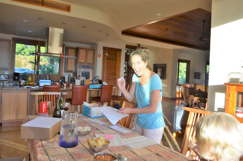
Launiupoko Firewise Committee members gathered together to put together wildfire preparedness mailers for over 350 residents.

Launiupoko in Western Maui is well on their way to Firewise Community certification as of 2016, making them one of the first to be certified on the island (Waiohuli and Kahikinui are also in the mix). To fulfill their “Firewise Day” requirement for the year, the Launiupoko Firewise Committee gathered at a home to put together mailer packets with wildfire preparedness information, including Hawaii Ready, Set, Go! Wildfire Action Guides, for over 350 residents. The committee members than handed off the packets to the local association management, who then mailed them off to all residents in Launiupoko. 

The handoff: giving the mailer packets to the association staff to send out to residents.

We are so proud of the work Launiupoko has done to truly take matters into their own hands and already address wildfire concerns that were identified during a community hazard assessment earlier in the year. Keep up the good work, Launiupoko! Mahalo to West Maui Mountains Watershed Partnership for their invaluable help this year with the certification process, as well. 

Launiupoko Firewise Day Outreach Mail-Out 11/30/16

Maui 4-H Tech Connect

NRCS representatives share about soil conservation.

HWMO’s Community Outreach Coordinator flew to Maui to meet with students and talk to them about wildfire ecology and preparedness. The event was put on by the Maui 4-H program, a University of Hawaii Cooperative Extension youth involvement program. The theme was appropriately titled: “Earth, Wind, and Fire.” You can guess which element HWMO covered!

Students, ranging from K-12, broke off into small groups to spend 20 minutes with each educator. Natural Resources Conservation Service, Island Energy Inquiry, Maui Electric, and Monsanto representatives were among those holding activities at the University of Hawaii Maui College campus. 

Firewise Plant characteristics that the students nailed during the activity.

Firewise Plant characteristics that the students nailed during the activity.

Although 20 minutes would fly by, Pablo was able to share quite a bit about the importance of preparing for wildfires. Students were able to grasp the concepts quickly and were able to play the Firewise Plant Game to familiarize themselves with native plants that can also serve as fire-buffers around the home. 

Launiupoko Firewise Community Hazard Assessment

Launiupoko on the west side of Maui has suffered through a number of close calls with wildfires over the past few years. Even this year alone, there have been a handful of fires that have started near or within the community. 

Chris Brosius (second from left) from West Maui Mountains Watershed Partnership explains the importance of defensible space to the Launiupoko Firewise Committee.

Chris Brosius (right) examines native landscaping around home.

As part of our current goal of creating at least ten nine Firewise Communities (Kanehoa was our first official one!) within the next year, HWMO's Pablo Beimler and West Maui Mountains Watershed Partnership's Chris Brosius met with Launiupoko residents on February 17th to conduct a Firewise Hazard Assessment. 

Launiupoko 

The site of the most recent wildfire prior to the assessment that burned within the community.

The team of new Firewise Committee members from Launiupoko gave background on the fire issues they had witnessed over the years. Much of the discussions revolved around the vegetative make-up of the area and water issues. Mr. Brosius helped connect the importance of creating a dynamic landscape that served the purpose of mitigating wildfire hazards while also restoring the watershed - these goals must work hand-in-hand to create a resilient landscape and community. 

We were able to tour some of the committee members' properties to assess wildfire hazards and mitigation successes at the home level. We also toured areas of wildland in and around the community to get a sense for the larger landscape and its relationship with the community. 

As a next step, HWMO will complete an official write-up of the assessment and deliver it to the committee members who will then devise an action plan. 

Mahalo to Launiupoko Firewise Committee members who were excellent hosts and are the spark plugs for larger community efforts to come!

GIS Presentation at UH Hilo Geography Class

Orlando Smith works on a Western Maui map using GIS software, mixing scientific knowledge with artistry.

HWMO's GIS specialist, Orlando Smith was invited to speak with University of Hawaii, Hilo geography students to share about his GIS work. The course was entitled: GIS Applications in Natural Resource Conservation, a course taught by Dr. Li. Orlando used data from real world HWMO work on Maui such as slope, vegetation, and land ownership during the presentation. He led students through the variables to isolate areas for mitigation efforts regarding wildfire and flood hazard. 

To see Orlando's great work, check out our maps on the HWMO Products page!