Field Tours/Site Visits

Ocean Warriors Wildfire Lessons and Activities at Spencer Beach

Ocean Warriors learning about Rapid ʻOhia Death and how they can prevent the spread.

Ocean Warriors learning about Rapid ʻOhia Death and how they can prevent the spread.

Learning the fire cycle is key to understanding the bigger picture of how wildfire changes our landscapes. When a wildfire burns a native forest in Hawaiʻi, the forest does not fully recover. Instead, invasive grasses, shrubs, and trees take over and crowd out native species. These invasive plants tend to be wildfire hazards and actually encourage fire to help them reproduce. The next human-caused fire will burn these plants and burn further into the forest. And thus, the cycle continues.

Ocean Warrior scanning area for clues to previous fires, including charred tree stumps.

Ocean Warrior scanning area for clues to previous fires, including charred tree stumps.

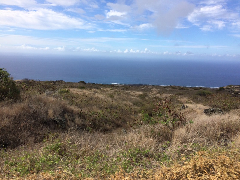
HWMO demonstrated this concept through a fun, interactive game with the Malama Kai Ocean Warriors program run by HWMO’s very own Elizabeth Pickett. The youth stewardship program linked with us on June 13 as a group of middle schoolers from Kohala met with us at Spencer Beach in Kawaihae. By playing a game of “fire tag,” similar to “red rover,” the students acted out how the fire cycle impacts our natural resources. After playing the game, we took the students on a short walk along the Ala Kahakai Trail towards Mauʻumae Beach. This stretch of trail had burned numerous times in recent years, with less and less native plants to burn each time. We encouraged the students to look for clues that indicate that fires had burned the coastline. In the end, the students were able to look at a familiar area with a different set of lenses, or what we like to call “fire goggles.”

Ocean Warriors Wildfire Lessons and Activities at Spencer Beach 6/13/17

Wildfire Preparedness Month ʻOhana Day at Kipuka Oweowe

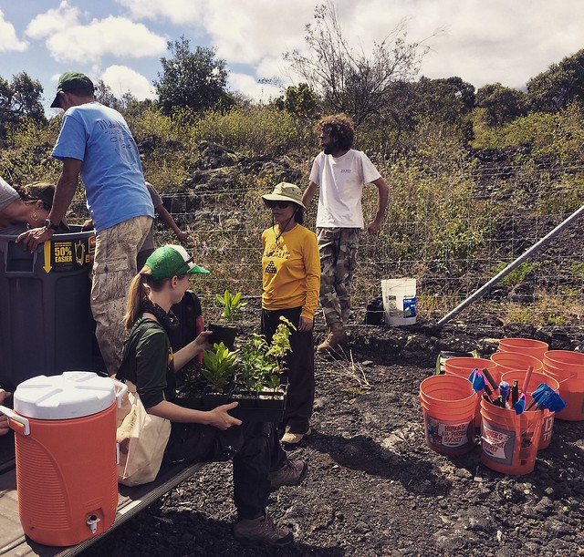
Preparing plants and field equipment for a day of planting and wildfire discussion at Kipuka Oweowe in Puʻuwaʻawaʻa.

Preparing plants and field equipment for a day of planting and wildfire discussion at Kipuka Oweowe in Puʻuwaʻawaʻa.

To wrap up a busy May of wildfire readiness events, DLNR Division of Forestry and Wildlife’s Nāpuʻu Conservation Project held an official Wildfire Preparedness Month event at Kīpuka Oweowe in Puʻuwaʻawaʻa. Each month, Nāpuʻu holds an ʻOhana Day, inviting volunteers to come plant a variety of native species, common and rare/endangered, in the lama-dominated forest restoration project.

This month’s ʻOhana Day was wrapped into Wildfire Preparedness Month. HWMO’s Pablo Beimler joined volunteers in the morning by helping plant natives in the beautiful, peaceful forest setting. As part of a potluck lunch, Pablo then shared background on the history of wildfires and fire management in the Puʻuwaʻawaʻa region. Others talked story about their experiences with fire in the area. It was great to spend time in the forest with good people who were all forest stewards and truly embodied Mālama ʻĀina. They also walked away with more knowledge on wildfires and fire preparedness, as well as Wildfire Lookout! and Ready Set Go! materials.

We thank everyone who participated in a fun and successful Wildfire Preparedness Month this May!

Wildfire Prep Month Ohana Day at Kipuka Oweowe 5/27/17

PFX Field Tour of Puʻu Waʻawaʻa

Starting the field tour in a circle at the baseyard at the foot of Puʻu Waʻawaʻa

Pacific Fire Exchange (PFX) continued to ramp up its ongoing effort to connect researchers and managers with a field tour of Puʻu Waʻawaʻa on Saturday, February 25. DLNR Division of Forestry and Wildlife (DOFAW) played host to over 35 participants, many of whom were involved in the conservation field in Hawaiʻi, including HWMO representatives, but even some who were just curious to learn more about the preserve and native dryland forests. The PFX Field Tour was a follow-up to the Nāhelehele Dry Forest Symposium, which was held the day before in Kailua-Kona. 

Leila Dudley, DOFAW, with Hualalai in the background, shares moʻolelo about Puʻu Waʻawaʻa and its surrounding areas.

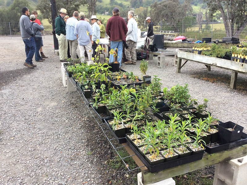
The tour kicked off at the Puʻu Waʻawaʻa Baseyard where hundreds of new native plant keiki were housed. After exploring the nursery, the group caravanned up to the Puʻu Waʻawaʻa Cinder Cone summit for a spectacular view of Hualālai, Mauna Loa, Mauna Kea, and the lands and ocean below it. Although the vog was particularly thick that day, we could still make out the outlines of the breathtaking giants that loomed over the cinder cone. Leilā Dudley, who works at the preserve with DOFAW, told an animated moʻolelo (history, tradition) about the connections between the place names and the people tied to them in North Kona. Clay Trauernicht, Co-Coordinator of PFX, shed light on the importance of understanding these stories in order to discuss proper management of these lands and the motivations behind the restoration and preservation of them. Puʻu Waʻawaʻa is the most diverse forest in Hawaiʻi and there are endless reasons for protecting and restoring the area. Wildfire has been a major driver of change for Puʻu Waʻawaʻa, and thus, the theme of the day was how to manage the landscape to keep wildfires at bay.

Clay Trauernicht (right) and Chris Wada (second from right) share economic analyses in front of a koa restoration plot. 

At the next stop, the Waihou Exclosure, Elliott Parsons, DOFAW, gave background on the large koa restoration plot in the upper reaches of the forest preserve. Chris Wada, University of Hawaiʻi, entered the conversation with an economic analyses on the prioritization of areas for restoration in order to reduce landscape flammability and restore groundwater recharge. Lunch soon followed at the cool and misty Forest Bird Sanctuary (indeed, the chorus of bird songs was a highlight). HWMO’s Pablo Beimler shared a brief history of the organization’s work in the area — Puʻu Waʻawaʻa and its wildfire issues helped spur the creation of HWMO in the early 2000’s. Much of the lessons we had learned in Puʻu Waʻawaʻa are what we continue to carry with us as we expand our work statewide and into the Western Pacific.

Field tour participants awestruck by the thriving native forest at Kīpuka Oweowe.

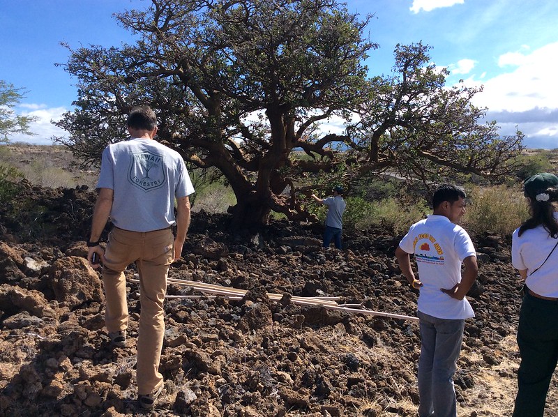
After lunch, the group stopped at the 25 Mile Marker Road overlook to talk about valuation of landscapes and elevation gradients. We stopped midway down the final stretch of road to the highway to examine a stand of lama trees, Hawaiian persimmons that are endemic to Hawaiʻi. The plot the group stopped to look at was overgrown with dense and flammable grasses and shrubs, as well as invasive silver oaks. To contrast this plot, DOFAW led us to the final stop at the Kīpuka Oweowe dry forest restoration site. There, the tour participants gathered and then wandered off to explore the many native dryland plant delights. Careful and persistent management of fire fuels (mostly fountain grass) on the aʻaʻ lava flow, along with hours upon hours of volunteer help, has led to a thriving native forest reflective of what once covered the North Kona landscape. As we sampled the lama berries, honed in on uhiuhi flowers, and inquired about native rare plants we had never seen before, we were reminded of just how beautiful Hawaii’s native forests were and why we must continue to bring all stakeholders to the table to ensure the forests that do remain (or are being restored) are protected from wildfire. 

A big mahalo to Melissa Kunz and Clay Trauernicht and to the forest preserve staff of DOFAW for an incredible and worthwhile tour. We are sure the others in the group agree!

PFX Field Tour of Puʻu Waʻawaʻa 2/25/17

Society for Range Management Fall Meeting and Field Tour

The paniolo (Hawaiian cowboy/girl) culture has thrived in Hawaii for more than a century. With each passing year, greater knowledge of best management practices are used and shared to ensure ranching is done in a sustainable manner. Since HWMO’s inception, our organization has worked closely with various large and small ranches in Hawaii to assist them with fuels management expertise and funding for pre-suppression tools (helicopter dip tanks, lines to draw water closer to communities/sensitive natural areas). Our very own board president, Mark Thorne, Ph.D., is the grazing extension specialist for University of Hawaii College of Tropical and Human Resources (UH CTAHR). 

Dr. Clay Trauernicht talks wildfire and its relationship to climate change in the Pacific.

Pablo Beimler shares about HWMO's efforts to alleviate the socioeconomic issues of wildfire in Hawaii.

Morning rainbow to kick off the field tour of Kapapala Ranch.

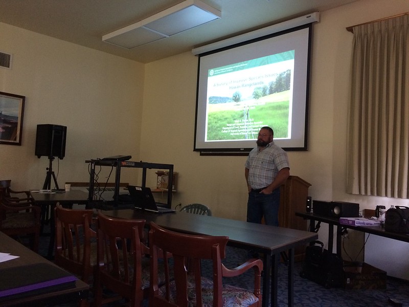
On October 27-28, Mr. Thorne and other Hawaii rangeland specialists hosted a Fall Meeting and Technical Tour in Volcano for the Society for Range Management, a “professional scientific society and conservation organization whose members are concerned with studying, conserving, managing and sustaining the varied resources of the rangelands which comprise nearly half the land in the world.” Several presentations covered topics ranging from livestock as a fuels management tool, invasive species effects on island plant communities, and climate/socioeconomic relationships with fire. Dr. Clay Trauernicht spoke on behalf of the Pacific Fire Exchange and UH CTAHR Cooperative Extension to showcase his new research on climate change’s effects on fires in the Pacific. HWMO’s very own Community Outreach Coordinator, Pablo Beimler, shed light on the socioeconomic issues of wildfire in Hawaii and what HWMO is doing to alleviate them. 

On the second day, Kapapala Ranch, a large ranch in Volcano, hosted a field tour through their beautiful pastures and native forests. Aside from morning rainbows, views of Kilauea crater, and clear skies, there was much to ponder and discuss in regards to proper range management in the unique climatic/topographical region that Kapapala Ranch is located in. Water storage and fire were just some of the many topics where lessons learned were shared across the regions. On the way out, a flat tire from old fencing on a dirt road made for a comical situation in which several participants, including Mr. Thorne, labored to remove the fencing remnants with all of their might as others cheered on. Just another day out in the field. 

Future rangeland managers?

The general theme that kept emerging during the event: conservation and rangeland management can and must coexist if we are to solve our growing environmental issues across the islands (and around the world). 

The event was dedicated to the life of Matt Stevenson, a beloved range professional we lost in 2016. His contributions to the field were tremendous. He will be missed.

Society for Range Management Presentations and Field Tour of Kapapala Ranch 10/27-10/28/16

PIFC Field Tour in Waikoloa

Native wiliwili tree at the Waikoloa Dry Forest Preserve.

Hawaii’s forests are some of the most novel ecosystems in the world. A blend of native, many endemic or restricted to a certain area, and non-native plants from around the world make for complex systems and thus complex challenges. Over 97% of Hawaii’s dryland native forests have disappeared over the years, much in part due to wildfires. Scientists, foresters, non-profit organizations, community members, and others across Hawaii have made it their careers and live’s work to protect and restore the native forests that are so dear to our islands’ residents and visitors. 

The Western Forestry Leadership Coalition (WLFC) “is a partnership between Western state and USDA Forest Service leaders working toward the sustainable management of Western forests.” The Pacific Islands Forestry Committee (PIFC), a group that is part of the larger WFLC network, held a field tour on Hawaii Island on October 25 to visit various forest restoration sites and community projects. HWMO’s Pablo Beimler joined the field tour in the afternoon when the group visited the Waikoloa Dry Forest Preserve. The beautiful native forest preserve is a project of the Waikoloa Dry Forest Initiative, a long-time partner of HWMO. Ms. Bev Brand, a founder of the project and member of the Waikoloa Fire Management Action Committee, led the group of foresters from Hawaii, Guam, California, and other parts of the Western U.S. and Pacific through the growing forest. The topic of wildfire was brought up many times — fire is one of the greatest concerns to the preserve. In the last few years, HWMO has partnered with WDFI to create and maintain fuelbreaks to protect the rare and endangered plants of Waikoloa. 

Mark Gordon talks to field tour participants on behalf of Waikoloa Fire Management Action Committee.

Following the dry forest preserve site visit, the group caravanned to the northeastern edge of Waikoloa Village. With a view of the vast fire fuels of South Kohala that run to the edge of homes and the community fuelbreak installed with HWMO’s assistance over a decade ago, Pablo told the history of fire management in the area. The winds blew at high speeds that day, which added not only drama, but a good teaching moment: winds are the driving factor of large wildfires in South Kohala. Pablo then passed the reigns over to Mr. Mark Gordon, HWMO Fundraising Committee member and chair of the Waikoloa Village Fire Management Action Team. Mark shared about Waikoloa’s recent efforts toward Firewise Community Recognition — as of 2016, Waikoloa Village could very well become the largest Firewise Community in the state!

Mahalo to Hawaii Division of Forestry and Wildlife and Pacific Islands Forestry for inviting us to share on the field tour!

Pacific Islands Forestry Committee Field Tour of Waikoloa 10/25/16

Waiohuli Firewise Community Hazard Assessment

HWMO assisted Waiohuli Hikina with a $5,000 grant from U.S. Forest Service WUI funds to create a fuelbreak between homes and the black wattle forest that is a potential wildfire threat.

Although Upcountry Maui may not typically be known as being at risk of wildfire, more and more wildfires have threatened communities even in areas that might be considered “wet.” The El Niño-caused drought conditions early in 2016 contributed to wildfires across that state that occurred in wetter areas including in Kula. In February, a wildfire burned within the Waiohuli homestead (Kula Hawaiian Homes), prompting residents to take action. In the spring of 2016, HWMO assisted the community with a $5,000 grant from U.S. Forest Service WUI funds. With the project money, the community hired a contractor to create a wide fuelbreak behind nearly a dozen homes along the edge of a wildland area. As a next step, the community is on board for becoming a Firewise Community, joining Launiupoko and Kahikinui on Maui to become the first Maui Firewise Communities.

When dry, invasive ivy and other shrubs in Waiohuli can become a wildfire hazard, threatening homes along the gulch, as seen above.

As one of the first steps towards certification, HWMO’s Pablo Beimler met with Lance De Silva of DOFAW to conduct a wildfire hazard assessment for the community. Even though the area looked “green” as they drove around the neighborhood, fire was still on the mind, especially considering how fast the plants there dried out during the El Niño drought. Once HWMO puts a report together of the assessment, the Waiohuli Firewise Committee members will develop an action plan and hold a Ready, Set, Go! Workshop led by HWMO. The workshop would count as their first Firewise Event, putting them in great position to become a Firewise Community as of 2016!

Waiohuli Firewise Community Hazard Assessment 9/15/16

Waikoloa Village Firewise Community Hazard Assessment

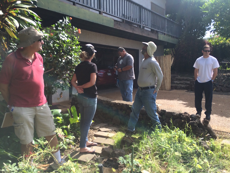
The crew visited a few homes to conduct "home ignition zone assessments" as part of the Firewise Community assessment report. 

Waikoloa Village’s new Fire Management Action Committee formed recently and is already in full swing, a big step for Waikoloa’s wildfire protection. The team, led by Chair Mark Gordon, is working with HWMO to become a nationally-recognized Firewise Community as of 2016. The certification would make the community the largest Firewise Community in the State, a challenge that the team and HWMO is willing to take on. 


A Waikoloa Village interior lot that the WVA recently created a fuelbreak for to protect neighboring homes.

On September13th, HWMO’s Pablo Beimler (Outreach Coordinator) and Mike Tomich (Board of Director) met with the WVA’s Roger Wehrsig, DOFAW’s Jay Hatayama, HFD’s West Hawthorne and Ed Kawasaki, WDFI’s Jen Lawson, and the Action Committee’s Mr. Gordon and Wayne Awai for a wildfire hazard assessment - a requirement for Firewise Community certification. The group drove to various sites around the village to examine wildfire hazards. Sites included the community fuelbreak (HWMO’s first grant-funded project that Waikoloa Village now maintains), fuels behind the schools, a vacant lot that was grazed by a goat-dozer for fuels reduction purposes (a pilot project facilitated by HWMO and WVA), and a larger grazed area on the critical northern/mauka boundary of the community. They also visited three homes to conduct brief home ignition zone assessments to fulfill one of the requirements of the Firewise hazard assessment. 

Illegal green waste dumping is a major hazard in Waikoloa and is very counterproductive to the wildfire mitigation efforts being made in the village.

After the assessment, HWMO will be compiling a report with recommendations for the Fire Management Action Committee to review. The Committee will discuss the recommendations and develop an action plan. Once completed, Waikoloa Village will be well on their way to Firewise certification as of 2016. Mahalo to our partners who joined the assessment and provided great input!

Waikoloa Village Firewise Community Hazard Assessment 9/13/16

PFX Kahikinui Field Tour

When it comes to solving our most complex issues, it truly takes a village and the coming together of a myriad of backgrounds and expertise. 

PFX FIeld Tour begins at lookout on the eastern makai side of Kahikinui.

On August 29th, over 40 representatives from a number of organizations and stakeholder groups joined a field tour of Kahikinui on the southern slopes of Hāleakala. Organized by our partners from Pacific Fire Exchange and Leeward Hāleakala Watershed Restoration Partnership, the group caravanned to various sites to view the post-fire landscape that resulted from the February 2016 wildfire. The fire not only burned through native preserves and cultural sites, but also came dangerously close to homes. A few of the homesteaders of Kahikinui spoke during the field tour to share their experiences of the 2016 fire (and other fires that have given the community a scare). 

Firefighters share their experiences fighting fires in Kahikinui. Attendees listen in as they survey the land from the mauka edge of the fire. Photo Credit: Clay Trauernicht/PFX

Throughout the field tour, there were great open discussions regarding topics from grazing for fuels reduction to increasing water access and availability to fuelbreak creation with erosion control in mind. Mahalo to Clay Trauernicht and Melissa Kunz of Pacific Fire Exchange for their great facilitation of these discussions. Big shoutout also to Andrea Buckman and the LHWRP crew for bringing in much of the stakeholder and community groups. And of course, a big mahalo to Kahikinui homesteaders who were so gracious enough to have such a large group tour their community. Also mahalo to the groups who were represented at the field tour: Auwahi Wind, Department of Hawaiian Homelands, Division of Forestry and Wildlife, Hāleakala Ranch, KOOK, Aha Moku O Kaupō, Kaupō Ranch, KGLMO, Mauʻi County Council Don Couch, Mauʻi County Fire, Find Us 911, Mauʻi County Office of Economic Development, West Mauʻi Mountains Watershed Partnership and UH College of Tropical Agriculture & Human Resources.

Pablo Beimler (HWMO) shares Firewise Communities updates with the group. Photo credit: Chris Brosius, West Maui Mountains Watershed Partnership

HWMO is working with Kahikinui community members to help their homestead become one of the first nationally-recognized Firewise Communities on Mauʻi, along with Waiohuli and Launiupoko. In fact, the field tour counted towards their Firewise Event requirement - they are well on their way to 2016 certification!

PFX Kahikinui Field Tour 8/29/16

Pu'u Wa'awa'a Field Tour

Wildfire management in Pu'u Wa'awa'a was an important focus for many of our organization's founding board members.  Now, over 16 years later, we still find the area of utmost priority and continue to build our relationship with the area's managers and nearby community members. DLNR Division of Forestry & Wildlife own and manage most of the land in the area and have been putting great effort into restoring the watershed, while also taking measures to protect critical habitat from wildfire. 

Edith Adkins (center) shares management maps with the group.

The group prepares to examine DOFAW's fuelbreaks and priority wildfire hazard areas.

DOFAW land managers tasked with protecting Pu'u Wa'awa'a's native forests invited HWMO's technical advisors to discuss and brainstorm next steps toward achieving some of the more challenging fire mitigation goals along the highway and community boundaries. HWMO technical advisors provided their expertise in addressing the WUI-based issues in the area. Neighboring land managers from private estates were also invited to be a part of the tour.

HWMO's staff, Board of Directors, and Technical Advisors with DLNR DOFAW and adjacent land managers.

On July 20th, 2016, a group of HWMO staff, Board of Directors, and Technical Advisors teamed up with DOFAW representatives at the beautiful Pu'u Wa'awa'a preserve. Because of HWMO’s long-standing history of wildfire management in Pu'u Wa'awa'a, our team had plenty to share in terms of lessons learned and input that will help DOFAW work towards their wildfire management goals. It was an exciting day to be out in the field and another strengthening of the invaluable bond between HWMO, its partners, and DOFAW to protect special places such as Pu'u Wa'awa'a.

Puuwaawaa Field Tour with HWMO Technical Advisors 7/20/16

Kahikinui Fire 2016 Post-Burn Site Visit with LHWRP

20 miles, or 40 minutes, of driving distance from the nearest fire station requires a different kind of thinking when it comes to wildfire preparedness. That is exactly what Kahikinui residents on Maui constantly have in mind given they are in a very fire prone and hazardous region. Just within the past decade or so, the community has experienced 5 major wildfires, most recently in February of this year. The recent wildfire burned right to the edge of homes, scalding 5,300 acres in its path. A month later, a flareup of the fire led firefighting efforts up into the difficult-to-access mauka forests. Road access, given the topography and limited infrastructure in Kahikinui, made for a challenging firefight. 

Getting ready for a bumpy ride through the scorched landscape.

Clay Trauernicht of UH CTAHR Cooperative Extension/PFX (middle) ground-truths wildfire intensity maps.

On June 29th, Leeward Haleakala Watershed Restoration Partnership invited Pablo Beimler (HWMO), Melissa Kunz (HWMO/PFX), and Clay Trauernicht (UH Coop Extension, CTAHR) on a site visit of the recent burn. LHWRP’s Andrea Buckman and Keahi Bustamante, who have worked together in the area for numerous years, led everyone on a bumpy ride through the burned areas. What they saw was a scorched landscape from makai to up mauka that included torched fencelines, warped water tanks, toasted PVC irrigation lines, and scalded wiliwili trees. There are hundreds more wiliwili and other native plants in this biodiverse stretch of leeward Maui that the Leeward Haleakala Watershed Partnership and Kahikinui residents and businesses are working together to protect. 

Fenceposts, water tanks, and wiliwili trees among other infrastructure and native plants were scorched by the wildfire.

Even ferns within the wetter mauka gulches were burnt to a crisp.

The site visit was mostly a sneak preview for a late-July field tour PFX will host, inviting various agency and community stakeholders to join. Pablo was also able to collect initial information for the hazard assessment that HWMO will put together for Kahikinui community in their pursuit of becoming a Firewise Community this year. 

We met with community members after the tour and were humbled by the stories they had to share. Since the early '90s, the Hawaiian families that reclaimed DHHL land are working to revive their ancestral lands and live off the grid even in the face of the 5 major fires in the past decade or so. Their grit, perseverance, sense of community, and love for the aina will all be assets as they work to achieve Firewise Certification. Facing the challenges with wildfires in Kahikinui will require uniting all stakeholders, from neighboring ranches to fire agencies to the watershed partnership, for the common goal of creating a Fire Adapted Community.

Kahikinui Post-Fire Site Visit with LHWRP 6/29/16