HWMO Blog — Hawaii Wildfire Management Organization

Maui

Kahikinui Ready, Set, Go! Workshop and Firewise Hazard Assessment

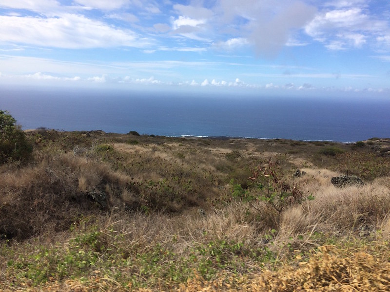
Assessment team poses in front of a local example of xeriscaping using Firewise principles and native/adapted plants.

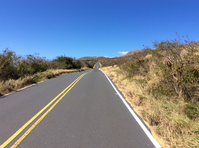
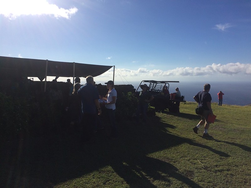
Kahikinui continued its incredible year of wildfire protection efforts on November 6, 2016. The homestead on the southern slopes of Haleakala on Maui is a small, but very active community that is on pace to become one of the first Firewise Communities on the island (and one of the first Hawaiian homesteads in the state). As one of the requirements, HWMO, Leeward Haleakala Watershed Restoration Partnership, and Department of Hawaiian Home Lands conducted a wildfire hazard assessment with Kahikinui Firewise Committee members. Together, they drove around the bumpy 4-WD roads of the community to take note of common wildfire hazards and good Firewise practices already being implemented. The greatest concerns were the high fuel loads on the highway, between homes, and in the surrounding wildland areas. Lack of water resources and firefighting access and ingress/egress were also noticeable concerns.

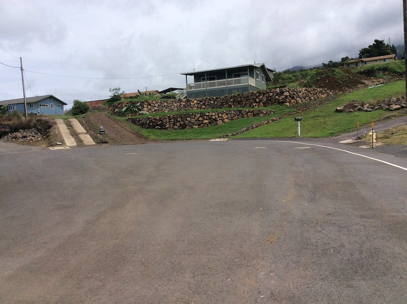
Assessment team walks the perimeter of a Firewise home within the community.

The Kahikinui Firewise Committee is already planning and working on multiple projects to address these concerns. With a contribution from Sempra Auwahi Wind, they will replace their front gate and remove flammable vegetation at the entrance of the community in December. The proactive committee is a great model for other communities at-risk of wildfires — even with the numerous challenges they face, they have persisted to take small, but important, steps to reduce wildfire hazards to protect their beloved home.

Kahikinui Firewise Community Hazard Assessment 11/6/16

HPA In-Class Presentation

As Fire Prevention Month reached its final week, HWMO Community Outreach Coordinator, Pablo Beimler, met with high school students at Hawaii Preparatory Academy in Waimea to talk about wildfires and their impacts on our waterways and oceans. Ms. Tani Cordova invited HWMO just in time — her students were in the middle of learning oceanography. Pablo gave a crash course on fire ecology and how wildfires could change soil chemistry and thus the ability to retain water.

Post-fire erosion in Maui 2016.

Halfway through his presentation, Pablo showed students the recently debuted Prevent Wildfires to Protect Our Ocean, featuring the intense wildfires and subsequent flooding in Maui this year. Students asked great questions after the presentation, sparking interesting conversations about wildfire in Hawaii. Encouraging to know these bright, thoughtful, enthusiastic teens will make positive impacts on our world in their adult lives. 

Waiohuli Firewise Community Hazard Assessment

HWMO assisted Waiohuli Hikina with a $5,000 grant from U.S. Forest Service WUI funds to create a fuelbreak between homes and the black wattle forest that is a potential wildfire threat.

Although Upcountry Maui may not typically be known as being at risk of wildfire, more and more wildfires have threatened communities even in areas that might be considered “wet.” The El Niño-caused drought conditions early in 2016 contributed to wildfires across that state that occurred in wetter areas including in Kula. In February, a wildfire burned within the Waiohuli homestead (Kula Hawaiian Homes), prompting residents to take action. In the spring of 2016, HWMO assisted the community with a $5,000 grant from U.S. Forest Service WUI funds. With the project money, the community hired a contractor to create a wide fuelbreak behind nearly a dozen homes along the edge of a wildland area. As a next step, the community is on board for becoming a Firewise Community, joining Launiupoko and Kahikinui on Maui to become the first Maui Firewise Communities.

When dry, invasive ivy and other shrubs in Waiohuli can become a wildfire hazard, threatening homes along the gulch, as seen above.

As one of the first steps towards certification, HWMO’s Pablo Beimler met with Lance De Silva of DOFAW to conduct a wildfire hazard assessment for the community. Even though the area looked “green” as they drove around the neighborhood, fire was still on the mind, especially considering how fast the plants there dried out during the El Niño drought. Once HWMO puts a report together of the assessment, the Waiohuli Firewise Committee members will develop an action plan and hold a Ready, Set, Go! Workshop led by HWMO. The workshop would count as their first Firewise Event, putting them in great position to become a Firewise Community as of 2016!

Waiohuli Firewise Community Hazard Assessment 9/15/16

PFX Kahikinui Field Tour

When it comes to solving our most complex issues, it truly takes a village and the coming together of a myriad of backgrounds and expertise. 

PFX FIeld Tour begins at lookout on the eastern makai side of Kahikinui.

On August 29th, over 40 representatives from a number of organizations and stakeholder groups joined a field tour of Kahikinui on the southern slopes of Hāleakala. Organized by our partners from Pacific Fire Exchange and Leeward Hāleakala Watershed Restoration Partnership, the group caravanned to various sites to view the post-fire landscape that resulted from the February 2016 wildfire. The fire not only burned through native preserves and cultural sites, but also came dangerously close to homes. A few of the homesteaders of Kahikinui spoke during the field tour to share their experiences of the 2016 fire (and other fires that have given the community a scare). 

Firefighters share their experiences fighting fires in Kahikinui. Attendees listen in as they survey the land from the mauka edge of the fire. Photo Credit: Clay Trauernicht/PFX

Throughout the field tour, there were great open discussions regarding topics from grazing for fuels reduction to increasing water access and availability to fuelbreak creation with erosion control in mind. Mahalo to Clay Trauernicht and Melissa Kunz of Pacific Fire Exchange for their great facilitation of these discussions. Big shoutout also to Andrea Buckman and the LHWRP crew for bringing in much of the stakeholder and community groups. And of course, a big mahalo to Kahikinui homesteaders who were so gracious enough to have such a large group tour their community. Also mahalo to the groups who were represented at the field tour: Auwahi Wind, Department of Hawaiian Homelands, Division of Forestry and Wildlife, Hāleakala Ranch, KOOK, Aha Moku O Kaupō, Kaupō Ranch, KGLMO, Mauʻi County Council Don Couch, Mauʻi County Fire, Find Us 911, Mauʻi County Office of Economic Development, West Mauʻi Mountains Watershed Partnership and UH College of Tropical Agriculture & Human Resources.

Pablo Beimler (HWMO) shares Firewise Communities updates with the group. Photo credit: Chris Brosius, West Maui Mountains Watershed Partnership

HWMO is working with Kahikinui community members to help their homestead become one of the first nationally-recognized Firewise Communities on Mauʻi, along with Waiohuli and Launiupoko. In fact, the field tour counted towards their Firewise Event requirement - they are well on their way to 2016 certification!

PFX Kahikinui Field Tour 8/29/16

Maui Island CWPP Signing

A lot goes into a single document. What ends up on dozens of pages of paper is only a small part of the hard work and dedication that goes into a Community Wildfire Protection Plan.

From left to right: Lance De Silva (DLNR DOFAW), Doreen Canto (DHHL), Anna Foust (Maui CD), Elizabeth Pickett (HWMO), and Chief Jeffrey Murray (MFD).

We are thankful for everyone who has helped us develop the Upcountry and Maui CWPPs, including those who showed up to provide input at meetings and our partners who shared their expertise and knowledge about the areas. A CWPP is only as strong as the amount of dedication and thought the partnering agencies and communities put into it, so we are truly blessed for everyone’s kokua.

To cap off the CWPP process, HWMO’s Elizabeth Pickett flew to Maui to meet with Lance De Silva (DLNR Division of Forestry and Wildlife), Anna Foust (Maui Civil Defense), Chief Jeffrey Murray (Maui Fire Department), and Doreen Canto (Department of Hawaiian Homelands) at the Maui Fire Prevention Office in Wailuku on July 29th. Mr. De Silva, Ms. Foust, and Chief Murray acted as representatives of their agencies to sign and thus make official the completion of the Upcountry and South Maui CWPPs. 

With these plans in place, communities, organizations, and landowners/managers within Upcountry and South Maui will be able to apply for federal grant funding for wildfire-related projects. 

Special mahalo to our very own Elizabeth Pickett, who pulled many all nighters to make sure the plans were ready to go this July! Mahalos also to our GIS specialist, Orlando Smith, for making the countless maps for the plans; Pablo Beimler, for his help writing parts of the plan and helping edit; and former employee, Ilene Grossman, for her help coordinating the community meetings. 

The plans will be available on our HWMO Products page shortly. 

Maui CWPP Signing 7/29/16

Maui 4-H Tech Connect

NRCS representatives share about soil conservation.

HWMO’s Community Outreach Coordinator flew to Maui to meet with students and talk to them about wildfire ecology and preparedness. The event was put on by the Maui 4-H program, a University of Hawaii Cooperative Extension youth involvement program. The theme was appropriately titled: “Earth, Wind, and Fire.” You can guess which element HWMO covered!

Students, ranging from K-12, broke off into small groups to spend 20 minutes with each educator. Natural Resources Conservation Service, Island Energy Inquiry, Maui Electric, and Monsanto representatives were among those holding activities at the University of Hawaii Maui College campus. 

Firewise Plant characteristics that the students nailed during the activity.

Firewise Plant characteristics that the students nailed during the activity.

Although 20 minutes would fly by, Pablo was able to share quite a bit about the importance of preparing for wildfires. Students were able to grasp the concepts quickly and were able to play the Firewise Plant Game to familiarize themselves with native plants that can also serve as fire-buffers around the home. 

Kahikinui Fire 2016 Post-Burn Site Visit with LHWRP

20 miles, or 40 minutes, of driving distance from the nearest fire station requires a different kind of thinking when it comes to wildfire preparedness. That is exactly what Kahikinui residents on Maui constantly have in mind given they are in a very fire prone and hazardous region. Just within the past decade or so, the community has experienced 5 major wildfires, most recently in February of this year. The recent wildfire burned right to the edge of homes, scalding 5,300 acres in its path. A month later, a flareup of the fire led firefighting efforts up into the difficult-to-access mauka forests. Road access, given the topography and limited infrastructure in Kahikinui, made for a challenging firefight. 

Getting ready for a bumpy ride through the scorched landscape.

Clay Trauernicht of UH CTAHR Cooperative Extension/PFX (middle) ground-truths wildfire intensity maps.

On June 29th, Leeward Haleakala Watershed Restoration Partnership invited Pablo Beimler (HWMO), Melissa Kunz (HWMO/PFX), and Clay Trauernicht (UH Coop Extension, CTAHR) on a site visit of the recent burn. LHWRP’s Andrea Buckman and Keahi Bustamante, who have worked together in the area for numerous years, led everyone on a bumpy ride through the burned areas. What they saw was a scorched landscape from makai to up mauka that included torched fencelines, warped water tanks, toasted PVC irrigation lines, and scalded wiliwili trees. There are hundreds more wiliwili and other native plants in this biodiverse stretch of leeward Maui that the Leeward Haleakala Watershed Partnership and Kahikinui residents and businesses are working together to protect. 

Fenceposts, water tanks, and wiliwili trees among other infrastructure and native plants were scorched by the wildfire.

Even ferns within the wetter mauka gulches were burnt to a crisp.

The site visit was mostly a sneak preview for a late-July field tour PFX will host, inviting various agency and community stakeholders to join. Pablo was also able to collect initial information for the hazard assessment that HWMO will put together for Kahikinui community in their pursuit of becoming a Firewise Community this year. 

We met with community members after the tour and were humbled by the stories they had to share. Since the early '90s, the Hawaiian families that reclaimed DHHL land are working to revive their ancestral lands and live off the grid even in the face of the 5 major fires in the past decade or so. Their grit, perseverance, sense of community, and love for the aina will all be assets as they work to achieve Firewise Certification. Facing the challenges with wildfires in Kahikinui will require uniting all stakeholders, from neighboring ranches to fire agencies to the watershed partnership, for the common goal of creating a Fire Adapted Community.

Kahikinui Post-Fire Site Visit with LHWRP 6/29/16

Launiupoko Firewise Community Hazard Assessment

Launiupoko on the west side of Maui has suffered through a number of close calls with wildfires over the past few years. Even this year alone, there have been a handful of fires that have started near or within the community. 

Chris Brosius (second from left) from West Maui Mountains Watershed Partnership explains the importance of defensible space to the Launiupoko Firewise Committee.

Chris Brosius (right) examines native landscaping around home.

As part of our current goal of creating at least ten nine Firewise Communities (Kanehoa was our first official one!) within the next year, HWMO's Pablo Beimler and West Maui Mountains Watershed Partnership's Chris Brosius met with Launiupoko residents on February 17th to conduct a Firewise Hazard Assessment. 

Launiupoko 

The site of the most recent wildfire prior to the assessment that burned within the community.

The team of new Firewise Committee members from Launiupoko gave background on the fire issues they had witnessed over the years. Much of the discussions revolved around the vegetative make-up of the area and water issues. Mr. Brosius helped connect the importance of creating a dynamic landscape that served the purpose of mitigating wildfire hazards while also restoring the watershed - these goals must work hand-in-hand to create a resilient landscape and community. 

We were able to tour some of the committee members' properties to assess wildfire hazards and mitigation successes at the home level. We also toured areas of wildland in and around the community to get a sense for the larger landscape and its relationship with the community. 

As a next step, HWMO will complete an official write-up of the assessment and deliver it to the committee members who will then devise an action plan. 

Mahalo to Launiupoko Firewise Committee members who were excellent hosts and are the spark plugs for larger community efforts to come!

Seabury Hall Presentation

Pablo Beimler gives background on Firewise native plants to Seabury Hall students.

A busy week of school outreach kicked off in Maui on Monday, November 16th. HWMO's Pablo Beimler gave a presentation to the 6-12th grade students of Seabury Hall, a coed college-preparatory school in Makawao.

Pablo kept students engaged by firing questions left and right about Hawaii's wildfire issues and prevention and preparedness messages. Students were especially excited about Kaleo the Pueo, stopping to pick up stickers and bookmarks along with "10 Ways to Prepare for Wildfire" brochures at the end. 

Mahalo to Ms. Jacque Peterka and the Seabury Hall staff and students who opened their doors to HWMO with a warm welcome.

GIS Presentation at UH Hilo Geography Class

Orlando Smith works on a Western Maui map using GIS software, mixing scientific knowledge with artistry.

HWMO's GIS specialist, Orlando Smith was invited to speak with University of Hawaii, Hilo geography students to share about his GIS work. The course was entitled: GIS Applications in Natural Resource Conservation, a course taught by Dr. Li. Orlando used data from real world HWMO work on Maui such as slope, vegetation, and land ownership during the presentation. He led students through the variables to isolate areas for mitigation efforts regarding wildfire and flood hazard. 

To see Orlando's great work, check out our maps on the HWMO Products page!

Powered by Squarespace