HWMO Blog — Hawaii Wildfire Management Organization

fire history

Kailapa Firewise Community Hazard Assessment

Kailapa is a Hawaiian homestead in Kawaihae on over 10,000 acres from the shoreline to the base of Kohala Mountain. Homes there, first built in the late 1980s, are surrounded by very flammable grasslands that have experienced numerous fires over the years. Winds are a major factor in the extreme wildfire behavior that can occur in the area. The most recent threat occurred starting on August 8, 2015. The most recent threat occurred starting on August 8, 2015. A 4,5000-acre wildfire burned across Kawaihae, directly impacting local communities, businesses, and cultural sites in the area. Roads were closed and evacuations were ordered by Civil Defense for Kawaihae. Nearly 90% of the native plants at Puu Kohola were destroyed and large piles of timber from a eucalyptus harvest project in Hamakua were ablaze. The fire burned towards Kailapa, but firefighters were able to stop it a few gulches away. A week later, a large rainfall event washed unprecedented amounts of sediment and debris down the watersheds and out into the ocean, smothering neighboring coral reefs. Local residents recount that the floods were the worst in recent memory. HWMO produced a video documenting the events.

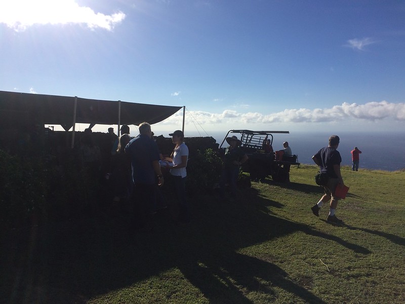
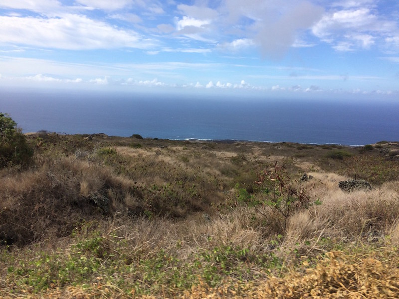
Assessment team looks out at the neighboring wildland areas that have burned numerous times.

The wildfire concerns in Kailapa have spurred the community to action. Since the beginning of 2016, a group of Kailapa residents have been working with HWMO to protect their community from wildfire by becoming a nationally-recognized Firewise Community. As one of the requirements, HWMO and Hawaii Fire Department conducted a community wildfire hazard assessment with Kailapa residents on November 3. Together, the assessment team caravanned throughout the community to note and photograph common wildfire hazards, as well as good Firewise practices already being implemented. The greatest concerns were the lack of water resources, ingress/egress, and fuels management between homes and in the surrounding wildland areas.

Living fuelbreak that was created in the spring of 2016 using U.S. Forest Service WUI grant funding through HWMO.

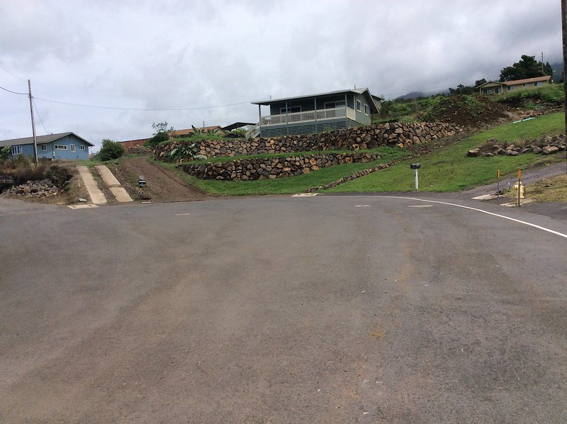
In the spring of 2016, Kailapa, with the facilitation of U.S. Forest Service WUI funds from HWMO, created a living fuelbreak on a slope on Kona side of the subdivision. The community would like to continue and expand project such as these throughout the subdivision to better protect homes from the dangers of wildfire in Kawaihae.

Kailapa is on pace to become the first Hawaiian homestead on Hawaii Island to be a certified Firewise Community. Great work Kailapa!

Kailapa Firewise Community Hazard Assessment 11/3/16

Waiohuli Firewise Community Hazard Assessment

HWMO assisted Waiohuli Hikina with a $5,000 grant from U.S. Forest Service WUI funds to create a fuelbreak between homes and the black wattle forest that is a potential wildfire threat.

Although Upcountry Maui may not typically be known as being at risk of wildfire, more and more wildfires have threatened communities even in areas that might be considered “wet.” The El Niño-caused drought conditions early in 2016 contributed to wildfires across that state that occurred in wetter areas including in Kula. In February, a wildfire burned within the Waiohuli homestead (Kula Hawaiian Homes), prompting residents to take action. In the spring of 2016, HWMO assisted the community with a $5,000 grant from U.S. Forest Service WUI funds. With the project money, the community hired a contractor to create a wide fuelbreak behind nearly a dozen homes along the edge of a wildland area. As a next step, the community is on board for becoming a Firewise Community, joining Launiupoko and Kahikinui on Maui to become the first Maui Firewise Communities.

When dry, invasive ivy and other shrubs in Waiohuli can become a wildfire hazard, threatening homes along the gulch, as seen above.

As one of the first steps towards certification, HWMO’s Pablo Beimler met with Lance De Silva of DOFAW to conduct a wildfire hazard assessment for the community. Even though the area looked “green” as they drove around the neighborhood, fire was still on the mind, especially considering how fast the plants there dried out during the El Niño drought. Once HWMO puts a report together of the assessment, the Waiohuli Firewise Committee members will develop an action plan and hold a Ready, Set, Go! Workshop led by HWMO. The workshop would count as their first Firewise Event, putting them in great position to become a Firewise Community as of 2016!

Waiohuli Firewise Community Hazard Assessment 9/15/16

PFX Kahikinui Field Tour

When it comes to solving our most complex issues, it truly takes a village and the coming together of a myriad of backgrounds and expertise. 

PFX FIeld Tour begins at lookout on the eastern makai side of Kahikinui.

On August 29th, over 40 representatives from a number of organizations and stakeholder groups joined a field tour of Kahikinui on the southern slopes of Hāleakala. Organized by our partners from Pacific Fire Exchange and Leeward Hāleakala Watershed Restoration Partnership, the group caravanned to various sites to view the post-fire landscape that resulted from the February 2016 wildfire. The fire not only burned through native preserves and cultural sites, but also came dangerously close to homes. A few of the homesteaders of Kahikinui spoke during the field tour to share their experiences of the 2016 fire (and other fires that have given the community a scare). 

Firefighters share their experiences fighting fires in Kahikinui. Attendees listen in as they survey the land from the mauka edge of the fire. Photo Credit: Clay Trauernicht/PFX

Throughout the field tour, there were great open discussions regarding topics from grazing for fuels reduction to increasing water access and availability to fuelbreak creation with erosion control in mind. Mahalo to Clay Trauernicht and Melissa Kunz of Pacific Fire Exchange for their great facilitation of these discussions. Big shoutout also to Andrea Buckman and the LHWRP crew for bringing in much of the stakeholder and community groups. And of course, a big mahalo to Kahikinui homesteaders who were so gracious enough to have such a large group tour their community. Also mahalo to the groups who were represented at the field tour: Auwahi Wind, Department of Hawaiian Homelands, Division of Forestry and Wildlife, Hāleakala Ranch, KOOK, Aha Moku O Kaupō, Kaupō Ranch, KGLMO, Mauʻi County Council Don Couch, Mauʻi County Fire, Find Us 911, Mauʻi County Office of Economic Development, West Mauʻi Mountains Watershed Partnership and UH College of Tropical Agriculture & Human Resources.

Pablo Beimler (HWMO) shares Firewise Communities updates with the group. Photo credit: Chris Brosius, West Maui Mountains Watershed Partnership

HWMO is working with Kahikinui community members to help their homestead become one of the first nationally-recognized Firewise Communities on Mauʻi, along with Waiohuli and Launiupoko. In fact, the field tour counted towards their Firewise Event requirement - they are well on their way to 2016 certification!

PFX Kahikinui Field Tour 8/29/16

Puako Firewise Community Recruitment Meeting

Historically known as a Hawaiian fishing village, Puako is now host to over 150 homes which have been threatened countless times from wildfires. The community is directly bordered by a large, dense kiawe forest that can carry fires quickly towards homes. Starting in 2003, HWMO linked with Puako Community Association to provide technical assistance in planning and creating a fuelbreak to protect homes from the kiawe wildland. The fuelbreak has received much applause from emergency responders in Hawaii and even from the U.S. and other countries. The Puako Community Association has been successfully maintaining the fuelbreak for a decade or so now.

A group of the dozen or so Puako community members ready to take part in the Firewise Communities Recognition Program.

A new chapter is opening for the coastal community: they will be working towards Firewise Communities certification through HWMO’s assistance. Puako is one of at least ten communities statewide that are working with HWMO to increase their community-wide wildfire readiness through the Firewise Communities program. 

On August 18th, HWMO Community Outreach Coordinator Pablo Beimler met with a dozen Puako community members who wanted to learn more about the Firewise certification process. A majority of them pledged to take part in whatever capacity they could offer, including being a part of a Firewise Committee or helping organize community preparedness events. 

Paauilo Mauka and Kalopa CA Annual Gathering

HWMO’s Pablo Beimler met with Paauilo Mauka and Kalopa Community Association (PMKCA) members twice during the month of July. On July 14th, Pablo proposed to the PMKCA Board the possibility of partnering to help the area become a Firewise Community. It would certainly be a unique opportunity, given the community’s location on the wetter side of Hawaii Island along the Hamakua Coast. 

Paauilo volunteer firefighter shares an update on new resources including new radios.

Although the Paauilo Mauka and Kalopa area receives an average of 100 or more inches of rain a year, drought conditions can create dangerous wildfire conditions that have led to some historic fires in the past. 

Joe Clarkson, President of the PMKCA, noted in a recent Hamakua Times post:

“After a severe drought in 1901, several large fires broke out in Hamakua, affecting areas from ‘O’okala to Kalopa. The following excerpt from P. Quentin Tomich’s Perspectives on Hamakua History describes the effects of these fires-

…the first fire started on 3 July in lands of a Niupea homesteader, and spread through several coffee plantations as well as into government lease lands. Thence the fire branched into cane lands of ‘O’okala and Ka’ala…, Kuka’iau and Koholalele…

A second fire started on homesteads in Pohakea and spread to lots in Ka’apahu. A third blaze, largest in area, began in Ka’ohe and was traced to careless honey hunters smoking out bees… It destroyed much coffee and cane land and burned out only when it reached the broad gorge of Kalopa Gulch.

It should be noted that the burned areas included dense rainforest above ‘O’okala to elevations of 4,500 feet, an area and type of forest that most folks would now think impossible to catch on fire. But it was observed at the time that there was “complete destruction of former existing tropical forest and great injury to soil by the depth (over six feet) to which the fire had penetrated”.

Part of our mission is to ensure intense wildfires like impact communities as little as possible. Pablo gave a presentation to 40 PMKCA members on July 30th at the North Hawaii Education and Research Center in Honokaa. He gave a brief overview about the Firewise Communities program and how HWMO could assist the community in working towards Firewise Recognition and overall wildfire readiness.

PMKCA is a step ahead in terms of community emergency response as they now have a new CERT trailer.

“Just imagine,” said Joe Clarkson, “the fire potential of thousands of acres of eucalyptus plantations (including harvest areas full of debris and tall grass), fallow guinea grass range land, forests of ironwood and gulch jungles of dead rose apple and waiwi, all desiccated by months of severe drought.

In addition to the 1901 drought, severe drought, with accompanying fires, affected Hamakua in the early and middle 1960s, with the 1965 drought being exceptionally extreme. It has been decades since a really severe drought has affected Hamakua, but one can and will happen, we just don’t know when.”

Banner photo credit: Island Friend/Flickr

Kahikinui Fire 2016 Post-Burn Site Visit with LHWRP

20 miles, or 40 minutes, of driving distance from the nearest fire station requires a different kind of thinking when it comes to wildfire preparedness. That is exactly what Kahikinui residents on Maui constantly have in mind given they are in a very fire prone and hazardous region. Just within the past decade or so, the community has experienced 5 major wildfires, most recently in February of this year. The recent wildfire burned right to the edge of homes, scalding 5,300 acres in its path. A month later, a flareup of the fire led firefighting efforts up into the difficult-to-access mauka forests. Road access, given the topography and limited infrastructure in Kahikinui, made for a challenging firefight. 

Getting ready for a bumpy ride through the scorched landscape.

Clay Trauernicht of UH CTAHR Cooperative Extension/PFX (middle) ground-truths wildfire intensity maps.

On June 29th, Leeward Haleakala Watershed Restoration Partnership invited Pablo Beimler (HWMO), Melissa Kunz (HWMO/PFX), and Clay Trauernicht (UH Coop Extension, CTAHR) on a site visit of the recent burn. LHWRP’s Andrea Buckman and Keahi Bustamante, who have worked together in the area for numerous years, led everyone on a bumpy ride through the burned areas. What they saw was a scorched landscape from makai to up mauka that included torched fencelines, warped water tanks, toasted PVC irrigation lines, and scalded wiliwili trees. There are hundreds more wiliwili and other native plants in this biodiverse stretch of leeward Maui that the Leeward Haleakala Watershed Partnership and Kahikinui residents and businesses are working together to protect. 

Fenceposts, water tanks, and wiliwili trees among other infrastructure and native plants were scorched by the wildfire.

Even ferns within the wetter mauka gulches were burnt to a crisp.

The site visit was mostly a sneak preview for a late-July field tour PFX will host, inviting various agency and community stakeholders to join. Pablo was also able to collect initial information for the hazard assessment that HWMO will put together for Kahikinui community in their pursuit of becoming a Firewise Community this year. 

We met with community members after the tour and were humbled by the stories they had to share. Since the early '90s, the Hawaiian families that reclaimed DHHL land are working to revive their ancestral lands and live off the grid even in the face of the 5 major fires in the past decade or so. Their grit, perseverance, sense of community, and love for the aina will all be assets as they work to achieve Firewise Certification. Facing the challenges with wildfires in Kahikinui will require uniting all stakeholders, from neighboring ranches to fire agencies to the watershed partnership, for the common goal of creating a Fire Adapted Community.

Kahikinui Post-Fire Site Visit with LHWRP 6/29/16

Waialea Firewise Community Hazard Assessment

Over a decade ago, the residents of Waialea and HWMO began discussing the establishment of a living (or shaded) fuelbreak along the mauka edge of the community to increase fire protection for the homes in the subdivision. Since then, HWMO has worked on a number of projects with Waialea to ensure wildfires, which are common in the area, keep clear of their homes. In the past, wildfires have even burned down homes and structures in Waialea, something we hope will never happen again if the right measures are taken.

HWMO VP Sam Patten points out charred fire post from a previous wildfire that burned right up to homes in Waialea.

Waialea residents and homeowners walk along a fire access road that splits the living fuelbreak.

To keep Waialea residents safe, HWMO is working with Waialea to help them become one of the next Firewise communities, a recognition that Kanehoa subdivision recently received. As a major step towards Firewise certification, HWMO’s Pablo Beimler and Sam Patten joined a group of residents (and a contractor who will be tasked with thinning the living fuelbreak with HWMO’s funding) to walk around the neighborhood and assess the community’s wildfire risk. 

The group began the tour by taking a look at the current state of the living fuelbreak. Within the break, there are a number of native and drought-tolerant plants that were established years ago but the area is currently in need of some thinning. HWMO will be providing a $5000 grant to Waialea to remove the flammable vegetation within the break and thin the trees to reduce ladder fuels. 

Keeping tree branches away from the home along the fire-free zone can make a significant difference protecting it from wildfire.

We also visited a couple of homes to get a better sense for what the average home looks like in relation to the landscape. Owners of the homes took a number of precautions to make sure there was enough defensible space, including creating a fire-free zone 5 feet around the home, and that structures were fire-proofed, including using non-combustible roofing and enclosing eaves.

HWMO will be working on completing the assessment over the next few weeks, which will become a useful tool for Waialea to help them determine the next steps for becoming wildfire ready.

Puuwaawaa Habitat Conservation Plan Community Meeting

HWMO teamed with DLNR DOFAW to host an informational booth regarding wildfire history and management in Puuwaawaa.

Puuwaawaa has long been an area of interest for wildfire protection not only for HWMO, but for the state. Over the years, countless wildfires have threatened the native preserves on the mauka and makai stretches of the ahupuaa, prompting numerous efforts to create buffers within and around them. Much time and effort has been spent by DLNR Division of Forestry and Wildlife (DOFAW) and its partnering organizations to restore the native dryland forest throughout Puuwaawaa. 

DOFAW representatives and community members gathered for the input portion of the meeting.

As part of the long-awaited Habitat Conservation Plan that will soon be established, DLNR DOFAW representatives held a community input meeting on March 1st at Auntie Sally's Hale in Hilo (another meeting will be held on March 7th in Kona). HWMO's Pablo Beimler drove to the meeting to hold court during an information session during the first half of the meeting. Pablo shared information regarding fire history in the area and prevention/preparedness tips for residents. DOFAW's Jupiter sat next to Pablo and shared great information on wildfire mitigation efforts that have taken place to protect the native forests of Puuwaawaa. 

To conclude the meeting, comments on the plan were opened up to the public - a great opportunity for community members to share their perspectives and thoughts on how Puuwaawaa should be managed.

Oahu Wildfire Information and Education (OWIE) Meeting - January 2016

OWIE representatives discuss coordinated inter-agency El Niño wildfire prevention and preparedness messaging.

Between 2005 and 2011, Oahu had an average of around 600 wildfires annually, according to new research co-published by HWMO, UH CTAHR, U.S. Forest Service, and CEMML.

This figure might see a major jump this year with the strengthening of El Niño and the intensifying of a drought to go along with it.

Pablo Beimler met with Oahu Wildfire Information and Education (OWIE) group members on January 26th at the Federal Fire Department Headquarters in Pearl Harbor to discuss an outreach campaign to get the word out there about the drought and preventing/preparing for the potential uptick in wildfires. Representatives from Honolulu Fire Department, DLNR Division of Forestry and Wildlife, University of Hawaii CTAHR Cooperative Extension, NOAA National Weather Service, Federal Fire Department - Navy, and U.S. Army-Garrison were present at the meeting. 

Hot dog, Sparky, rearing up for a busy wildfire period.

Derek Wroe, of NOAA NWS, gave an update on the El Niño outlook, which does not look good for Hawaii. This El Niño, which will go down as on the top 3 worst on record, has already significantly impacted the leeward and windward sides of Oahu. In December, there was less than 30% of normal rainfall in most areas, with January looking even worse. We'd be lucky to have a solid rainfall event for the rest of the winter!

With spring break on the way, fire activity could be on the rise.

OWIE members had an excellent discussion on ideas for reaching out to the public - plenty of exciting news to share once event details come to fruition and can be publicized. 

Mauna Kea Watershed Alliance Huakai

Koa forests on Mauna Kea make for a mist-erious drive.

Part of what makes a partnership strong is sharing knowledge, especially in person and among place. HWMO had the great opportunity to meet with its partners from Mauna Kea Watershed Alliance (MKWA) for a huakai of one of their preservation areas on the eastern flanks of Mauna Kea. After a bumpy, Indiana Jones-esque ride to the site, Pablo Beimler, representing HWMO toured the site with Jermy Uowolo and Joe Kern of MKWA to discuss the fuels management issues in and around the area and to brainstorm ideas for reducing fuel and creating better suppression access. More importantly, Pablo was able to take in-depth notes with photos that he added to a report that he will share with members of HWMO's Technical Advisory Committee (TAC). The TAC members hold a diverse wealth of knowledge about the area's fire issues and fuels management techniques that would work in the area. 

A pueo keeps a watchful eye on us as we enter the preserve.

The site acts as a bird corridor for some of Hawaii's most precious birds, such as palila and pueo (HWMO's mascot). A few years ago, a wildfire burned through parts of the preserve, including koa and mamane tree plots, so wildfire is a high priority for the MKWA team. MKWA crew are continuing to work to preserve the precious native forests that still exist there and are reinvigorating existing forests and creating new ones by out-planting more trees like koa, mamane, and iliahi. Pablo had the exciting opportunity, at the end of the tour, of putting in some volunteer hours by helping fertilize new koa starts that will act as a barrier from the invasion of gorse. The vigorous shrub has taken over large tracts of land on the mauna and are continuing their march to new areas.Their seeds can stay viable in the ground for 50+ years and when a fire comes around, they re-sprout with ease (their seed pods open after fires and their burnt stumps can generate new sprouts). This is certainly one of the hazards we will discuss with our team of experts.

Endless field of gorse (darker green vegetation).

An area that was burned in the latest wildfire can be seen in the furthest puu where a group of mamane trees were scorched.

Big mahalo to the MKWA crew, including Jermy, Joe, and Cheyenne Perry (who wasn't able to attend but is also an integral member of the HWMO team). We are very fortunate to have such great partners all across the board - it's the only way we can truly take on a challenge as vast and complicated as wildfire. 

A beautiful new koa that we fertilized at the end of the tour. 


Powered by Squarespace