0
items
$0


South Kohala CDP Action Committee Presentation

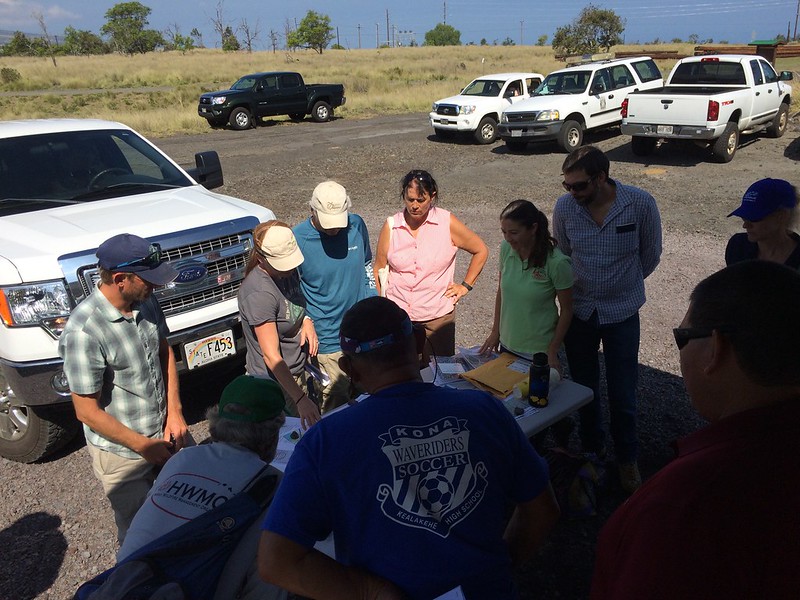
Pablo Beimler pointing to a map of wildfire hazards in Northwest Hawaiʻi Island during the CDP presentation. Credit - David Tarnas
On July 24, HWMO gave a presentation at the South Kohala Community Development Plan Action Committee meeting at the Waimea Senior Center. A Community Development Plan, CDP for short, provides an opportunity for community input for establishing County policies that can then be put into action. Wildfire is featured in the South Kohala CDP, especially considering South Kohala is known for the largest brushfires in the entire state. As a reminder to why wildfire is included in the CDP, we shared to a couple dozen people, including the Action Committee, about the various fire hazards that threaten communities in South Kohala. The threats are not just vegetation and environmental conditions, but also building materials, subdivision-level hazards (such as poor access and ingress/egress), lack of water access, and not enough community engagement.
Our presentation was preceded by a presentation from our partners from South Kohala Coastal Partnership. Julia Rose, the Marine Coordinator for SKCP, highlighted how wildfires directly impacted our nearshore resources, especially after large post-fire storm events. The Kawaihae fire was a topic of discussion during the meeting. The enormous fire in 2015 charred thousands of acres, but soon thereafter, a large storm dropped heavy rain in the area that led to dangerous flooding, shutting down roads and businesses and forcing evacuations of residents. Planning for fire is necessary to ensure events like these are prevented and we hope to see the CDP continue to integrate wildfire concerns and actions into the planning process, whether from integrating WUI codes and ordinances to finding ways to increase public participation in wildfire solutions.