HWMO Blog — Hawaii Wildfire Management Organization

cultural preservation

Hawaii Wildfire Summit 2018

Over the years, HWMO has come to understand that wildfire-related challenges are faced by a wide array of professionals and citizens, including more than just those focused on emergency response. HWMO, through a grant from the U.S. Forest Service, held the first ever Hawaii Wildfire Summit between April 30 and May 4 at the Mauna Lani Bay Hotel & Bungalows to bring together not just fire professionals, but people working in riparian and marine conservation, cultural resource protection, the visitor industry, planning professionals, and community groups from across Hawaii, the Western Pacific, and the rest of the U.S.
 

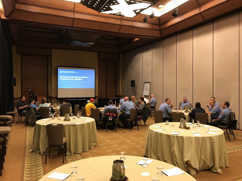
Pre-Summit: NFPA Assessing Structural Ignition Potential for Wildfire Course

The first two days were dedicated to the NFPA course on Assessing Structural Ignition Potential from Wildfire. Participants included firefighters, land managers, and homeowners who learned the ins and outs of fire and its interaction with the built environment. Wildland fire expert, Pat Durland, who traveled from the mainland to teach the course, also shared valuable information on the latest research for improving the survivability of a home during a wildfire.
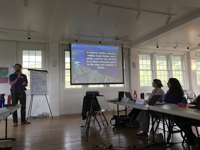
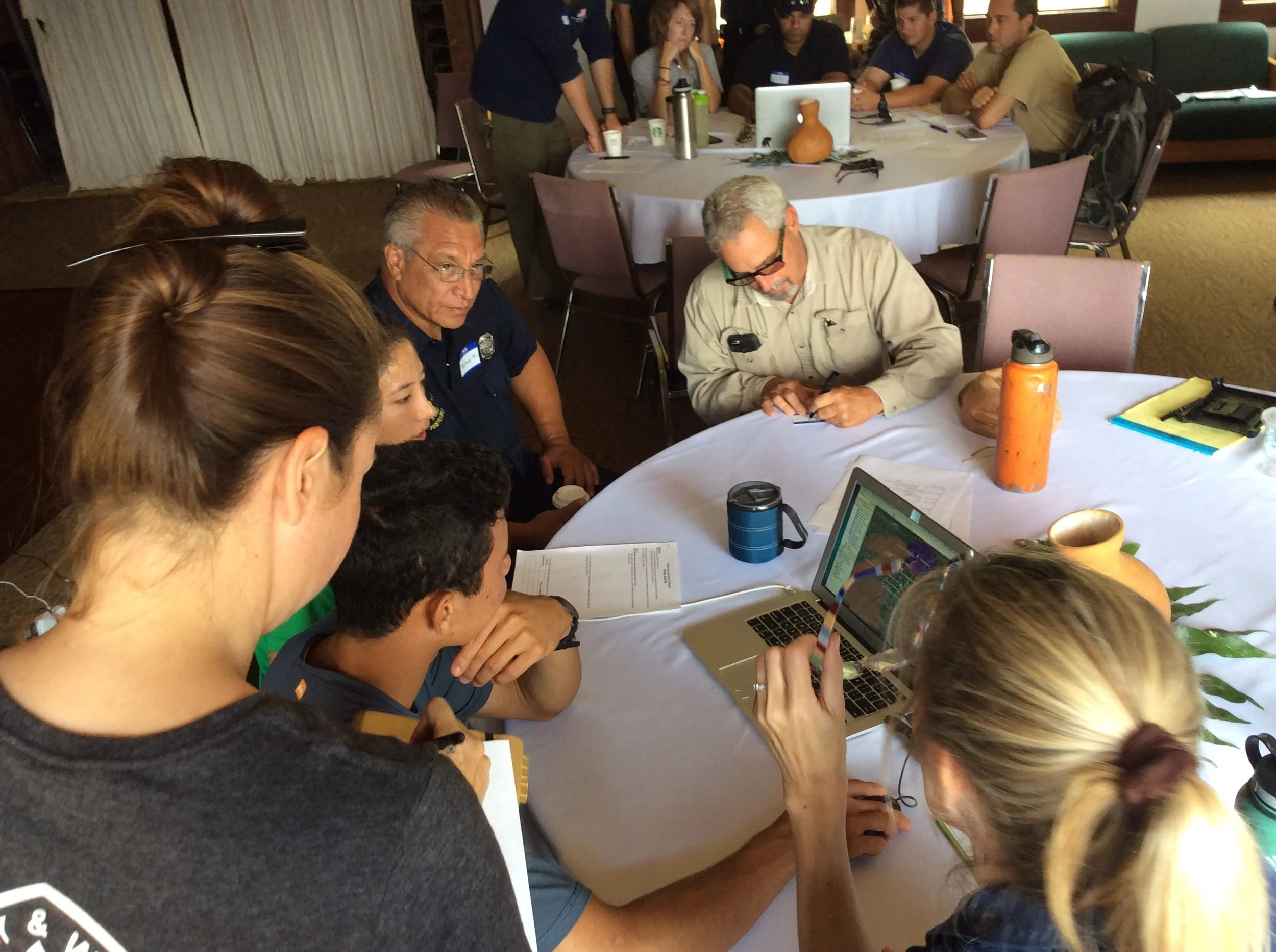
Hawaii Wildfire Summit 2018 - NFPA ASIP Training
Hawaii Wildfire Summit 2018 - Lei Making Party 5/1/18


Summit Main Event

The main event began on Wednesday, May 2, kicking off two days packed with presentations and workshops from over 40 speakers, including our two keynote speakers, Gloria Edwards of Southern Rockies Fire Science Network and Dr. Steve Quarles of the Insurance Institute for Business & Home Safety. A wealth of knowledge was shared throughout the summit by these speakers with the diverse audience. Speakers highlighted lessons learned, best practices and innovations in wildfire protection. Check out the list of speakers and their bios by clicking the buttons below.

Hawaii Wildfire Summit 2018 - Summit Day 1 5/2/18
Hawaii Wildfire Summit 2018 - Summit Day 2 5/3/18

HWMO emphasized the importance of using creativity and outside-the-box thinking to get out of our comfort zones, a point that keynote speaker Gloria Edwards so eloquently urged in her presentation. To spur creativity and collaborative dialogue, HWMO encouraged participants to take part in several activities during the breaks and the first evening's meet-and-greet:

* A collaborative Summit to Sea art project
* A collaborative ideas sharing space
* Casting ballots for a statewide youth wildfire prevention bookmark contest. Submissions were from students at Kamaile Academy in Waianae and Kohala and Waikoloa Schools on Hawaii Island. 


Smokin' Word


To cap off the event and to further encourage participants to use their creativity and get out of their comfort zones, we held a "Smokin' Word" open mic. Various brave volunteers, from local fire chiefs to representatives from national programs, gave spoken word performances about "why we do what we do, what we are aiming to protect, and to ignite applause and laughter." We were extremely pleased to see our colleagues dig into their creative space and shake off some nerves to share their great pieces. Professional spoken word artist (and HWMO Community Outreach Coordinator), Pablo Akira Beimler, rounded out the open mic with a performance of his poem in tribute to the summit and all of the inspiring work happening by the people in the room to make Hawaii a better, safer place to live. 

We also had a great turnout of Firewise Community members from Hawaii Island and Maui-- almost all Firewise Communities in Hawaii were represented! Firewise committee members Lisa Chu-Thielbar (Kanehoa), Gordon Firestein (Launiupoko), and Diane Makaala Kanealii (Honokoa) presented lessons learned and background about their Firewise efforts during the general session on the 2nd day. We had a Firewise gathering at the end of the 2nd day where participants played "get to know you bingo" to frantically and comically break the ice. From this point onward, HWMO is committed to forming a statewide peer learning network between all of the Firewise Communities. 
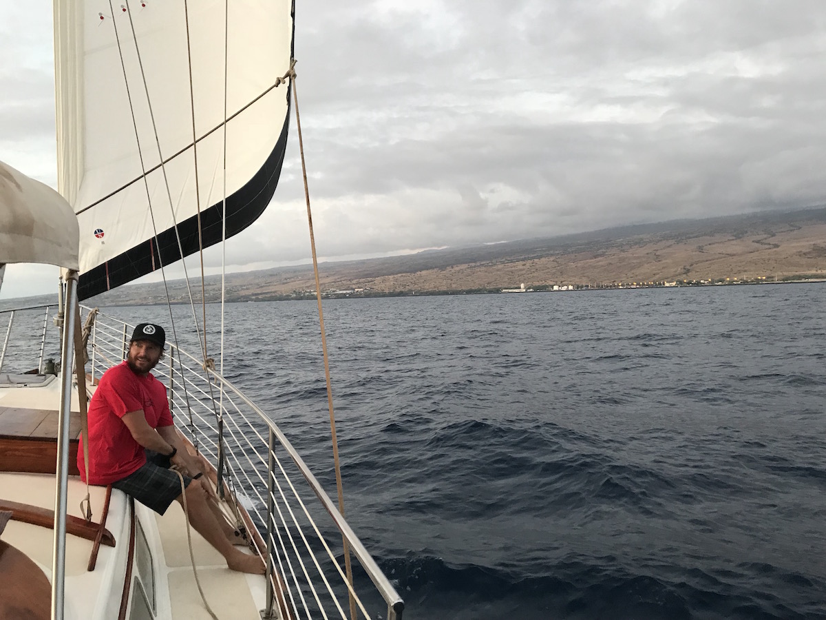
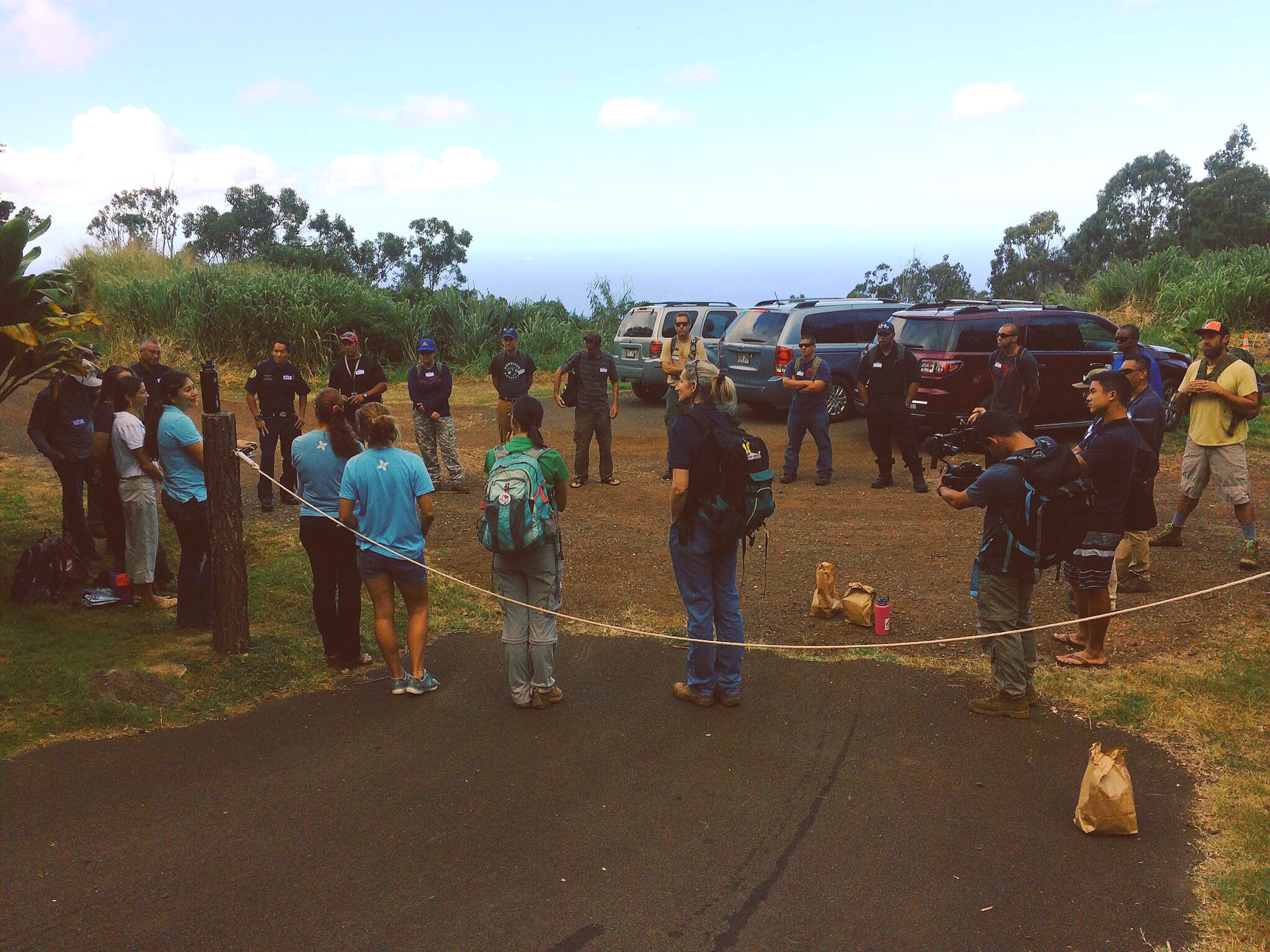
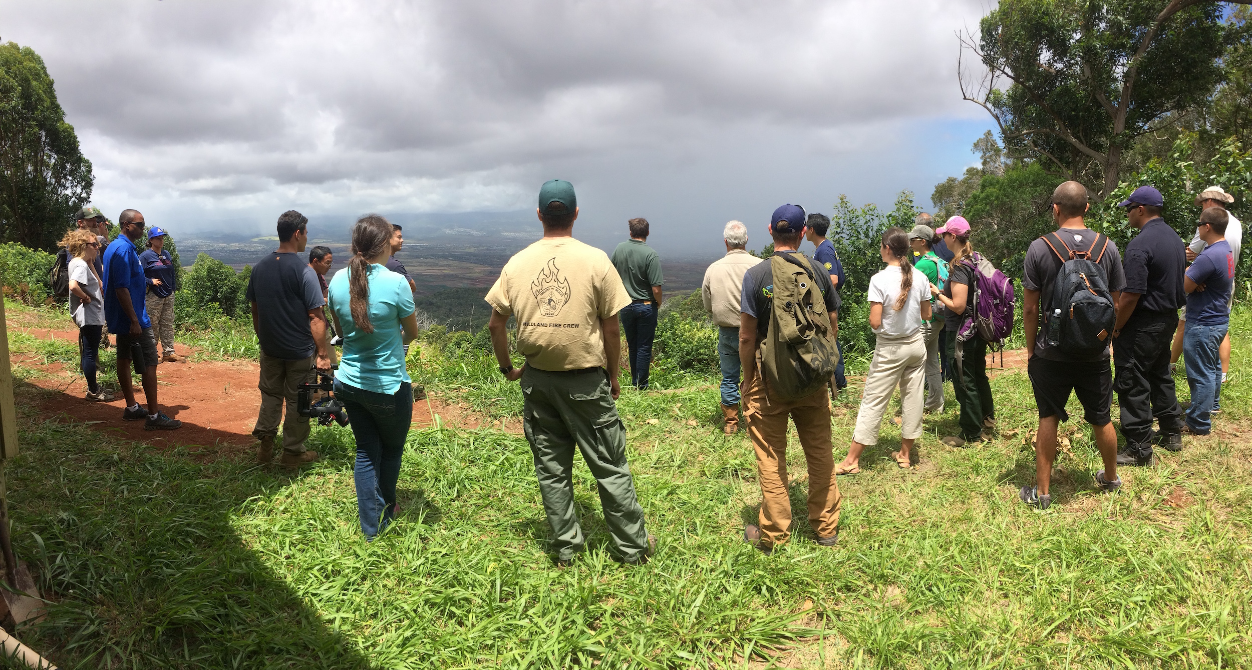
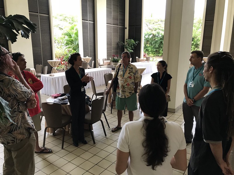
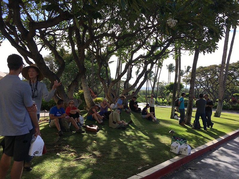
Hawaii Wildfire Summit 2018 - Post-Summit Activities


Field Workshop


On the final day of the summit, a large group of the summit attendees hopped aboard vehicles to caravan around the South Kohala area to visualize much of what was discussed indoors at the Mauna Lani. The Pacific Fire Exchange field workshop began at the Upper Waikoloa Road Intersection to ground the participants in a sense of place and seeing a landscape-level view of the summit-to-sea watersheds of South Kohala. Then, it was on to Wai Ulaula Waimea Nature Park, where participants learned about watershed planning and about the local native forest. The following stop helped participants understand the wildfire threat that threatens the native forests and the subsequent post-fire flooding that has vastly impacted Hawaii's shorelines. What better place to talk about wildfire than in Kawaihae, where the 2014 wildfire burned thousands of acres and threatened many homes, burned millions of dollars of timber, and post-fire flooding shut down businesses and impacted the livelihoods of local residents. Representatives from Hawaii County Fire Department and National Park Service shared their lessons learned from responding to the massive fire. 

After lunch with a beautiful view of the South Kohala Coastline and a jolt from an earthquake in Kilauea, the group walked to the Puu Kohola Heiau visitor center to learn the history of the sacred site. The group then walked along a trail to learn more about the conditions that are ripe for wildfire in Kawaihae. They continued walking down to Pelekane Bay, the site of intense post-fire runoff and coral reef decay. 

The field workshop ended in Puako where Peter Hackstedde shared about the community's efforts to create a large fuelbreak behind homes and their recent Firewise Community recognition efforts. Paniau was the final stop and a nice place to wrap-up the summit to sea discussion. Some workshop participants stayed for a snorkel tour of the reef. 

Great job, Melissa Kunz, on coordinating such a smooth, exciting, and informative field workshop!

Hawaii Wildfire Summit 2018 - Field Workshop 5/4/18


Here is a thank you letter from our Executive Director, Elizabeth Pickett, to the summit participants:

Screen Shot 2018-05-30 at 11.14.56 AM.png
Screen Shot 2018-05-30 at 11.15.25 AM.png

Puuwaawaa Bio-Cultural Blitz 2018

Pablo Akira Beimler leads students through an activity to learn about the mauka to makai impacts of wildfire.

Pablo Akira Beimler leads students through an activity to learn about the mauka to makai impacts of wildfire.

Our dry forests are so critical to the health of our leeward areas in Hawaii. It’s no wonder that so many organizations working to protect the dry forests came together on March 9th at Puuwaawaa to outreach with hundreds of students. Puuwaawaa was formed over 110,000 years ago and is home to a rich diversity of native plants and animals — which are all at risk of devastating wildfires that have burned through the area before. HWMO held a booth to talk about the mauka to makai (summit-to-sea) impacts of wildfire with smiling and interested keiki from all over the island.


Puuwaawaa Bio-Cultural Blitz 2018


South Kohala Conservation Action Plan - Climate Action Planning Workshop

Climate change is a serious threat that is already having a major impact in Hawaii, and there are no signs that the threats and impacts will go away. In fact, an overwhelming percentage of scientists predict they will worsen. The Nature Conservancy (TNC), NOAA National Centers for Coastal Ocean Science (NCOOS), and South Kohala Coastal Partnership (SKCP) invited various partners who are stewards of South Kohala to discuss climate change threats, impacts, and solutions for 3 days at Anna’s Ranch in Waimea from January 23-25. Using climate change as a framework to update the South Kohala Conservation Action Plan, an effort that started in 2010, the workshop pinpointed six major climate threats that could have a big impact for South Kohala’s coastal and marine resources. 

Teams discuss their rationales behind ranking certain threats higher than others.

Teams discuss their rationales behind ranking certain threats higher than others.

On the last day, teams shared their climate action ideas including coastal policy changes and reforestation strategies.

On the last day, teams shared their climate action ideas including coastal policy changes and reforestation strategies.

What are those major threats?

Warming of ocean temperature, sea level rise, ocean acidification, reduced rainfall, increased storms, and…you guessed it, more frequent and damaging wildfires. HWMO was invited to speak on the first day to talk about the mauka to makai effects of wildfire: fires in South Kohala have notoriously led to large erosion / flooding events (check out our video on the Kawaihae Fire and Floods for more information). Post-fire sediment that is carried out to the ocean can be detrimental to coral reefs and all who live off of them, including fish and us humans. 

View of Kohala Mountain and the watersheds that connect the vulnerable forests with the sensitive coastlines.

View of Kohala Mountain and the watersheds that connect the vulnerable forests with the sensitive coastlines.

Chad Wiggins of TNC points out mauka to makai connections, while we look out from the ocean towards the coast.

Chad Wiggins of TNC points out mauka to makai connections, while we look out from the ocean towards the coast.

Due to increasing conditions that are ripe for more frequent and severe wildfires in South Kohala, including warmer temperatures, decreasing annual rainfall, and increasing consecutive dry days, we could be in for more destructive land based pollution events that destroy reefs. This goes hand in hand with the scientific predictions of increased storms in Hawaii, which, after a wildfire, can make matters a whole lot worse for erosion and sedimentation and thus for our coastal and marine ecosystems. Check out our infographic on climate change’s impacts on wildfire for more information.

On the 2nd day of the workshop, we were part of a “mauka” breakout group where we ranked the threats of fire, storms, and reduced rainfall as contributors of coastal and marine impacts. Fire repeatedly came up as a major threat that needed to be addressed seriously in South Kohala. 

In order to think BIG about action planning for South Kohala, workshop attendees were invited to join in on an afternoon of sailing from Kawaihae Harbor to Puako. The sailboat was graciously donated by Maile Charters for the purpose of building stronger connections between the various agencies and organizations involved with SKCP and to look at the connectedness of South Kohala from the vantage point of being on the water. As an added bonus, whales and dolphins frequently visited the boat and we were able to swim around Puako’s reefs to experience the beautiful coral and marine life that are critical to the health of our ecosystems and communities. Before an epic sunset, HWMO’s Community Outreach Coordinator, Pablo Beimler, performed spoken word about the Hokulea’s important message that we need to work together as one “Island Earth” and work with Mother Nature rather than against her.

Setting sails for an adventure experienced by various SKCP partners.

Setting sails for an adventure experienced by various SKCP partners.

Sunsets and whales an added bonus.

Sunsets and whales an added bonus.

The final day of the workshop revolved around finding solutions. Breakout groups developed actions that could improve coastal health and reduce climate threats. Pablo shared HWMO’s vision of having communities be buffered by native and Firewise living fuelbreaks, which would also help bring communities together. Better water management and increased water resources was also a key discussion and was ranked very high by the entire group as an important next step for South Kohala. In another smaller breakout group, TNC’s Chad Wiggins, Hawaii State Parks’ Dena Sedar, and Pablo brainstormed ideas to reforest South Kohala (ranked highly as an important next step) with the intention of reducing wildfire threats, increasing watershed health, and improving community engagement, livelihoods, and employment/career opportunities.

The planning area and what is at stake. Working together is the only path forward to build climate resilience.

The planning area and what is at stake. Working together is the only path forward to build climate resilience.

After three days with so many enthusiastic, positive, intelligent, and conservation-minded folks, we feel more determined to continue the important work we are doing to make South Kohala a more vibrant area, even in the face of worrying climate predictions. We are more resilient when we work together and that is a major reason why the South Kohala Coastal Partnership exists and is taking on this climate action planning process. We are extremely grateful for being a part of this partnership and look forward to collaborate with all involved to ensure our coastal areas, cultural resources, landscapes, and communities are safe from or adapted to climate impacts such as wildfire.

Thank you to The Nature Conservancy, NOAA National Centers for Coastal Ocean Science, and South Kohala Coastal Partnership for inviting us to be a part of this monumental effort!

South Kohala CAP Climate Action Planning Workshop 1/23-25/18

Kanehoa Firewise Native Plant Workshop

Kanehoa, a subdivision halfway between Kawaihae and Waimea on Hawaii Island, was the second community in Hawaii to become a nationally-recognized Firewise Community. Since 2015, they have contributed hundreds of volunteer hours and linked with HWMO for a couple of $5,000 grants to remove flammable vegetation from along internal roadsides. As part of the next step in their action plan, they hope to plant more native vegetation along common areas and around their own homes. 

2016 Firewise Day: Kanehoa residents took fuels reduction into their own hands with a $500 grant from State Farm and $5,000 grant from HWMO to remove haole koa from roadsides. Here is a before...

2016 Firewise Day: Kanehoa residents took fuels reduction into their own hands with a $500 grant from State Farm and $5,000 grant from HWMO to remove haole koa from roadsides. Here is a before...

...and after.

...and after.

Native dryland plants can be an added defense for your home, though like with any plants, site location and what you plant matters greatly for fire safety reasons. On November 4th, Kanehoa Firewise Committee members invited HWMO to join them for a Firewise Native Plant Workshop. Fifteen community members listened in as guest speaker Jill Wagner of Hawaii Island Seed Bank talked story about the importance of restoring native plants in our own communities. The area between Puu Waa Waa to Kohala Mountain on the leeward side was one of the most biodiverse areas in Hawaii, she shared. Years of drought, invasive species and disease stress, overgrazing, climate change, and wildfire have contributed to the demise of the native forests, which act as important watersheds. We have seen some success in recent years towards preserving and restoring these native forests with the emergence of strong conservation partnerships and efforts, better grazing practices targeted towards conservation and wildfire risk reduction, and wildfire protection projects that span the South Kohala area. However, there is still a lot to be done and we can all play a large role even around our own homes. 

Ms. Wagner brought in a few native plants of her own for Kanehoa residents to pass around and get to know better. She enlightened us on ground covers such as iliee, akia, pohinahina and pau o hiiaka; shrubs such as aalii, aweoweo, and alahee; and trees such as mamane, lama, ohe makai, and wiliwili. If these names are unfamiliar to you or you would like to learn more, click on the links below. 

Na Kilo Aina Nohona

Keiki having fun dressing up as wildland firefighters at Na Kilo Aina Nohona.

Keiki having fun dressing up as wildland firefighters at Na Kilo Aina Nohona.

On October 12, HWMO staff members Elizabeth Pickett, Melissa Kunz, and Orlando Smith set-up a wildfire prevention activities table at Na Kilo Aina in Honokoa. Various other community organizations, agencies, and businesses joined in on the fun by hosting groups of keiki to learn about stewardship of the aina.

 “Na Kilo Aina practices place-base awareness that emphasizes pilina or relationships. This encompasses the holist interactions of our communities with our environment speaking to the wealth of our lands and waters as well as the wealth of our families and community members. In building and strengthening a community of observers we remember who we are through listening to our aina and activating all senses of kilo working towards Aina Momona: productive and thriving communities.” - Honokoa (Kailapa Community Association)

The event was hosted by Honokoa, a Firewise Community in Kawaihae. For the 5th year in a row, they held the camp which brought in dozens of bright-eyed participants. At HWMO’s table, keiki visited to learn about wildfire prevention measures they could take with their families. They also got to dress in real wildland fire gear to experience what it would be like to be a wildland firefighter. Keiki drew creative wildfire prevention signs, as well.

Since 2016, the community has been a certified Firewise Community with the help of HWMO. They have done an amazing job creating a culture of fire awareness in the community and have even taken large steps towards greater overall hazard resilience. For example, they are in the final stages of completing a large pavilion that can serve as an evacuation shelter during emergencies. 

Thank you Kailapa Community Association for inviting us to the camp and for all of your efforts this year in reducing wildfire risk!

Na Kilo Aina Nohona 10/12/17

PFX/HWMO Palehua Wildfire Mitigation Strategies Workshop and Field Tour

Opening circle and prayer to begin the day.

Opening circle and prayer to begin the day.

Pacific Fire Exchange (PFX) and HWMO linked up on July 17 to hold an exciting day of fun and learning in Palehua, just mauka of Makakilo on Oʻahu. PFX’s Clay Trauernicht, Melissa Kunz, and Elizabeth Pickett spent several weeks planning this wildfire mitigation strategies workshop that led into a field tour as a follow-up to a workshop they put on at the PICCC conference several months ago. HMMO’s Pablo Beimler also joined the workshop as a helping hand. The Palehua workshop was tied into the Hawaiʻi Conservation Conference as a pre-conference event that interested conservationists could attend. Thirty or so people from various agencies and organizations including National Park Service, Honolulu Fire Department, Fed Fire, DLNR Division of Forestry and Wildlife, and University of Hawaiʻi joined the event. 

The day kicked off with a workshop at Palehua Camp, formerly Camp Timberline, amongst tall trees and with scenic views of the Ewa area below. Clay Trauernicht gave a brief presentation on fire science using data he was synthesizing from the HWMO fire history database. Some interesting new factoids included:

* 75% of fires in Hawaiʻi are accidental

* 75% of fires in Hawaiʻi occur under drought conditions

* Over 80% of areas burned in Hawaiʻi are grassland/shrubland areas

Clay also shared about values at risk and their vulnerabilities. He adapted an equation he learned from a recent climate adaptation workshop, to fit into the fire science framework:

Vulnerability = exposure (fire hazards) + resource sensitivity (sensitivity to fire) — adaptive capacity (wildfire mitigation)

Elizabeth followed Clay’s presentation by highlighting various mitigation strategies. With these presentations in mind, the participants broke into groups for a computer-based activity. The groups picked a “designated mouse driver” and dug into the wildfire hazards and values at risk in Palehua using Google Earth. Once they determined areas of concern and the hazards that threatened those areas, they determined mitigation strategies they could apply to the area to reduce the fire hazard. They then shared their findings with the rest of the workshop participants. Anu and McD, two men who knew Palehua on the back of their hands, blessed us with examples of mitigation strategies they had actually implemented or planned to implement in the area. 

Breaking out into groups to discuss wildfire mitigation strategies for Palehua.

Breaking out into groups to discuss wildfire mitigation strategies for Palehua.

Scanning through Google Earth to determine areas of concern and wildfire hazards in Palehua.

Scanning through Google Earth to determine areas of concern and wildfire hazards in Palehua.

The workshop then shifted into a field tour as participants hopped into vans for the afternoon. The first stop was an overlook area where one could see where the 2014 Makakilo fire started and took off. The fire was an intense one that killed over 200 wiliwili trees and charred several homes. Mikiʻala Akiona, Public Education Specialist for Honolulu Fire Department, noted how difficult the fire was to suppress due to the many hot spots and restarts that occurred. The group then stopped towards the top of Palehua at a ranch-style building called Hokuloa, which had been used as a staging area and command center for large fires. Participants learned about the importance of having the right fittings for water tanks (as well as the need for suction hoses) and for creating fuelbreaks horizontal to the slope. Throughout this discussion, the participants had a spectacular view of central Oʻahu, which became increasingly obscured by a large rain cloud headed their way. 

Looking out over the area where the Makakilo 2014 fire started.

Looking out over the area where the Makakilo 2014 fire started.

Group photo in front of Nānakuli backdrop.

Group photo in front of Nānakuli backdrop.

Rain cloud headed towards the group while looking towards Kunia.

Rain cloud headed towards the group while looking towards Kunia.

Back of Nānakuli Valley where remnant native forests still exist.

Back of Nānakuli Valley where remnant native forests still exist.

The group then traveled up to a cabin for views of the north side of Palehua, where the discussion turned its focus toward the 2016 Nānakuli Fire that threatened homes and resources such as communication towers. The final stop added a little bit of adventure to the day. The participants hiked up to the top of Mauna Kapu through bamboo forests, stopping for a chant led by Anu before reaching the sacred peak. Once atop the mauna, Gary Gill, a large landowner in the area, gave background on how special the place they were surrounded by was. The area used to have one of the highest concentrations of native tree snails, but the population had been steadily declining within the last couple of years. There were several populations of different varieties of native birds still calling the area their home. Previous fires had burned ʻiliahi forests in the back of Nānakuli Valley, but about half of them had recovered, although they were much more stunted in growth than before. 

The workshop and field tour was a memorable one for us all and we hope that the valuable lessons and conversations that took place were of value for all of the participants. Mahalo to all who came out for a special day in Palehua.  

PFX-HWMO Wildfire Mitigation Strategies Workshop and Field Tour of Palehua 7/17/17

Ocean Warriors Wildfire Lessons and Activities at Spencer Beach

Ocean Warriors learning about Rapid ʻOhia Death and how they can prevent the spread.

Ocean Warriors learning about Rapid ʻOhia Death and how they can prevent the spread.

Learning the fire cycle is key to understanding the bigger picture of how wildfire changes our landscapes. When a wildfire burns a native forest in Hawaiʻi, the forest does not fully recover. Instead, invasive grasses, shrubs, and trees take over and crowd out native species. These invasive plants tend to be wildfire hazards and actually encourage fire to help them reproduce. The next human-caused fire will burn these plants and burn further into the forest. And thus, the cycle continues.

Ocean Warrior scanning area for clues to previous fires, including charred tree stumps.

Ocean Warrior scanning area for clues to previous fires, including charred tree stumps.

HWMO demonstrated this concept through a fun, interactive game with the Malama Kai Ocean Warriors program run by HWMO’s very own Elizabeth Pickett. The youth stewardship program linked with us on June 13 as a group of middle schoolers from Kohala met with us at Spencer Beach in Kawaihae. By playing a game of “fire tag,” similar to “red rover,” the students acted out how the fire cycle impacts our natural resources. After playing the game, we took the students on a short walk along the Ala Kahakai Trail towards Mauʻumae Beach. This stretch of trail had burned numerous times in recent years, with less and less native plants to burn each time. We encouraged the students to look for clues that indicate that fires had burned the coastline. In the end, the students were able to look at a familiar area with a different set of lenses, or what we like to call “fire goggles.”

Ocean Warriors Wildfire Lessons and Activities at Spencer Beach 6/13/17

Wildfire Preparedness Month ʻOhana Day at Kipuka Oweowe

Preparing plants and field equipment for a day of planting and wildfire discussion at Kipuka Oweowe in Puʻuwaʻawaʻa.

Preparing plants and field equipment for a day of planting and wildfire discussion at Kipuka Oweowe in Puʻuwaʻawaʻa.

To wrap up a busy May of wildfire readiness events, DLNR Division of Forestry and Wildlife’s Nāpuʻu Conservation Project held an official Wildfire Preparedness Month event at Kīpuka Oweowe in Puʻuwaʻawaʻa. Each month, Nāpuʻu holds an ʻOhana Day, inviting volunteers to come plant a variety of native species, common and rare/endangered, in the lama-dominated forest restoration project.

This month’s ʻOhana Day was wrapped into Wildfire Preparedness Month. HWMO’s Pablo Beimler joined volunteers in the morning by helping plant natives in the beautiful, peaceful forest setting. As part of a potluck lunch, Pablo then shared background on the history of wildfires and fire management in the Puʻuwaʻawaʻa region. Others talked story about their experiences with fire in the area. It was great to spend time in the forest with good people who were all forest stewards and truly embodied Mālama ʻĀina. They also walked away with more knowledge on wildfires and fire preparedness, as well as Wildfire Lookout! and Ready Set Go! materials.

We thank everyone who participated in a fun and successful Wildfire Preparedness Month this May!

Wildfire Prep Month Ohana Day at Kipuka Oweowe 5/27/17

PFX Field Tour of Puʻu Waʻawaʻa

Starting the field tour in a circle at the baseyard at the foot of Puʻu Waʻawaʻa

Pacific Fire Exchange (PFX) continued to ramp up its ongoing effort to connect researchers and managers with a field tour of Puʻu Waʻawaʻa on Saturday, February 25. DLNR Division of Forestry and Wildlife (DOFAW) played host to over 35 participants, many of whom were involved in the conservation field in Hawaiʻi, including HWMO representatives, but even some who were just curious to learn more about the preserve and native dryland forests. The PFX Field Tour was a follow-up to the Nāhelehele Dry Forest Symposium, which was held the day before in Kailua-Kona. 

Leila Dudley, DOFAW, with Hualalai in the background, shares moʻolelo about Puʻu Waʻawaʻa and its surrounding areas.

The tour kicked off at the Puʻu Waʻawaʻa Baseyard where hundreds of new native plant keiki were housed. After exploring the nursery, the group caravanned up to the Puʻu Waʻawaʻa Cinder Cone summit for a spectacular view of Hualālai, Mauna Loa, Mauna Kea, and the lands and ocean below it. Although the vog was particularly thick that day, we could still make out the outlines of the breathtaking giants that loomed over the cinder cone. Leilā Dudley, who works at the preserve with DOFAW, told an animated moʻolelo (history, tradition) about the connections between the place names and the people tied to them in North Kona. Clay Trauernicht, Co-Coordinator of PFX, shed light on the importance of understanding these stories in order to discuss proper management of these lands and the motivations behind the restoration and preservation of them. Puʻu Waʻawaʻa is the most diverse forest in Hawaiʻi and there are endless reasons for protecting and restoring the area. Wildfire has been a major driver of change for Puʻu Waʻawaʻa, and thus, the theme of the day was how to manage the landscape to keep wildfires at bay.

Clay Trauernicht (right) and Chris Wada (second from right) share economic analyses in front of a koa restoration plot. 

At the next stop, the Waihou Exclosure, Elliott Parsons, DOFAW, gave background on the large koa restoration plot in the upper reaches of the forest preserve. Chris Wada, University of Hawaiʻi, entered the conversation with an economic analyses on the prioritization of areas for restoration in order to reduce landscape flammability and restore groundwater recharge. Lunch soon followed at the cool and misty Forest Bird Sanctuary (indeed, the chorus of bird songs was a highlight). HWMO’s Pablo Beimler shared a brief history of the organization’s work in the area — Puʻu Waʻawaʻa and its wildfire issues helped spur the creation of HWMO in the early 2000’s. Much of the lessons we had learned in Puʻu Waʻawaʻa are what we continue to carry with us as we expand our work statewide and into the Western Pacific.

Field tour participants awestruck by the thriving native forest at Kīpuka Oweowe.

After lunch, the group stopped at the 25 Mile Marker Road overlook to talk about valuation of landscapes and elevation gradients. We stopped midway down the final stretch of road to the highway to examine a stand of lama trees, Hawaiian persimmons that are endemic to Hawaiʻi. The plot the group stopped to look at was overgrown with dense and flammable grasses and shrubs, as well as invasive silver oaks. To contrast this plot, DOFAW led us to the final stop at the Kīpuka Oweowe dry forest restoration site. There, the tour participants gathered and then wandered off to explore the many native dryland plant delights. Careful and persistent management of fire fuels (mostly fountain grass) on the aʻaʻ lava flow, along with hours upon hours of volunteer help, has led to a thriving native forest reflective of what once covered the North Kona landscape. As we sampled the lama berries, honed in on uhiuhi flowers, and inquired about native rare plants we had never seen before, we were reminded of just how beautiful Hawaii’s native forests were and why we must continue to bring all stakeholders to the table to ensure the forests that do remain (or are being restored) are protected from wildfire. 

A big mahalo to Melissa Kunz and Clay Trauernicht and to the forest preserve staff of DOFAW for an incredible and worthwhile tour. We are sure the others in the group agree!

PFX Field Tour of Puʻu Waʻawaʻa 2/25/17

Kahikinui Ready, Set, Go! Workshop and Firewise Hazard Assessment

Assessment team poses in front of a local example of xeriscaping using Firewise principles and native/adapted plants.

Kahikinui continued its incredible year of wildfire protection efforts on November 6, 2016. The homestead on the southern slopes of Haleakala on Maui is a small, but very active community that is on pace to become one of the first Firewise Communities on the island (and one of the first Hawaiian homesteads in the state). As one of the requirements, HWMO, Leeward Haleakala Watershed Restoration Partnership, and Department of Hawaiian Home Lands conducted a wildfire hazard assessment with Kahikinui Firewise Committee members. Together, they drove around the bumpy 4-WD roads of the community to take note of common wildfire hazards and good Firewise practices already being implemented. The greatest concerns were the high fuel loads on the highway, between homes, and in the surrounding wildland areas. Lack of water resources and firefighting access and ingress/egress were also noticeable concerns.

Assessment team walks the perimeter of a Firewise home within the community.

The Kahikinui Firewise Committee is already planning and working on multiple projects to address these concerns. With a contribution from Sempra Auwahi Wind, they will replace their front gate and remove flammable vegetation at the entrance of the community in December. The proactive committee is a great model for other communities at-risk of wildfires — even with the numerous challenges they face, they have persisted to take small, but important, steps to reduce wildfire hazards to protect their beloved home.

Kahikinui Firewise Community Hazard Assessment 11/6/16

Powered by Squarespace