HWMO Blog — Hawaii Wildfire Management Organization

grazing

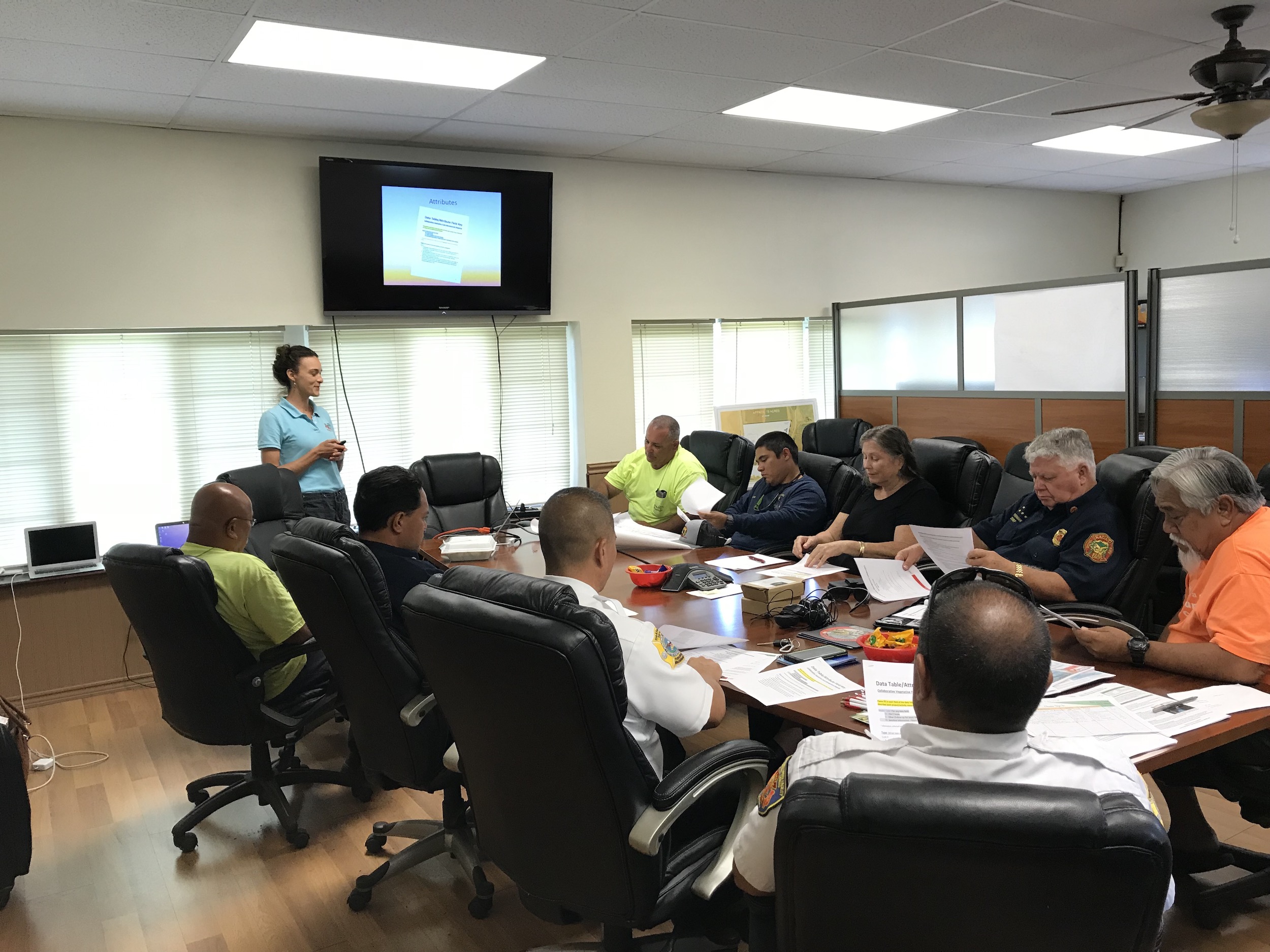
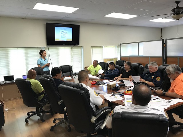
Kauai Vegetative Fuels Management Mapping Workshop with KAA

Mapping with KAA members, Navy, and Kauai Fire Department on the west side of Kauai.

Mapping with KAA members, Navy, and Kauai Fire Department on the west side of Kauai.

As a hub of wildfire protection efforts across the Hawaiian Islands, we are always looking for ways to bring people together to solve some of our most complex wicked problems. The Hawaiian Islands have been struggling with invasive species spread for decades, but now we are seeing what happens when invasive flammable plants take over the landscape and allow fires to spread more quickly and over larger areas. By controlling or managing flammable vegetation at the landscape-level, we can make great strides towards reducing the wildfire risk on our islands.

That’s why HWMO is coordinating a statewide vegetative fuels management mapping project — a rapid assessment to understand the vegetation management needs and priorities of landowners and land managers throughout the Hawaiian Islands. DLNR Division of Forestry and Wildlife and University of Hawaii CTAHR Cooperative Extension are key partners in the effort.

The vision for the project is that the resulting maps will lead to 1) better prioritization and communication of vegetative fuels management on the landscape-scale and 2) enhance project coordination between organizations and funding opportunities.

On September 26, we partnered with Kekaha Agriculture Association for a workshop to map current and desired vegetation management activities in Kekaha on the west side of Kauai (where most of the island’s most devastating wildfires have occurred). Activities could include any vegetation reduction or conversion projects such as roadside mowing, fuelbreaks, grazing rotations, clearing around structures or power poles, brush abatement or thinning, tree trimming, loi restoration, agriculture, and native forest restoration. Mahalo KAA for hosting the workshop and for participating in this critical project!

Kauai KAA Vegetative Fuels Management Mapping Workshop 9/26/18

Oahu Vegetative Fuels Management Mapping Workshops with DOFAW and WMWP

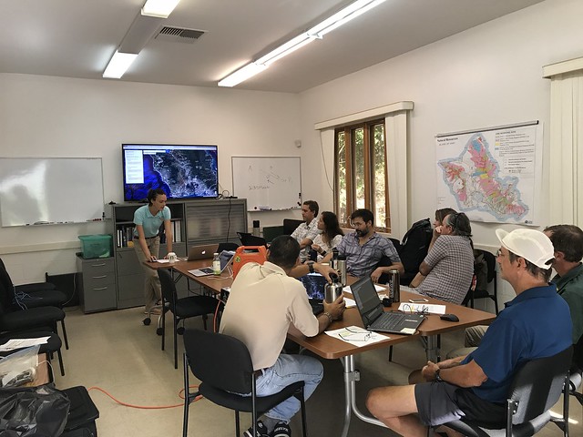
Mapping in action!

Mapping in action!

As a hub of wildfire protection efforts across the Hawaiian Islands, we are always looking for ways to bring people together to solve some of our most complex wicked problems. The Hawaiian Islands have been struggling with invasive species spread for decades, but now we are seeing what happens when invasive flammable plants take over the landscape and allow fires to spread more quickly and over larger areas. By controlling or managing flammable vegetation at the landscape-level, we can make great strides towards reducing the wildfire risk on our islands.

That’s why HWMO is coordinating a statewide vegetative fuels management mapping project — a rapid assessment to understand the vegetation management needs and priorities of landowners and land managers throughout the Hawaiian Islands. DLNR Division of Forestry and Wildlife and University of Hawaii CTAHR Cooperative Extension are key partners in the effort.

The vision for the project is that the resulting maps will lead to 1) better prioritization and communication of vegetative fuels management on the landscape-scale and 2) enhance project coordination between organizations and funding opportunities.

On September 25, we joined up with DOFAW and Waianae Mountains Watershed Partnership (WMWP) for back-to-back workshops to map current and desired vegetation management activities on Oahu. Activities could include any vegetation reduction or conversion projects such as roadside mowing, fuelbreaks, grazing rotations, clearing around structures or power poles, brush abatement or thinning, tree trimming, loi restoration, agriculture, and native forest restoration. The workshop took place at the DOFAW Makiki office at the foot of the beautiful Makiki Valley.

Oahu DLNR and WMWP Vegetative Fuels Management Mapping Worshops 9/25/18

Hilo Vegetative Fuels Management Mapping Workshop with DOFAW

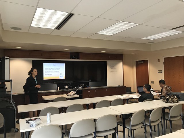
Mapping with DOFAW representatives in Hilo.

Mapping with DOFAW representatives in Hilo.

As a hub of wildfire protection efforts across the Hawaiian Islands, we are always looking for ways to bring people together to solve some of our most complex wicked problems. The Hawaiian Islands have been struggling with invasive species spread for decades, but now we are seeing what happens when invasive flammable plants take over the landscape and allow fires to spread more quickly and over larger areas. By controlling or managing flammable vegetation at the landscape-level, we can make great strides towards reducing the wildfire risk on our islands.

That’s why HWMO is coordinating a statewide vegetative fuels management mapping project — a rapid assessment to understand the vegetation management needs and priorities of landowners and land managers throughout the Hawaiian Islands. DLNR Division of Forestry and Wildlife (DOFAW) and University of Hawaii CTAHR Cooperative Extension are key partners in the effort.

The vision for the project is that the resulting maps will lead to 1) better prioritization and communication of vegetative fuels management on the landscape-scale and 2) enhance project coordination between organizations and funding opportunities.

On September 18, we linked up with DOFAW for a workshop in Hilo to map current and desired vegetation management activities. Activities could include any vegetation reduction or conversion projects such as roadside mowing, fuelbreaks, grazing rotations, clearing around structures or power poles, brush abatement or thinning, tree trimming, loi restoration, agriculture, and native forest restoration.

Hilo Vegetative Fuels Management Mapping Workshop with DOFAW 9/18/18

Waikiʻi Ranch Firewise Hazard Assessment

HFD Fire Prevention, HWMO, and Waikiʻi Ranch HOA teamed up to assess wildfire hazards in and around the subdivision.

HFD Fire Prevention, HWMO, and Waikiʻi Ranch HOA teamed up to assess wildfire hazards in and around the subdivision.

For the casual passer-by during the winter, the rolling green hills of Waikiʻi Ranch may strike them as an area free of wildfire threats. However, over the past several years, Waikiʻi Ranch has had numerous close calls with wildfires that have burned in and around the subdivision. The subdivision is exposed on each side by large tracts of unmanaged grass and shrublands prone to ignition from starts along neighboring roads and highways. 

On March 6, HWMO teamed up with Hawaiʻi Fire Department and Waikiʻi Ranch HOA to conduct a Firewise hazard assessment for Waikiʻi. The group first met at the community clubhouse to discuss what it takes for a community to become Firewise certified. As a major first step towards certification, the a few members of the group drove to various points of interest within the community. Some of the major wildfire hazards that struck our attention included the many dead trees along the edges of roads and fencelines, piles of wood underneath tree canopies, and large expanses of unmanaged grass and shrublands surrounding homes and the greater Waikiʻi area. 

The association has been allocating some of their funds and resources towards Firewise improvements already. Most notably, the community has herds of cows, goats, and sheep that are used to graze easements along the perimeters of properties and the subdivision boundary. As more and more people in Waikiʻi join the Firewise efforts, the community will hopefully become another shining example in Hawaiʻi and a part of a statewide collaborative, grassroots movement for communities to take fire readiness into their own hands.

Waikii Ranch Firewise Hazard Assessment

Puʻunoa Firewise Hazard Assessment

Assessment team walking along a road to assess wildfire risks/hazards.

In 2016, Launiupoko, near Lahaina, became the first nationally-recognized Firewise Community in West Maui. The accomplishment did not go unnoticed. In fact, news quickly spread to the neighboring Puʻunoa community. This year, Puʻunoa will be working towards the same certification as Launiupoko. 

To begin the process, HWMO joined its partners from Division of Forestry and Wildlife and West Maui Mountains Watershed Partnership to conduct a Firewise hazard assessment of the agricultural lots in Puʻunoa. The team first met with several residents from Puʻunoa and the general manager of the HOA to discuss the Firewise certification process.

Assessment team examines road crossing on Kauaula Stream that was damaged during a recent rain event. 

Assessment team examines road crossing on Kauaula Stream that was damaged during a recent rain event. 

They soon followed the meeting by caravanning (and walking/hiking) throughout the community to assess common wildfire hazards and successful Firewise modifications around homes. Brainstorming ideas, the topic of managed grazing emerged numerous times as one of the ways to mitigate the large tracts of flammable grasslands. The group made their way to the Makila Reservoir and Kauaula Stream, important water suppression resources used by firefighters during past wildfires in the area. During one of the recent storms, the roadway across the stream was destroyed — flooding is another hazard the community faces.

Mahalo to DOFAW, WMMWP, Hawaiiana Management Company, and the newly formed Puʻunoa Firewise Committee for playing an important role in moving Puʻunoa towards Firewise certification.

Puunoa Firewise Hazard Assessment 2/10/17

Method to the Madness Podcast - HWMO Interview

HWMO Community Outreach Coordinator, Pablo Beimler (left) and Method to the Madness host, Niklas Lollo

On December 23, just before the holiday season was in full swing, HWMO's Community Outreach Coordinator, Pablo Beimler visited his alma mater, University of California, Berkeley, and was interviewed by Niklas Lollo, a current graduate student and co-host of the Method to the Madness podcast. The show, which airs regularly on KALX 90.7FM (staffed by students and community volunteers), celebrates "the innovative spirit of the Bay Area." Each episode, they "explore the people behind the ideas, what makes them tick, and why so many of them have come out of" the beautiful Bay Area.

Pablo Beimler was interviewed about various topics including the work HWMO does in the Pacific and his past experiences in the fire world.

During the interview, Pablo talked story about how HWMO came to existence and the innovative work our organization is doing to safeguard communities and natural areas in Hawaii. Topics ranged from the differences between wildfire behavior on the islands and on the mainland, Firewise Communities, the Pacific Fire Exchange, and what to expect in the coming years for wildfire management in Hawaii. Tune in and you'll also hear about some of Pablo's past experiences working in the Stephens Fire Science Lab at UC Berkeley and Lake Tahoe for CAL FIRE.


Big mahalo to Niklas Lollo and the folks over at KALX for dedicating a half hour of their air time and inviting us to be on the show!


Society for Range Management Fall Meeting and Field Tour

The paniolo (Hawaiian cowboy/girl) culture has thrived in Hawaii for more than a century. With each passing year, greater knowledge of best management practices are used and shared to ensure ranching is done in a sustainable manner. Since HWMO’s inception, our organization has worked closely with various large and small ranches in Hawaii to assist them with fuels management expertise and funding for pre-suppression tools (helicopter dip tanks, lines to draw water closer to communities/sensitive natural areas). Our very own board president, Mark Thorne, Ph.D., is the grazing extension specialist for University of Hawaii College of Tropical and Human Resources (UH CTAHR). 

Dr. Clay Trauernicht talks wildfire and its relationship to climate change in the Pacific.

Pablo Beimler shares about HWMO's efforts to alleviate the socioeconomic issues of wildfire in Hawaii.

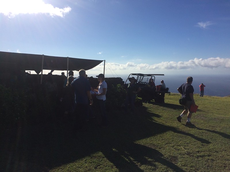
Morning rainbow to kick off the field tour of Kapapala Ranch.

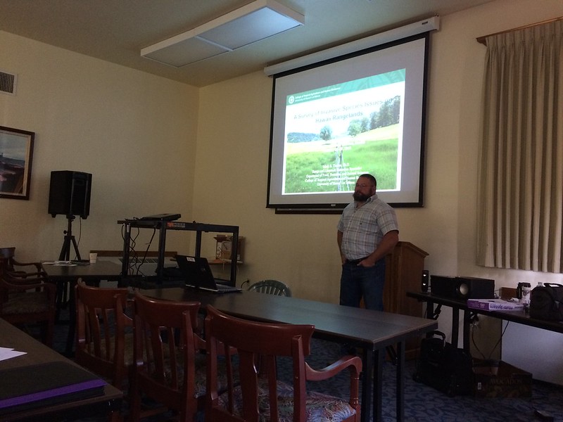
On October 27-28, Mr. Thorne and other Hawaii rangeland specialists hosted a Fall Meeting and Technical Tour in Volcano for the Society for Range Management, a “professional scientific society and conservation organization whose members are concerned with studying, conserving, managing and sustaining the varied resources of the rangelands which comprise nearly half the land in the world.” Several presentations covered topics ranging from livestock as a fuels management tool, invasive species effects on island plant communities, and climate/socioeconomic relationships with fire. Dr. Clay Trauernicht spoke on behalf of the Pacific Fire Exchange and UH CTAHR Cooperative Extension to showcase his new research on climate change’s effects on fires in the Pacific. HWMO’s very own Community Outreach Coordinator, Pablo Beimler, shed light on the socioeconomic issues of wildfire in Hawaii and what HWMO is doing to alleviate them. 

On the second day, Kapapala Ranch, a large ranch in Volcano, hosted a field tour through their beautiful pastures and native forests. Aside from morning rainbows, views of Kilauea crater, and clear skies, there was much to ponder and discuss in regards to proper range management in the unique climatic/topographical region that Kapapala Ranch is located in. Water storage and fire were just some of the many topics where lessons learned were shared across the regions. On the way out, a flat tire from old fencing on a dirt road made for a comical situation in which several participants, including Mr. Thorne, labored to remove the fencing remnants with all of their might as others cheered on. Just another day out in the field. 

Future rangeland managers?

The general theme that kept emerging during the event: conservation and rangeland management can and must coexist if we are to solve our growing environmental issues across the islands (and around the world). 

The event was dedicated to the life of Matt Stevenson, a beloved range professional we lost in 2016. His contributions to the field were tremendous. He will be missed.

Society for Range Management Presentations and Field Tour of Kapapala Ranch 10/27-10/28/16

Waikoloa Village Firewise Community Hazard Assessment

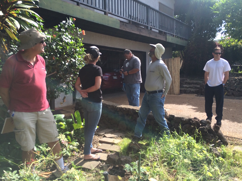
The crew visited a few homes to conduct "home ignition zone assessments" as part of the Firewise Community assessment report. 

Waikoloa Village’s new Fire Management Action Committee formed recently and is already in full swing, a big step for Waikoloa’s wildfire protection. The team, led by Chair Mark Gordon, is working with HWMO to become a nationally-recognized Firewise Community as of 2016. The certification would make the community the largest Firewise Community in the State, a challenge that the team and HWMO is willing to take on. 


A Waikoloa Village interior lot that the WVA recently created a fuelbreak for to protect neighboring homes.

On September13th, HWMO’s Pablo Beimler (Outreach Coordinator) and Mike Tomich (Board of Director) met with the WVA’s Roger Wehrsig, DOFAW’s Jay Hatayama, HFD’s West Hawthorne and Ed Kawasaki, WDFI’s Jen Lawson, and the Action Committee’s Mr. Gordon and Wayne Awai for a wildfire hazard assessment - a requirement for Firewise Community certification. The group drove to various sites around the village to examine wildfire hazards. Sites included the community fuelbreak (HWMO’s first grant-funded project that Waikoloa Village now maintains), fuels behind the schools, a vacant lot that was grazed by a goat-dozer for fuels reduction purposes (a pilot project facilitated by HWMO and WVA), and a larger grazed area on the critical northern/mauka boundary of the community. They also visited three homes to conduct brief home ignition zone assessments to fulfill one of the requirements of the Firewise hazard assessment. 

Illegal green waste dumping is a major hazard in Waikoloa and is very counterproductive to the wildfire mitigation efforts being made in the village.

After the assessment, HWMO will be compiling a report with recommendations for the Fire Management Action Committee to review. The Committee will discuss the recommendations and develop an action plan. Once completed, Waikoloa Village will be well on their way to Firewise certification as of 2016. Mahalo to our partners who joined the assessment and provided great input!

Waikoloa Village Firewise Community Hazard Assessment 9/13/16

PFX Kahikinui Field Tour

When it comes to solving our most complex issues, it truly takes a village and the coming together of a myriad of backgrounds and expertise. 

PFX FIeld Tour begins at lookout on the eastern makai side of Kahikinui.

On August 29th, over 40 representatives from a number of organizations and stakeholder groups joined a field tour of Kahikinui on the southern slopes of Hāleakala. Organized by our partners from Pacific Fire Exchange and Leeward Hāleakala Watershed Restoration Partnership, the group caravanned to various sites to view the post-fire landscape that resulted from the February 2016 wildfire. The fire not only burned through native preserves and cultural sites, but also came dangerously close to homes. A few of the homesteaders of Kahikinui spoke during the field tour to share their experiences of the 2016 fire (and other fires that have given the community a scare). 

Firefighters share their experiences fighting fires in Kahikinui. Attendees listen in as they survey the land from the mauka edge of the fire. Photo Credit: Clay Trauernicht/PFX

Throughout the field tour, there were great open discussions regarding topics from grazing for fuels reduction to increasing water access and availability to fuelbreak creation with erosion control in mind. Mahalo to Clay Trauernicht and Melissa Kunz of Pacific Fire Exchange for their great facilitation of these discussions. Big shoutout also to Andrea Buckman and the LHWRP crew for bringing in much of the stakeholder and community groups. And of course, a big mahalo to Kahikinui homesteaders who were so gracious enough to have such a large group tour their community. Also mahalo to the groups who were represented at the field tour: Auwahi Wind, Department of Hawaiian Homelands, Division of Forestry and Wildlife, Hāleakala Ranch, KOOK, Aha Moku O Kaupō, Kaupō Ranch, KGLMO, Mauʻi County Council Don Couch, Mauʻi County Fire, Find Us 911, Mauʻi County Office of Economic Development, West Mauʻi Mountains Watershed Partnership and UH College of Tropical Agriculture & Human Resources.

Pablo Beimler (HWMO) shares Firewise Communities updates with the group. Photo credit: Chris Brosius, West Maui Mountains Watershed Partnership

HWMO is working with Kahikinui community members to help their homestead become one of the first nationally-recognized Firewise Communities on Mauʻi, along with Waiohuli and Launiupoko. In fact, the field tour counted towards their Firewise Event requirement - they are well on their way to 2016 certification!

PFX Kahikinui Field Tour 8/29/16

Kauai Annual Brushfire Mitigation Meeting

Captain Daryl Date gives an update on KFD's latest news.

At least compared to 2015, Kauai was off to a quieter start in terms of brushfire activity. There were 69 brushfires to date (by June 9th) for 2016 compared to 122 by the same date in 2015. However, with the possibility of increased drought statewide, especially in leeward areas this summer, Kauai Fire Department and its partners are on guard for what could be a busy season. 

KFD invited HWMO, National Weather Service, DLNR Division of Forestry and Wildlife, Department of Hawaiian Homelands, Natural Resources Conservation Service, and various large landowners ranging from coffee growers to seed companies to helicopter pilots to discuss wildfire preparedness and mitigation on June 9th. National Weather Service’s Derek Wroe gave a presentation on the current drought predictions. He warned that La Niña, which has a good chance of occurring by the end of the summer, doesn’t necessarily mean more rain. Typically, the tradewinds tend to be steadier during La Niña events in Hawaii, but that doesn’t necessarily mean more rainfall and could potentially intensify drought conditions

Pablo Beimler gave a presentation on behalf of HWMO on the input collected for the Kauai Community Wildfire Protection Plan update, which will be completed and signed by the end of July. He also shared information on the Wildfire & Drought Look Out! campaign, asking for partnership on the collaborative statewide effort. 

The final portion of the meeting involved a great discussion amongst all of the large landowners and agencies regarding wildfire suppression resources. Each representative let KFD know what resources they had available (access roads, water supplies, large equipment) should a wildland fire occur on their property or on adjacent lands. This type of information sharing was a great example of the collaboration needed to address the shortfall of wildfire suppression and mitigation resources on Kauai. 

Kauai Annual Brush Fire Meeting and Presentation 6/9/16

Powered by Squarespace